Tohoku gets six prefectures of land, an area roughly the size of Switzerland, less than five percent of foreign visitor traffic, and the best autumn-leaf colour on Honshu. Most Japan trips skip it because the Shinkansen is the wrong speed for what’s actually here.
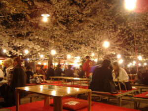
I write this with three Aprils in Hirosaki, two Augusts in Aomori for the Nebuta float parade, and the kind of winter at Zao Onsen where the snow-rime trees the Japanese call juhyo close around the gondola line in a white silence Kyoto cannot give you. Hirosaki Castle has 2,600 cherry trees and you can walk the ramparts at midnight in late April with a thousand other people, not the half-million who gridlock Ueno Park. The Nebuta parade fills Aomori City for six nights every August, two million spectators in a year when Kyoto is empty in the heat. I’m going to make a case for putting this region in the middle of your trip rather than at the end, and back it up with named stations, named ryokan, named restaurants, and yen prices verified against operator sites in 2026.
In This Article
- Where Tohoku is, and what people get wrong about it
- Getting there: which Shinkansen, when, how much
- The four-season swing Tohoku is famous for
- Spring: the late-April bloom and the petal moat
- Summer: the festival circuit, the Tohoku Six
- Autumn: Oirase, Naruko, the colour line moving south
- Winter: snow monsters, gas-lamp onsen, and the stove train
- The Pacific east: the Sanriku coast and what 2011 left
- The mountain spine: Yamadera, Hiraizumi, Dewa Sanzan
- The Sea-of-Japan west: Akita and the rural Yamagata coast
- Northern Aomori: Nebuta, Hirosaki, the apple country
- Sannai-Maruyama and the Jomon site
- Mt Osore and the spirit world
- The Tohoku food map
- Where to base, and a sample route
- Fukushima 2026: the actual status
- Practical: what surprises first-timers
- A note on the regional capitals
- The case for going now
Where Tohoku is, and what people get wrong about it
Tohoku means “northeast” and covers the top third of Honshu: Aomori, Akita, Iwate, Yamagata, Miyagi, Fukushima. Six prefectures, 25,800 square miles, eight million people. By area that’s about the same as Switzerland, but with the population of New York City spread across it, mostly along three coastal corridors and the central spine.
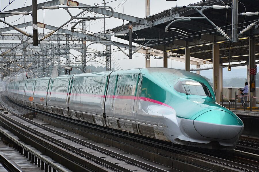
The geography matters more than people expect. There’s a Pacific east, a mountain middle, and a Sea-of-Japan west. They don’t link up the way the Tokaido does south of Tokyo. The Tohoku Shinkansen runs straight up the middle from Tokyo to Shin-Aomori, with the Akita Shinkansen branching west at Morioka and the Yamagata Shinkansen branching south-west at Fukushima. To reach the Pacific Sanriku coast or the Sea-of-Japan side properly, you change to a local line, sometimes a private one. None of this is hard, but it’s why the region rewards a base-and-spoke approach rather than a Shinkansen-only blitz.
Three things first-timers consistently get wrong. One, they treat Tohoku as a pass-through on the way to Hokkaido. The Hokkaido Shinkansen does extend through the Seikan Tunnel from Shin-Aomori to Hakodate, and that’s a fine onward link, but using Tohoku as a transit corridor wastes the festivals, the temples and the food. Two, they assume Sendai is enough. Sendai is the regional capital and a perfectly good first night’s stop, but the things you came for, in most cases, are 90 minutes north or west by local train. Three, they think Fukushima is closed. It isn’t. The exclusion zone around the 2011 nuclear plant is a small fraction of the prefecture, well-mapped, and the rest of Fukushima, including Aizu-Wakamatsu, Ouchi-juku, the Goshikinuma ponds and the Tadami Line, has been open and operating throughout. I’ll come back to this in detail later.
Getting there: which Shinkansen, when, how much
Three Shinkansen lines reach Tohoku from Tokyo. Each one feeds a different part of the region.
| Route | Train | Tokyo to terminus | Adult one-way reserved (2026) | What it gets you |
|---|---|---|---|---|
| Tohoku Shinkansen | Hayabusa / Yamabiko | Tokyo to Shin-Aomori in 3h 10m fastest | ¥17,670 to Shin-Aomori; ¥11,410 to Sendai | Sendai, Morioka, Hachinohe, Aomori, on into Hokkaido |
| Akita Shinkansen | Komachi (joins Hayabusa as far as Morioka) | Tokyo to Akita in 3h 50m | ¥18,020 to Akita | Akita, Tazawako, Kakunodate |
| Yamagata Shinkansen | Tsubasa (joins Yamabiko to Fukushima) | Tokyo to Yamagata in 2h 40m, Shinjo in 3h 30m | ¥11,450 to Yamagata; ¥13,380 to Shinjo | Yamagata City, Yonezawa, Shinjo (closest stop for Yamadera, Mogami River, Ginzan Onsen) |
Pricing is for ordinary-car reserved seat in regular season. Numbers checked against jreast.co.jp on 2026-05-07. Green-car and GranClass cost more, the children’s fare is half. The Akita Shinkansen and the Yamagata Shinkansen both run as connected trains coupled to a Tohoku Shinkansen service for the Tokyo-side leg, then split at Morioka and Fukushima respectively, which is cheaper rolling-stock use and one of those quietly clever JR East operations that’s worth watching from the platform if you’re a train person.
If you want a multi-day pass instead of point-to-point tickets, JR East consolidated its old separate Tohoku-area and Nagano-Niigata-area passes into a single unified JR EAST PASS in March 2026. Five days ¥35,000, ten days ¥50,000, adult, valid on all JR East lines including the Tohoku, Akita and Yamagata Shinkansen, plus the Sanriku Railway and a couple of through-running private lines. For two or more long Shinkansen rides plus regional moves, it pays back fast. My full breakdown of the JR East Pass covers what’s in and what isn’t, and there’s a separate national Japan Rail Pass guide if you’re combining Tohoku with Kyushu or Western Japan.
One detail people miss: GALA Yuzawa, the ski-resort station on the Joetsu Shinkansen, is on the JR EAST PASS but only operates winter and spring. If you’re chasing a quick Shinkansen-to-snow weekend, it’s there. The same pass also includes Tokyo Monorail to Haneda, which is a useful tail on a Tohoku trip if you’re flying out of Haneda rather than Narita.
The four-season swing Tohoku is famous for
Other regions have a season. Tohoku has four, all with their own anchor experience, and the rotation is the strongest argument for visiting the region more than once.
Spring: the late-April bloom and the petal moat
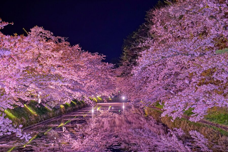
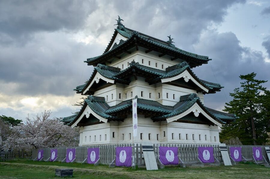
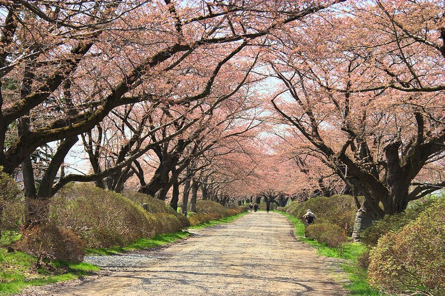
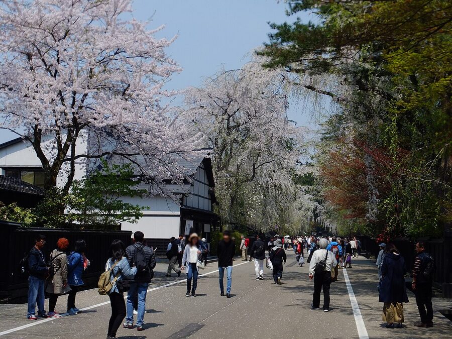
Tohoku’s cherry-blossom timing trails Tokyo by two to three weeks. Sendai usually peaks early April, Aomori late April, the highest spots into the first week of May. My national cherry-blossom guide has prefecture-level dates, but the headline acts in Tohoku are: Hirosaki Park in Aomori (2,600 trees, the moat-petal phenomenon), Kakunodate on the Akita Shinkansen line (samurai district lined with weeping cherries), Kitakami Tenshochi in Iwate (a 2-km cherry tunnel above the Kitakami River), and Tsuruga Castle in Aizu-Wakamatsu, Fukushima, with about 1,000 trees lit at night. Hirosaki sells out hotels months ahead. Kakunodate, less so.
Summer: the festival circuit, the Tohoku Six
The first week of August is the densest stretch of major festivals anywhere in Japan, with three of the country’s most-photographed events running simultaneously across Tohoku and a fourth in Yamagata a week later. The full circuit is sometimes called the Tohoku Six or Rokkonsai, and you can theoretically see all of them in a hard week of trains. Don’t try, you’ll exhaust yourself, but it’s worth knowing the dates so you can pick.
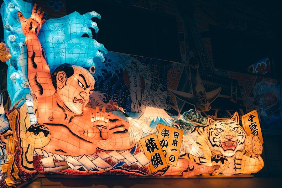
- Aomori Nebuta Matsuri, Aomori City, 2–7 August every year. Two million spectators across the run, illuminated wire-and-paper floats, the haneto dancer chant of “rassera, rassera”. Daytime parade on the 7th, then a sea launch with floats on barges and fireworks.
- Akita Kanto Matsuri, Akita City, 3–6 August. Performers balance 12-metre bamboo poles with 46 lit paper lanterns each on their forehead, lower back or hip. About 250 poles in a single line. Goes back to the 1700s.
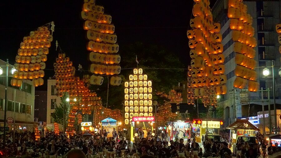
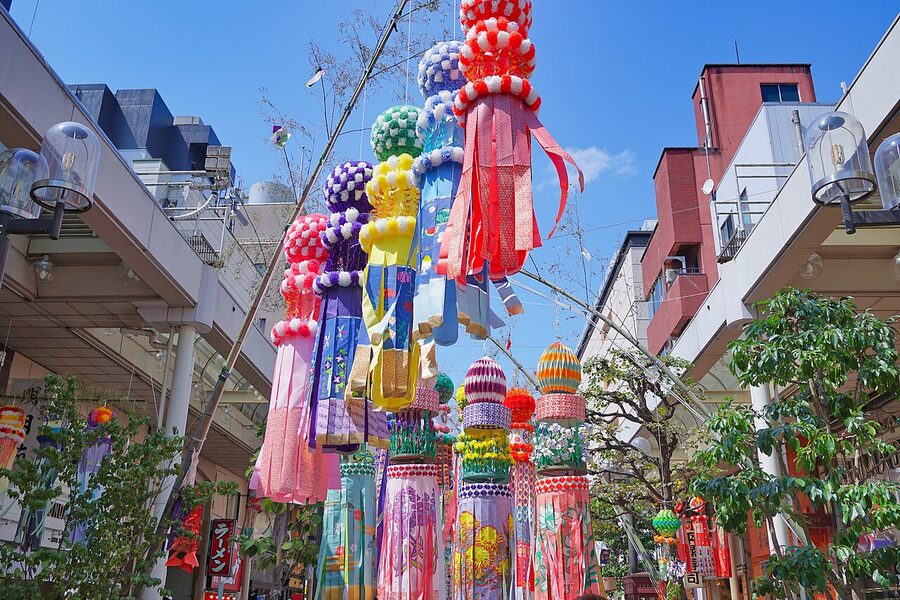
- Sendai Tanabata Matsuri, Sendai, 6–8 August. Three thousand large-scale paper-and-bamboo decorations strung along the central arcades. Quieter than the lantern festivals, more of an everyday-life feel.
- Morioka Sansa Odori, Iwate, 1–4 August. Parade of dancers and taiko drummers; the Guinness-record drum line is part of the appeal.
- Yamagata Hanagasa Matsuri, Yamagata City, 5–7 August. Hanagasa hat-dancers, the rhythmic shout of “yassho, makasho”.
- Fukushima Waraji Matsuri, Fukushima City, first weekend of August. A 12-metre, two-tonne straw sandal carried through the streets, which is less odd than it sounds when you’ve seen it.
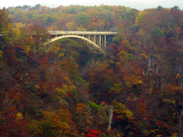
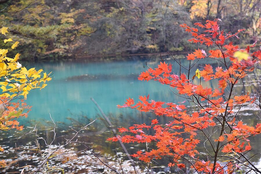
Autumn: Oirase, Naruko, the colour line moving south
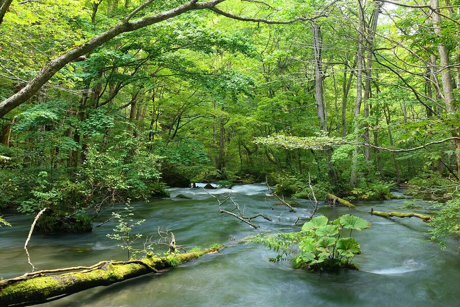
Tohoku’s autumn-leaf colour is the strongest on Honshu, in my opinion, because the deciduous mix runs through brighter reds and oranges than the more cedar-and-bamboo south. The headline two are Oirase Stream in Aomori, the 14-km river-walk parallel to the outflow of Lake Towada, and Naruko Gorge in Miyagi, where the JR Rikuu East Line runs along the canyon and the Naruko-kyo viaduct gives you the famous train-on-bridge shot.
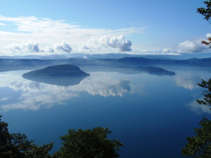
Other autumn picks worth carving time for: Lake Towada itself (the caldera lake; rent the lakeshore loop bus or do the ferry across to Yasumiya), Mt Hakkoda in Aomori (gondola, ridge-top heath), Goshikinuma in Fukushima (the five-coloured ponds at the foot of Bandai-san), and Geibikei Gorge in Iwate, where you ride a flat-bottomed boat downstream while the boatman sings.
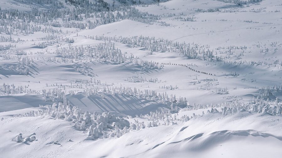
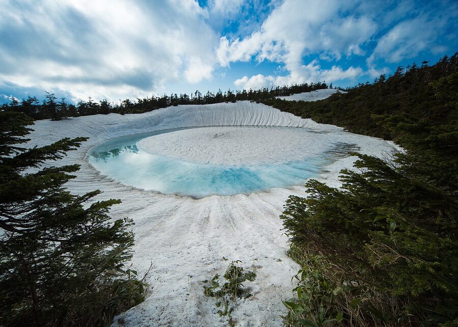
Winter: snow monsters, gas-lamp onsen, and the stove train
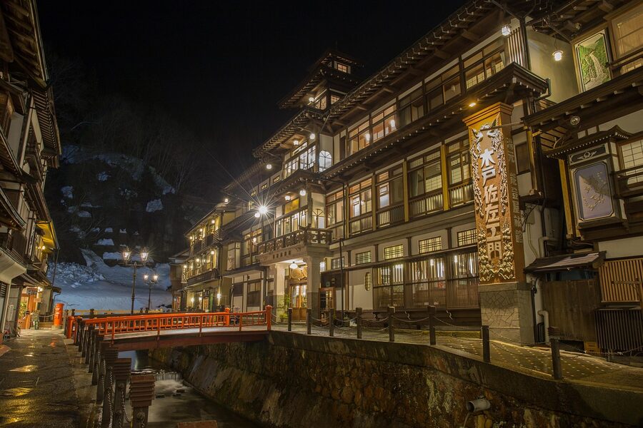
Winter Tohoku is what most international visitors miss, and it’s where the region opens up best. Zao Onsen in Yamagata is the famous one for the snow-rime trees called juhyo, viewable from the Zao Ropeway in late January through early March. The base village is a working onsen town with rotenburo open to day visitors for ¥700. Hakkoda in Aomori has the same juhyo phenomenon on a wilder scale, with smaller crowds. Ginzan Onsen in Yamagata is the gas-lamp street where the wooden ryokan inns line both banks of a small river and the snow piles up on their roofs. The look is the one Studio Ghibli’s Spirited Away drew from. It’s also reservation-only on most weekends in winter, so plan ahead.
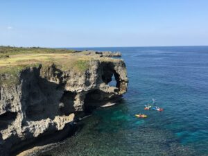
The Pacific east: the Sanriku coast and what 2011 left
The Sanriku coast runs from southern Aomori through Iwate down into northern Miyagi, a serrated rias coastline of fishing harbours, sea cliffs and pine-clad islets. It was the part of Tohoku hardest-hit by the March 2011 earthquake and tsunami. Fifteen years on, the rebuild is mostly finished, and travellers who only know the coast from the news photos haven’t seen what it actually looks like now.
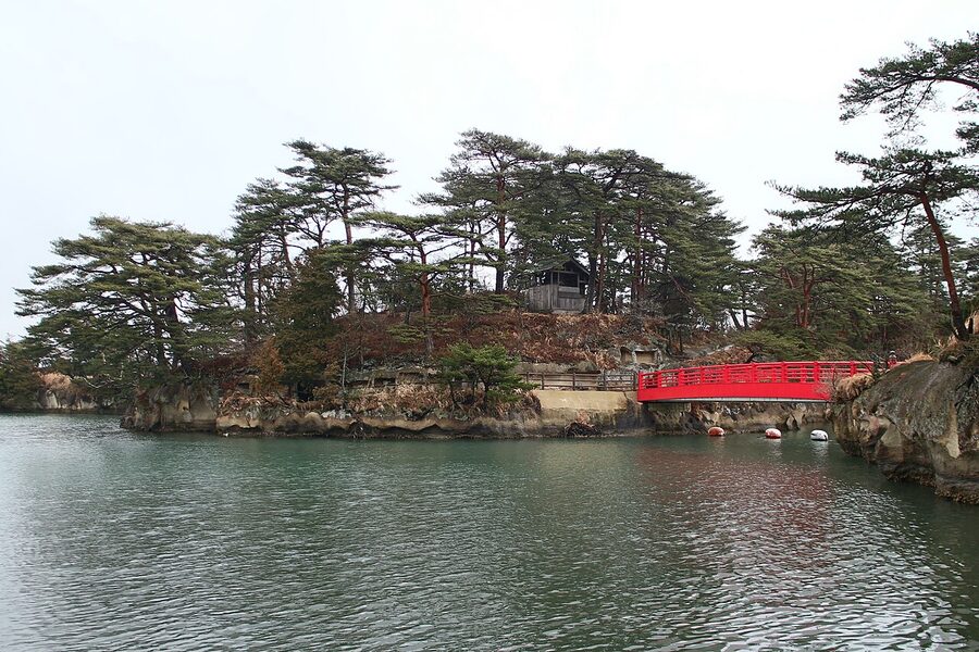
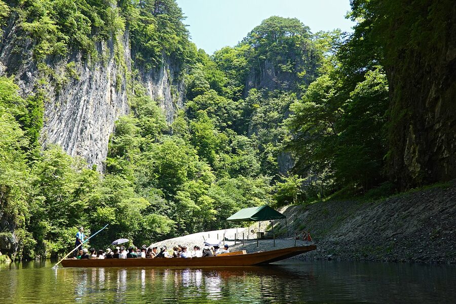
The standout stops for travellers: Matsushima Bay in Miyagi, classed historically as one of Japan’s three great views, with its 260 pine-clad islets and the Zen temple Zuiganji on the bay shore. Ferries circuit the bay from Matsushima Pier in 50 minutes for ¥1,500. The town survived the 2011 wave because the islets broke the energy. Jodogahama beach in Iwate, white pebbles, blue water, sea-cliff cliffs. Geibikei Gorge upstream in Iwate, the singing-boatman 90-minute round-trip. Kitayamazaki Cliffs, 200-metre sea cliffs north of Miyako. Ryusendo Cave, a limestone cave with three underground lakes.
The Sanriku Railway itself is worth riding for the way it threads the coast. The Rias Line covers 163km between Sakari (Ofunato) and Kuji, with the Tono-bound JR Kamaishi Line splicing the system to the inland network. Locals use it for school runs and shopping; tourists get the windows. Day passes available from any station.
The mountain spine: Yamadera, Hiraizumi, Dewa Sanzan
Tohoku’s middle is dominated by the Ou Mountains, a 500-km north-south spine that splits the Pacific from the Sea-of-Japan side. The mountains are the reason Tohoku gets the snow it does, the volcanoes that feed the onsen, and the temple sites that were built up here precisely because the terrain made them defensible.
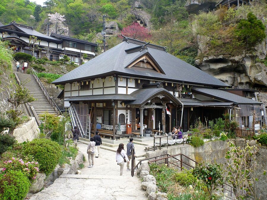
Yamadera, formal name Risshakuji, is the cliff-side temple complex above Yamadera Station on the JR Senzan Line. The poet Matsuo Basho stopped here in 1689 and wrote one of the most-quoted verses in Japanese literature about the silence of the cicadas in the rocks. The 1,015-step climb to the Godaido Hall is the standard pilgrimage. Most visitors stop at Godaido. The 30-minute Hidden Yamadera trail beyond the main complex, with its torii gate and rock formations, is rarely walked and you’ll have it to yourself.
Hiraizumi, in southern Iwate, was a Heian-period second capital briefly competing with Kyoto in the 12th century. The complex of temples, including the Konjikido (Golden Hall) at Chusonji, is a UNESCO World Heritage Site. Konjikido is the small gilded chapel inside a protective concrete pavilion, holding the mummified remains of the Northern Fujiwara clan rulers; comparisons to Kinkakuji are unavoidable but Konjikido is older and more strange. Combined ticket for Chusonji’s three pay-to-enter halls is ¥1,000.
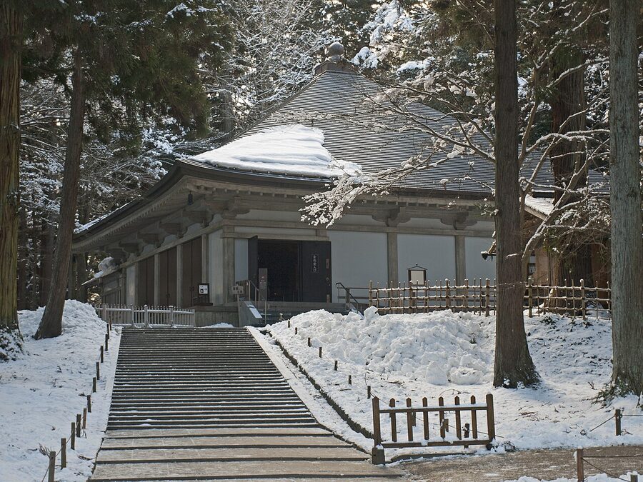
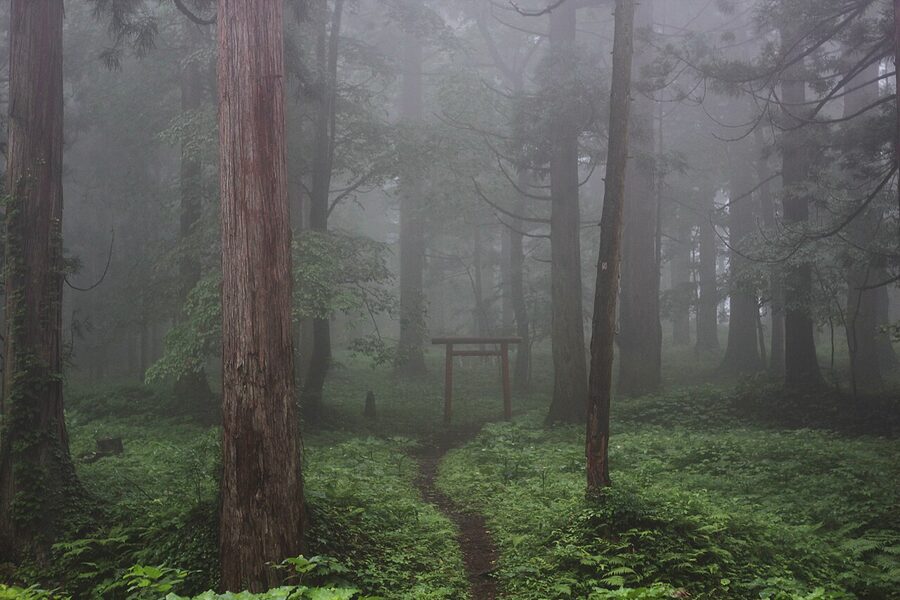
Dewa Sanzan, the Three Mountains of Dewa, in Yamagata: Mt Haguro, Mt Gassan, Mt Yudono. The Shugendo ascetic-Buddhist tradition treats them as past, present and future respectively, and the multi-day pilgrimage circuit between them is one of the few still walked by working yamabushi mountain priests. Haguro is open year-round and the most accessible: the 2,446 stone steps through cedar forest to the Sanjin Gosaiden hall pass a five-storey pagoda dating from 937, free to view. Gassan opens July to early October.
The Sea-of-Japan west: Akita and the rural Yamagata coast
Cross the Ou spine and you’re on a different climate, slightly drier in winter, definitely slower. The west side is where the rice country is, the sake breweries, the apple and cherry orchards. Kakunodate in Akita is the standout town: a samurai district called Bukeyashiki-dori where black wooden walls run a couple of city blocks and weeping cherry trees overhang the pavement. Six of the original samurai houses are open to the public. The Aoyagi family house (¥500) and the Ishiguro house (¥400) are the two I’d pick.
From Kakunodate the Akita Shinkansen continues 30 minutes north to Tazawa, Japan’s deepest lake, and another 30 to Nyuto Onsen, the seven-bath Akita onsen town hidden in the mountains. The standout ryokan is Tsurunoyu, a 350-year-old wooden farmhouse-style inn with a milky-white open-air bath that’s one of the most-photographed rotenburo in Japan. Day visitors are welcome 10:30 to 15:00 for ¥700, but the right way to experience it is overnight if you can book months out.
South into Yamagata, the coastline runs through Sakata, a former merchant port with sake breweries and the unusual Honma family rice-merchant museum, and Tsuruoka, the Dewa Sanzan trailhead town that’s been running shojin-ryori vegetarian-temple cuisine longer than most international cities have existed.
Northern Aomori: Nebuta, Hirosaki, the apple country
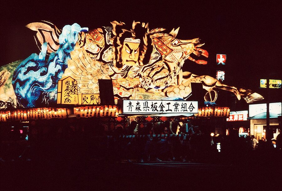
Aomori is the top prefecture of Honshu, weather rougher than the south, fishing-and-orchard country with a cultural confidence that’s distinct from anywhere else in Tohoku. The two August anchors are the Nebuta Matsuri in Aomori City (above) and Hirosaki’s tamer Neputa Matsuri 1–7 August, with fan-shaped floats instead of the city’s three-dimensional warriors. Both are worth catching, and Hirosaki is small enough to enjoy before catching the train into Aomori City for the late-night main parade.
Hirosaki itself is the town I’d live in if I had to pick somewhere in Tohoku. The castle park is one of Japan’s last twelve original castles (smaller than the famous ones, but real, not a 1960s reconstruction), there’s a Western-style brick neighbourhood from the Meiji-era cultural exchange around the museum, and a quietly excellent restaurant scene with French-influenced bistros. The apple cider here is some of the best in Japan, and yes, that is a sentence I never expected to write.
For nature, Mt Hakkoda south of Aomori City carries the same juhyo snow-rime trees as Zao but with a tenth of the visitors. The Hakkoda Ropeway runs year-round; in summer it’s a hiking gateway, in winter a backcountry-ski paradise, in autumn the colour you’d expect.
Sannai-Maruyama and the Jomon site
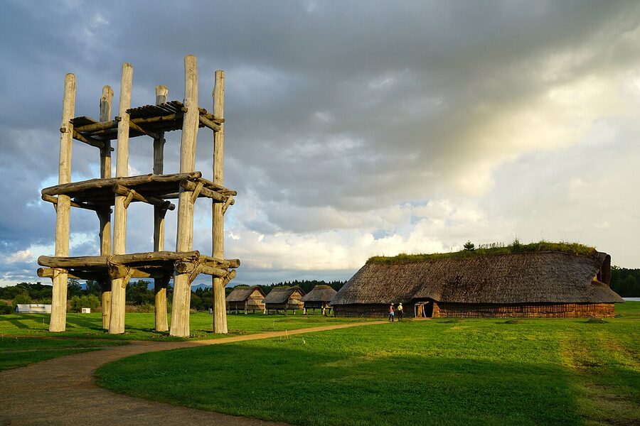
Less than 30 minutes by bus from Aomori Station, Sannai-Maruyama is a major Jomon-era settlement, occupied roughly 5,500 to 3,900 BC. It was registered as part of the Jomon Prehistoric Sites of Northern Japan UNESCO listing in 2021. The reconstructed wooden pit-dwellings and the six-pillar tower are the visual draws; the on-site Jomon Jiyukan museum has the original artefacts. Free entry to the grounds; museum is ¥410.
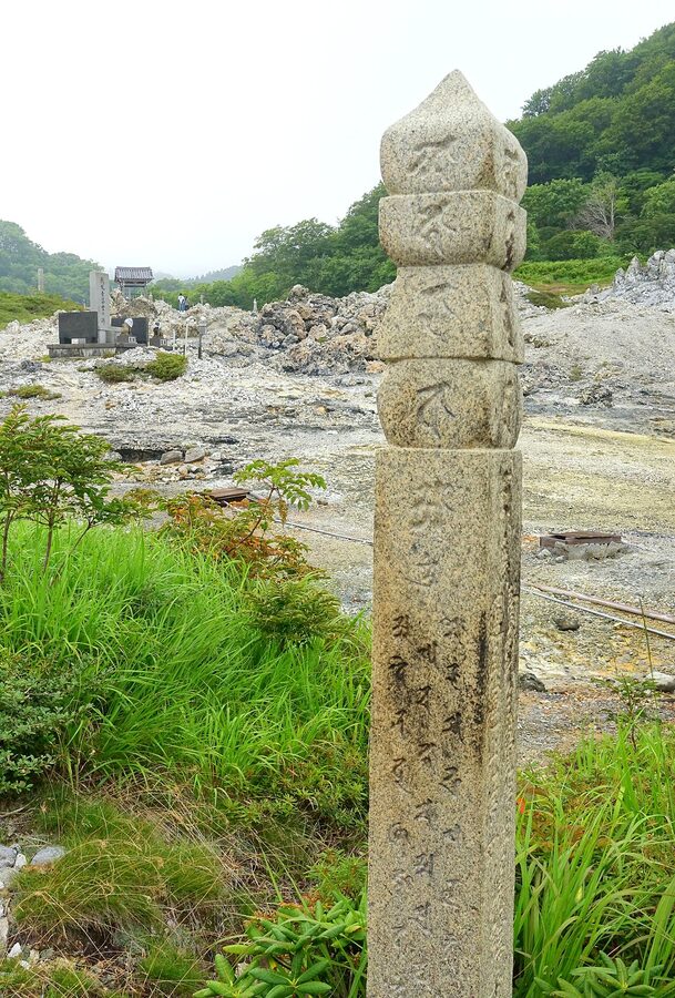
Mt Osore and the spirit world
For something stranger, the Shimokita Peninsula north-east of Aomori City holds Mt Osore, “Mount Fear”, one of Japan’s three sacred mountains and a long-standing site for communing with the dead. The volcanic crater landscape is sulphurous and otherworldly. Bodaiji temple here keeps blind female mediums called itako who, twice a year, transmit messages from departed family members. You can visit any time, you don’t need to be in mourning. Open May to October, ¥700.
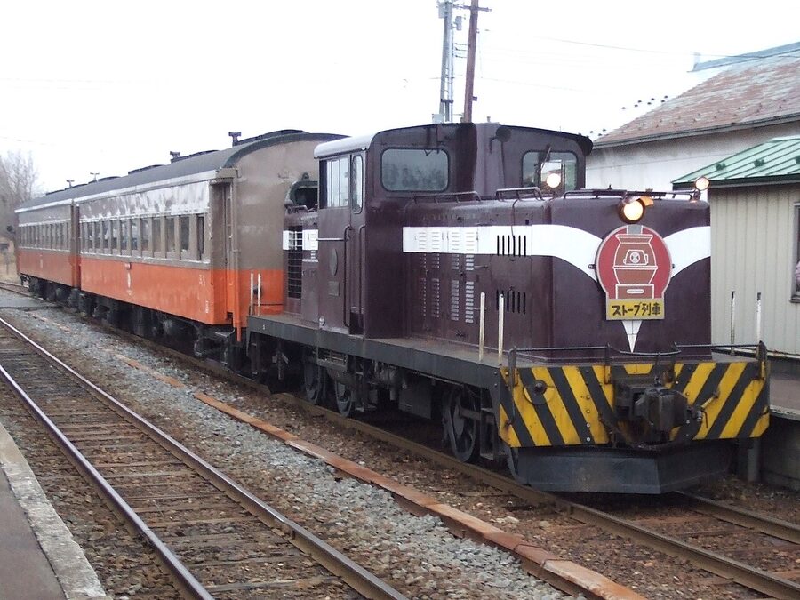
Sanriku-Aomori connects via the Tsugaru Railway, the small private line running between Tsugaru-Goshogawara and Nakasato. From December to March, the company runs the daruma-stove train: a cast-iron coal stove in each carriage, dried squid sold by the conductor and grilled over the stove, and the kind of slow-rural rail experience the rest of the country lost in the 1980s. Verified operating on tsutetsu.com as of 2026-05-07.
The Tohoku food map
Each prefecture has at least one signature, and the food trail is enough on its own to plan a trip around. The shorthand:
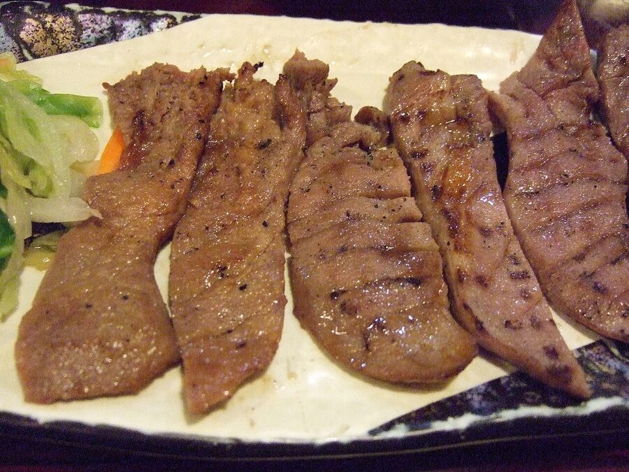
- Miyagi (Sendai): gyutan, thick-sliced grilled beef tongue, with barley rice and tail-soup. The post-war Sendai invention now exported nationwide; eat it at the source.
- Iwate (Morioka): three noodle dishes the city calls its trio: jajamen (flat noodles, miso meat sauce), reimen (chilled spicy beef broth, Korean-influenced), wanko-soba (the small-bowl marathon where staff keep refilling tiny bowls until you can’t take another one). Pyongyang Restaurant for reimen, Pairon for jajamen.
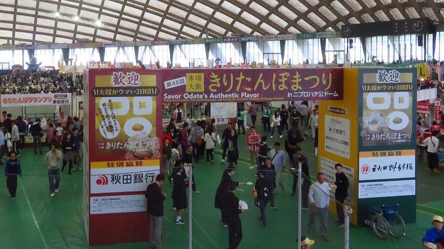
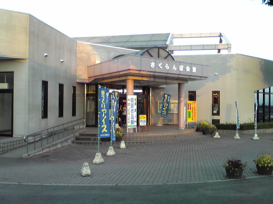
- Akita: kiritanpo, mashed-rice-on-a-cedar-stick grilled then dropped into chicken hotpot. Plus inaniwa udon, ribbon-thin chilled wheat noodles. Eat both in Akita City or in Kakunodate.
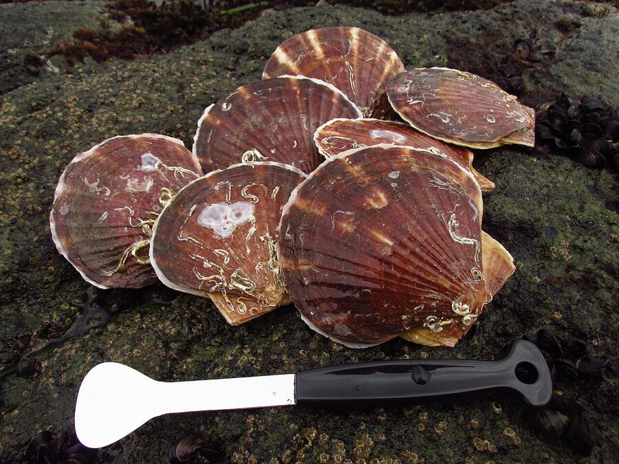
- Aomori: Mutsu Bay scallops, deep-cold tuna out of Oma at the peninsula’s tip, and apple everything. Aomori produces about 60% of Japan’s apples.
- Yamagata: sakuranbo (sweet cherries, Sato-Nishiki cultivar; June pick-your-own), imoni-jiru (taro-and-beef autumn river-bank stew), Yonezawa beef.
- Fukushima: Kitakata ramen (curly noodles, soy-pork broth, the Fukushima city of Kitakata has a per-capita ramen-shop count rivalling Sapporo). Plus Aizu’s sauce-katsu-don and Wappa-meshi steamed rice in cedar boxes.
Where to base, and a sample route
I’ve tried every base combination over the years. The shortlist:
- Sendai for first-timers. Largest city in Tohoku, three Shinkansen lines converge nearby, day-trips to Matsushima Bay (40 minutes by Senseki Line), Yamadera (60 minutes by Senzan Line), Naruko Onsen (90 minutes), Akiu Onsen (45 minutes). The downside is everywhere genuinely interesting is at least an hour out.
- Morioka for north-Iwate. Shinkansen hub, friendly walkable-mid-size feel, gateway to the Sanriku coast and the Tono folk-tale country. Wanko-soba and reimen are here.
- Aomori or Hirosaki for north-Tohoku. If you’re chasing Nebuta, the Hokkaido onward link, Hakkoda or Hirosaki Castle, base here. Aomori has more hotel inventory; Hirosaki has more atmosphere.
- Yamagata or Tsuruoka for inland Yamagata. Yamadera, Mogami River, Ginzan Onsen, Dewa Sanzan all reachable from one of these two. The Yamagata Shinkansen in is the cleanest access from Tokyo.
- Aizu-Wakamatsu for Fukushima. Castle town, sake breweries, gateway to Ouchi-juku and the Tadami Line. Not on the Shinkansen, you change at Koriyama.
If you’ve got seven days and want to see the region without rushing, here’s a sample route I’ve used:
- Day 1, Tokyo to Sendai by Hayabusa, afternoon walk on Matsushima Bay, gyutan dinner near Sendai Station.
- Day 2, Sendai to Yamadera by JR Senzan Line, climb the temple, continue to Yamagata City, sleep there.
- Day 3, day-trip to Ginzan Onsen by JR + bus, return Yamagata, evening at the Yamagata sake bar Hayashibara.
- Day 4, Yamagata Shinkansen back to Fukushima, change for Tohoku Shinkansen up to Morioka, evening jajamen.
- Day 5, Morioka day-trip to Hiraizumi (45 minutes by Shinkansen south, swap to local), Konjikido and Motsuji, return Morioka.
- Day 6, Morioka to Shin-Aomori by Hayabusa, transfer to Tsugaru-Goshogawara for the stove train (winter only) or Hirosaki Castle (spring/summer/autumn), back to Aomori, sleep there.
- Day 7, Sannai-Maruyama in the morning, train south, Hokkaido Shinkansen tunnel onward to Hakodate or back to Tokyo on the Hayabusa.
Fukushima 2026: the actual status
The 2011 disaster cost Tohoku tourism for years, and the prefecture-wide reluctance was the strongest in Fukushima. Fifteen years on, the situation is well-mapped: a small “difficult-to-return zone” around the Fukushima Daiichi plant on the Pacific coast, an evacuation order lifted from most surrounding municipalities by 2017, the Joban Line through-trains to Sendai resumed in March 2020. The prefecture’s Pacific coastal stretch is open with monitored air doses well below medical-imaging exposure levels and Japanese government data published transparently.
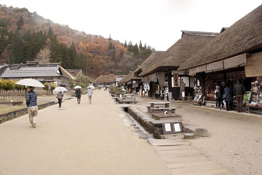
Practically: most Fukushima travel is in the western half, the Aizu region, which is the inland mountain part and was never exposure-affected at all. Aizu-Wakamatsu is the regional capital, with Tsuruga Castle (rebuilt 1965, but on its original 1593 site, with the mossy original stone walls), the samurai-housing complex of Bukeyashiki, and the sweets shops around the Nanokamachi area. From Aizu you can day-trip to Ouchi-juku, an Edo-period post-station with thatched-roof buildings preserved as a single street, by Aizu Railway and bus.
The Goshikinuma ponds at the foot of Mt Bandai, the Tadami Line for the famous bridge-over-river photograph at Daiichi-Tadamigawa-kyoryo, the snowboarding at Aizu-Tashiro and Hoshino Resorts Alts Bandai, and the volcanic geology around Mt Adatara are all open and operating. Air-dose monitoring data is published by Fukushima Prefecture; the Aizu region routinely reads at levels indistinguishable from Tokyo.
If you’re nervous, the simplest thing is to stay west of the Joban Line and the Tohoku Shinkansen and there’s no question to answer. Most of the prefecture’s signature destinations are over there anyway.
Practical: what surprises first-timers
Tohoku is rural by Japanese standards. The Shinkansen runs the spine, the rest is local trains, sparse buses, and rented cars. A few things I wish I’d known earlier:
- English signage thins north of Sendai. Tohoku Shinkansen station signs and announcements are bilingual; the local lines and small-town signage often aren’t. Have Google Translate offline-ready, especially for menu reading and bus stops.
- Buses are the connector you’ll lean on. Sanriku coast, Lake Towada loop, Dewa Sanzan, Aoni Onsen access: all bus, not train. The JR-issued kotsu hojo bus apps on smartphones aren’t well integrated; offline timetables in Japanese-only PDFs are still common. Plan a half-hour buffer.
- Distances are bigger than the rest of Japan. Aomori to Akita on the train involves changing at Hirosaki and is two and a half hours; by car along the coast it’s longer. Treat each prefecture as a 2-3-day commitment if you want depth.
- Snow closes things. Many mountain ryokan, the Hachimantai Aspite Line, the Bandai-Azuma Skyline, the Mt Gassan road: snow-closed November to April or May. Check ahead. Conversely, the snow-corridor opening on Hachimantai in mid-April to early May, with 8-metre snow walls flanking the road, is a destination in its own right.
- Cash is more of a thing here. Tokyo and Kyoto have caught up on contactless; rural Tohoku, less so. Carry ¥20,000 in cash, especially for ryokan and small restaurants. 7-Eleven ATMs accept foreign cards everywhere.
- Hotels book out around festivals. Aomori in early August, Hirosaki in late April, Sendai in early August: 90-day-out booking, easily. Other times, last-minute is fine.
A note on the regional capitals
The three child guides in this cluster go deeper on the regional anchors. If you’ve decided where you’re going, read those next:
- Sendai: Tohoku’s capital and the right way to use it. Gyutan, the Loople bus, day-trips to Matsushima and Yamadera done properly.
- Aomori: festivals, castles, and apples at the top of Honshu. Nebuta in detail, Hirosaki Castle bloom timing, the Tsugaru stove train, Mt Osore.
- Yamagata: mountain temples, snow monsters, cherry-pick country. The case for basing in Yamagata rather than passing through.
For broader cross-references: the Japan Rail Pass guide covers nationwide pass options; the JR East Pass guide walks through the unified Tohoku-and-Niigata pass introduced in March 2026; and the cherry-blossom guide has the Tokyo-to-Tohoku timing rotation that lets you chase the bloom north over a week or two.
The case for going now
The yen-weak window of the last few years has closed somewhat, but Tohoku remains the cheapest of Japan’s main regions to visit, both in cost-per-day and in human cost: hotels half the price of Tokyo or Kyoto, restaurants you can walk into without a six-week reservation, and a sense that your visit is genuinely welcome rather than absorbed into a tourist economy that long since hit capacity. The Sanriku coast in particular has actively wanted travellers back for fifteen years.
I think about Hirosaki’s castle moat in late April, with the petals on the water and a thousand of us standing along the wall, mostly Japanese, a few foreigners. Last year I was there at 21:30 with the gas lamps going, the keep lit pink, and a man next to me, maybe 70, said quietly, “you came a long way to see this.” I’d been in Japan for three weeks. He nodded once, looked back at the moat, and said, “good. It deserves it.” Then he walked off into the dark.
That’s Tohoku. Go.
.jpg)
_20170327.jpg)
,_Yamagata_(14214237536).jpg)
.jpg)
.jpg)