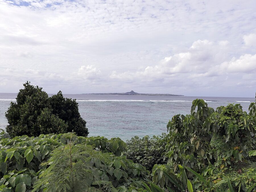
Yonaguni, the southernmost speck in the Okinawa archipelago, sits 509 km from Taipei and 1,925 km from Tokyo. Most Japan trips treat the prefecture as a long-weekend appendage, three days slotted in after a week of Honshu and Kyoto. That’s the mistake. Okinawa is its own country in everything but the passport: 47 inhabited islands, 1,000 km of Pacific between Yoron in the north and Yonaguni in the south, an extinct kingdom whose language is still spoken in fragments by the over-eighties, and a cuisine that uses pork and bitter melon where mainland Japan reaches for fish and soy. Seeing why takes a week minimum. Two weeks if you want to stop counting flights and just be somewhere.
I came in expecting a tropical Japan and left understanding that the order is reversed. Okinawa is tropical first and Japanese second, and once that lands you stop apologising for the rental car, the patchy English signage, and the fact that the bus from Naha to Cape Hedo takes the better part of a working day. You plan around it. You drive everywhere. You learn to read ¥-prices in shokudo windows and to point at the photo board when you don’t. And then, if you’re paying attention, you start clocking what makes Okinawa Okinawa: the shisa on the roof, the tomb shaped like a turtle’s back in the field next to the highway, the obasan at the produce stand who answers your tentative arigatou with a slightly different sounding nifedebiru.
In This Article
- The shape of the prefecture
- Getting there: only by air, mostly
- From Tokyo
- From Osaka, Nagoya, Fukuoka
- From Naha to elsewhere on Main Island
- What makes Okinawa not-Japan
- The Ryukyu Kingdom (1429–1879)
- The Battle of Okinawa (1 April–22 June 1945)
- US administration (1945–1972) and the bases now
- Naha and the south
- The Yui Rail and getting around Naha
- Up the spine of Main Island
- Cape Maeda and the Blue Cave
- Kouri Island and Kouri Bridge
- Churaumi Aquarium
- Yanbaru, the rainforest tip
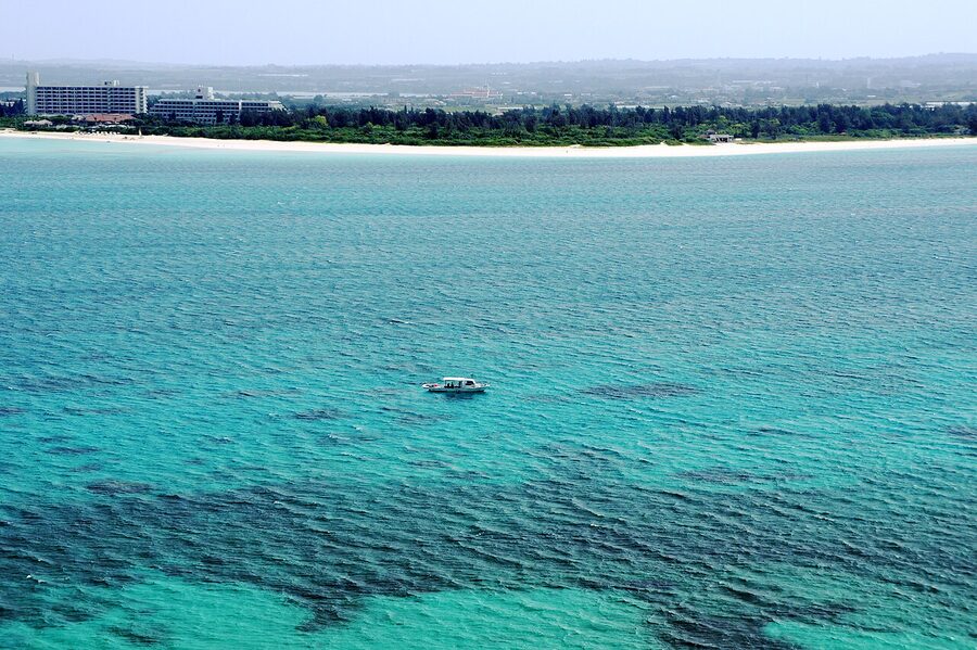
- Beaches, coral, the Kerama
- The Yaeyama: the version of Okinawa most people miss
- Miyako, the bridge-linked archipelago
- The food
- Okinawa soba
- Goya champuru
- Sata andagi
- Awamori
- Orion beer
- Culture you’ll see in passing
- Shisa
- Eisa
- Sanshin and Ryukyu music
- The seasons (different from mainland)
- The Okinawa rainy season (May–June)
- Typhoon season (June–October, peak August–September)
- Winter (December–February): the underrated season
- What surprises first-timers
- The distances are bigger than they look
- English signage is patchy
- Rental cars are normal here, even if you skipped them on the mainland
- The Uchinaaguchi language is real but mostly invisible to tourists
- Okinawa cuisine doesn’t include sushi
- Where to stay, broadly
- One-week sample itinerary
- What you came here for
The shape of the prefecture
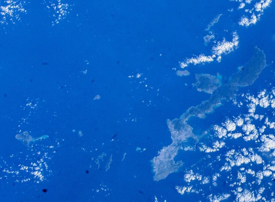
Okinawa Prefecture covers a maritime zone of roughly 1,000 km east-west and 400 km north-south, which makes it geographically the largest prefecture in Japan if you count water. The land area is modest, 2,281 sq km, but it’s broken into 160 islands, 49 of them inhabited. Travel planning hinges on understanding which group you’re going to.
Four groupings matter for a first trip:
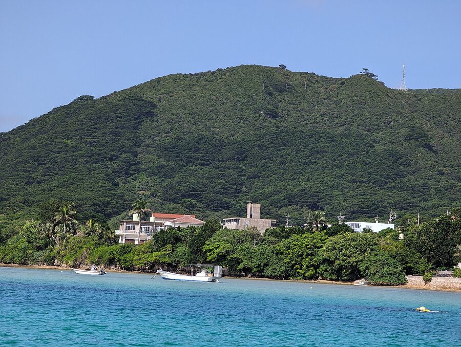
- Okinawa Main Island (Okinawa Honto). The big one. Naha at the south, the Yui Rail monorail running 17 km from the airport up to Tedako-Uranishi, the urban centre of the prefecture, the Battle of Okinawa sites in the south, the Churaumi Aquarium up north, the Yanbaru rainforest at the very tip. Most first-timers spend their full trip here and see only half of what they should.
- The Kerama Islands. A 30 to 50 minute ferry from Tomari Port in Naha, gazetted as a national park in 2014. Zamami, Tokashiki, Aka. Water visibility runs 50 m on a calm day and the islands are small enough to walk in a morning. The day trip is viable, but the islands earn an overnight.
- Miyakojima. A 50-minute flight south of Naha or a 3-hour direct from Tokyo. Flat, ringed by the prefecture’s most photographed beaches (Yonaha Maehama, Sunayama, the Iriomote-no-Kaigan stretch on Irabujima). One island bridge-linked to its neighbours, which makes it a rental-car paradise.
- The Yaeyama Islands. Ishigaki the gateway, Iriomote the jungle, Taketomi the preserved Ryukyu village, Hateruma the southernmost inhabited point in Japan, Yonaguni the western edge. Another 1-hour flight south of Naha or direct from Tokyo. This is where Okinawa stops feeling like Japan.
If you’re trying to do all four on one trip, ten days is the floor and you’ll still be on a tight rotation. The honest planning maths is two groups per trip, with at least three full days in each. I’d recommend starting with Main Island plus either the Kerama (for snorkel-and-stay simplicity) or the Yaeyama (for the bigger payoff). Save Miyako for a return.
Getting there: only by air, mostly
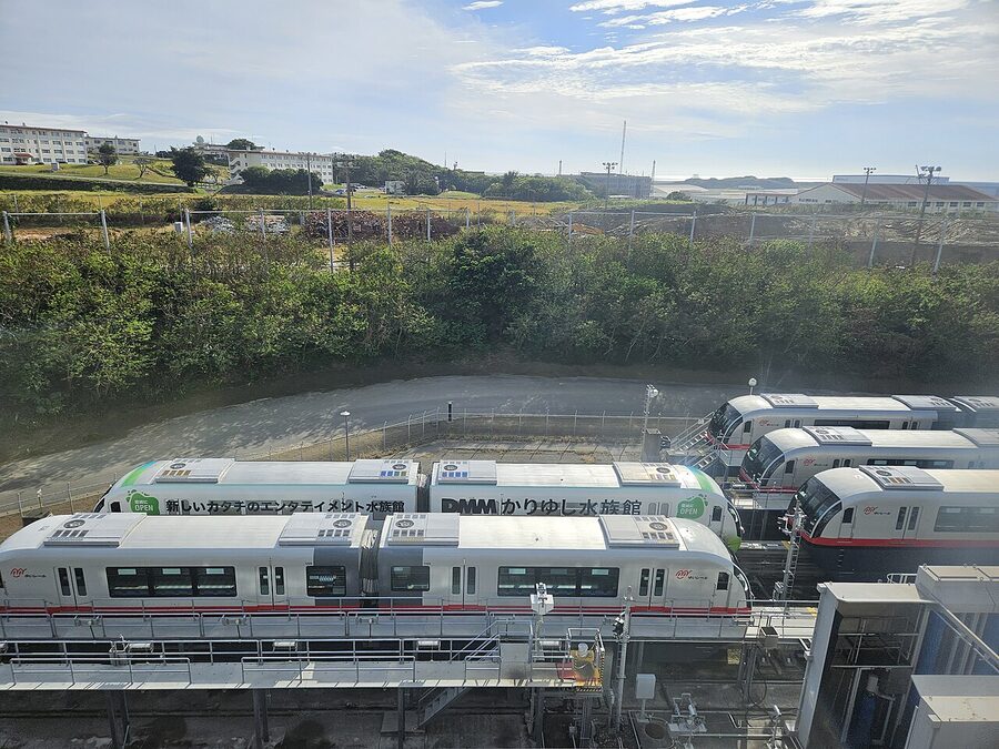
The Japan Rail Pass does not cover Okinawa. There are no JR lines in the prefecture and no shinkansen south of Kagoshima, so the pass is useful only for the leg before you fly. The Yui Rail in Naha is the prefecture’s sole urban rail and it accepts Suica and OKICA cards, not JR passes. Plan accordingly.
From Tokyo
Both ANA and JAL run Tokyo Haneda to Naha as a high-frequency trunk route, around 18 daily flights between them. Flight time is 2h 30m to 3h depending on winds. Standard economy fares book at ¥15,000–30,000 one-way two months out; promotional Tabiwari and Saki-toku fares drop into the ¥10,000–14,000 range if you commit early. Skyscanner finds the LCCs (Peach, Solaseed, Jetstar Japan) at ¥6,000–9,000 if you’re flexible on dates and bag-free. Naha to Tokyo on the return leg books cheaper than the outbound by a small but consistent margin.
For Yaeyama, both ANA and JAL run direct Tokyo Haneda to Ishigaki services, three daily flights, 3h flight time. Fares run ¥25,000–45,000 standard economy. The alternative is Haneda-Naha-Ishigaki on a connection, which adds 2 to 3 hours and rarely beats the direct on price.
Miyako is direct from Haneda once daily on JAL or via Naha (Naha-Miyako is 50 min, several flights a day on ANA, JAL, JTA and Solaseed).
From Osaka, Nagoya, Fukuoka
Itami and Kansai both fly direct to Naha (2h 15m), with Kansai adding direct Ishigaki services on JAL and Peach. Nagoya Chubu runs daily to Naha, occasional charter direct to Ishigaki. Fukuoka is the surprise sleeper: 1h 30m to Naha and a popular weekend route for west Japan residents.
From Naha to elsewhere on Main Island
You’ll exit Naha Airport’s domestic terminal into the Yui Rail platform. Three minutes’ walk, no stairs, signed in English. The Naha Airport-Kencho-mae trip (the closest stop to Kokusai-dori) is 15 min and ¥270, or 30 min and ¥380 to Shuri. A 24-hour pass is ¥800, the 48-hour pass ¥1,400, both worth it if you stay in central Naha and visit Shuri.
For the northern half of Main Island (Onna, Nago, Motobu, Cape Hedo), you’ll either drive or take an Okinawa Bus expressway service. The Yanbaru Express bus from Naha Airport / DFS Galleria to Nago Bus Terminal runs 7 times daily, 2h 15m, ¥2,000. From Nago you change buses for Motobu and the Churaumi Aquarium. Realistically, the bus network outside Naha and the Naha-Nago corridor is sparse enough that most travellers rent a car. Tomi Rent A Car, OTS, Nippon, Toyota, Times. Daily rates start around ¥5,500 for a compact, more in peak season.
What makes Okinawa not-Japan
The Ryukyu Kingdom (1429–1879)
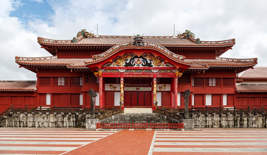
For 450 years before annexation, these islands were the Ryukyu Kingdom, a tributary state of Ming and Qing China that traded all the way to Siam and Java. The kings sat at Shuri, the capital was Naha, and the architecture, the religion, the music, the dance and the cuisine grew sideways from the Japanese mainland under heavy continental and Southeast Asian influence. You see it in the red-tiled roofs and the limestone tombs, in the three-stringed sanshin (the spiritual ancestor of the shamisen, but with snakeskin where mainland instruments use silk), in the bingata textile patterns. Stand inside the Shuri courtyard and you’re closer to a Beijing courtyard than to Kyoto.
The Satsuma domain of Kyushu invaded in 1609 and made Ryukyu a vassal, but the kingdom retained nominal independence and its tributary relationship with China until the Meiji government formally annexed it as Okinawa Prefecture in 1879. Within a generation the kingdom’s institutions were dismantled. The language was banned in schools. The traditional dress shifted toward standard mainland forms in public, though older women in the islands still wear the bingata kimono for festivals. A lot of what you see in Naha museums today is reconstruction, because the originals burned in 1945.
The Battle of Okinawa (1 April–22 June 1945)
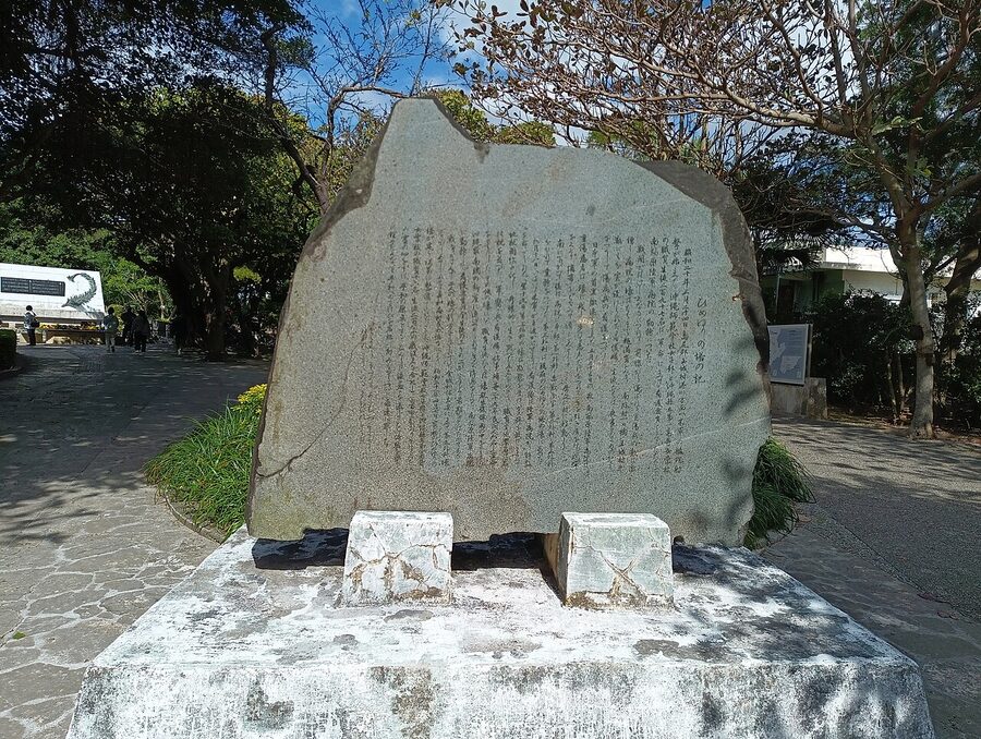
The only ground battle fought on Japanese soil in the Second World War lasted 82 days. American forces landed on Okinawa Main Island on 1 April 1945; organised Japanese resistance ended on 22 June. Roughly 12,500 Americans died. Around 110,000 Japanese soldiers died. And approximately 100,000 to 150,000 Okinawan civilians died, conscripted into auxiliary units, killed in the crossfire, or pushed into mass suicide by Japanese military propaganda about American atrocities. The numbers are still contested. The orthodox figure quoted in school textbooks is one in four civilians.
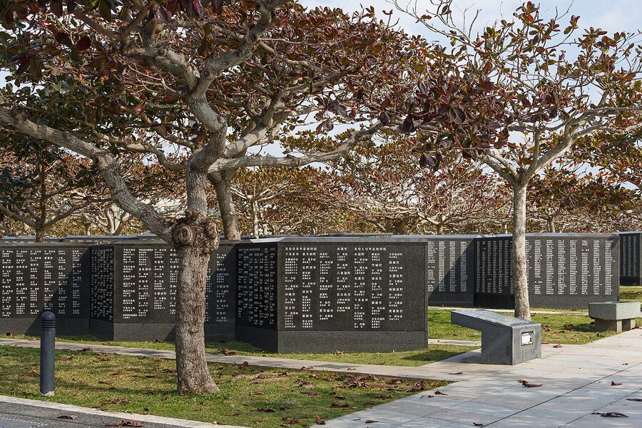
You see the war everywhere in southern Main Island. The Himeyuri Peace Museum (the cave hospital where 200 schoolgirl nurses died), the Cornerstone of Peace memorial at Itoman, the former Imperial Japanese Navy underground headquarters at Tomigusuku. Visit one of them at minimum. The Cornerstone is the place where the politics of the 1945 narrative falls away and you’re just looking at names.
US administration (1945–1972) and the bases now
After Japan’s surrender Okinawa was placed under direct American military administration and remained outside Japanese sovereignty for 27 years. The yen was replaced by US dollars. Cars drove on the right. Currency, government, language signage, all American. Reversion to Japanese rule happened on 15 May 1972, an anniversary still observed annually. The reversion didn’t end the base presence: roughly 74% of US military facilities in Japan are concentrated in Okinawa, on about 10% of the prefecture’s land. Around 47,000 US military personnel and dependents live here. The big bases (Kadena, Futenma, Camp Schwab) are visible from the highways. The political fight over Henoko and the relocation of MCAS Futenma is ongoing and you’ll see “no base” placards on chain-link fences in the north. As a traveller you don’t need to take a position. As a traveller you do need to know that if your map shows a green-roof rectangle on the west coast labelled “Camp Foster”, you can’t drive through it.
Naha and the south
Naha is where almost everyone arrives, and most travel guides under-program the city. Two days is the realistic minimum. Three is comfortable. The full city guide lives at the Naha city guide, but the regional-hub-level highlights:
Shuri Castle is the symbol of the Ryukyu Kingdom and a UNESCO World Heritage Site (registered 2000). The Seiden, the main hall, burned to the ground in a 31 October 2019 fire that destroyed roughly 4,200 sq m of the castle complex. Reconstruction is the ongoing story: the exterior of the Seiden was completed in 2025, with interior renovation expected to finish in autumn 2026. During reconstruction the castle has stayed open and you can watch the rebuild from a viewing platform, which is a more interesting visit than the finished structure was. Park admission is ¥400 for adults, ¥300 high school, ¥160 elementary and junior high, free under six (verified May 2026).
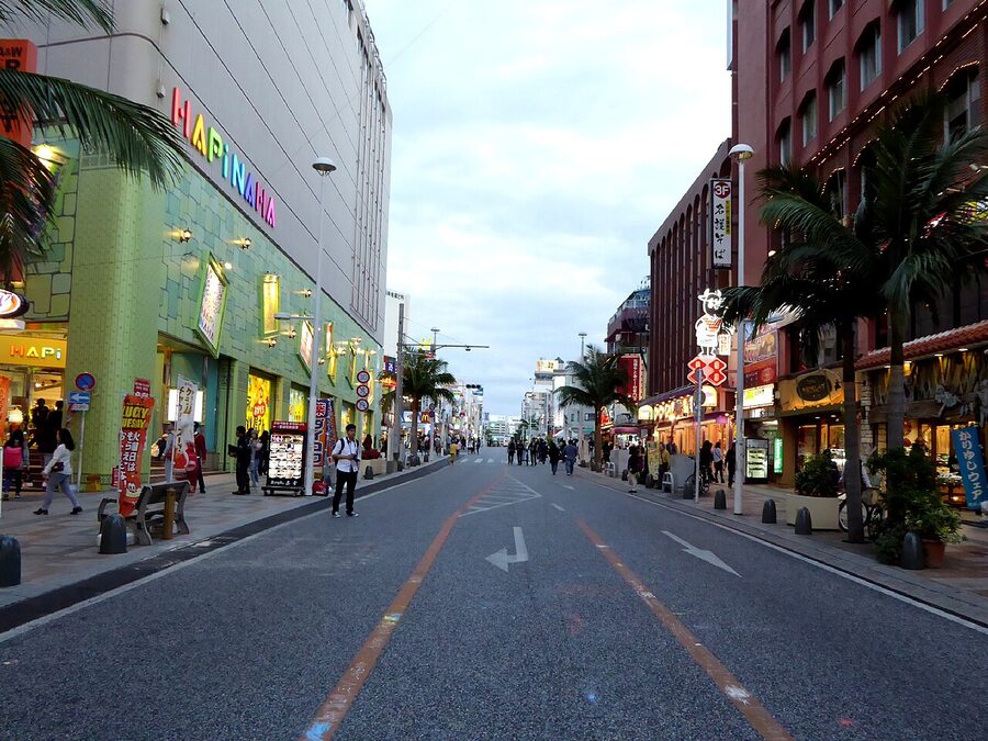
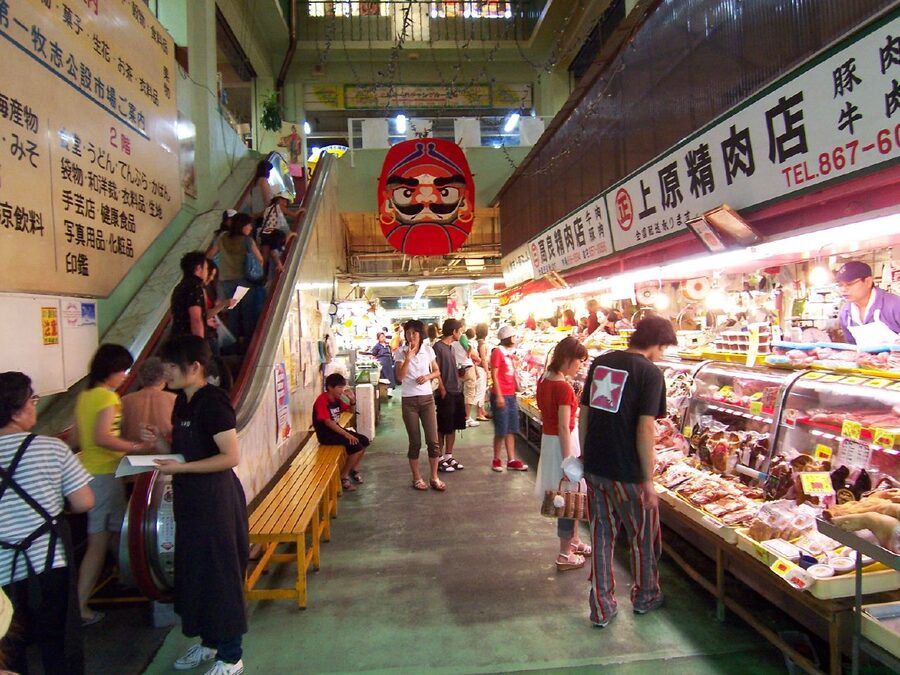
Kokusai-dori, “International Street”, is the 1.6 km central shopping spine. Tourist-priced but unavoidable, and the side alleys are where the value is, especially the covered Heiwa-dori and Ichiba-Hondori arcades. Drop into the Makishi Public Market on Heiwa-dori and head upstairs for the second-floor shokudo where vendors will cook your purchases from the ground floor for around ¥500 per dish. It’s the tourist version of a tradition that’s still genuinely good.
Tsuboya pottery district is two streets behind Kokusai-dori, the historic kiln neighbourhood for yachimun ware. The big working kilns moved out to Yomitan in the north decades ago, but the shops remain and the small Tsuboya Yachimun Museum is a serious primer. Cup-and-saucer pieces start around ¥2,500, plates ¥3,500–8,000.
If you have a third Naha day, give it to the south end of Main Island: the Peace Memorial Park, the Himeyuri Museum, and the Naval Underground Headquarters. Together they’re the war-history loop and it’s hard to do them in less than half a day. After that you might add Shikinaen, the Ryukyu kings’ second residence and garden (UNESCO 2000, ¥400 admission), or Tamaudun, the royal mausoleum across from Shuri (also ¥400, opens 09:00).
The Yui Rail and getting around Naha
The Yui Rail (Okinawa Urban Monorail) runs 19 stations across 17 km, from Naha Airport in the southwest to Tedako-Uranishi in the northeast. Service is 06:00 to 23:30 daily, every 4 to 15 minutes depending on time. Single fares are ¥230 to ¥390. The 24-hour pass is ¥800; the 48-hour is ¥1,400. The pass is the better deal almost always, because Shuri (the obvious second day’s destination) is at the far end of the line.
Outside Naha, the city bus network is patchy and the regional bus network is slow. Within Naha proper you can walk and monorail. For Shuri Castle, take the Yui Rail to Shuri Station and walk 12 minutes uphill, or to Gibo and walk 15 minutes (less steep). For the Peace Memorial Park, the Naha Bus #89 from Naha Bus Terminal is the public option (1h, ¥580); the rental car is faster.
Up the spine of Main Island
The west coast of Main Island, north of Naha, is the resort coast. Onna village strings together a 20-km sequence of headland-and-beach resort hotels, from Tiger Beach in the south to Cape Maeda’s Blue Cave snorkel site in the middle. The Naha Tourist Highway (officially Expressway Route 58) runs the length. If your trip is only Main Island, plan three nights down here at minimum.
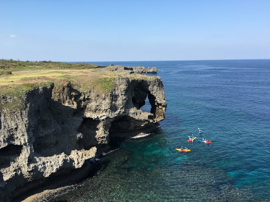
Cape Maeda and the Blue Cave
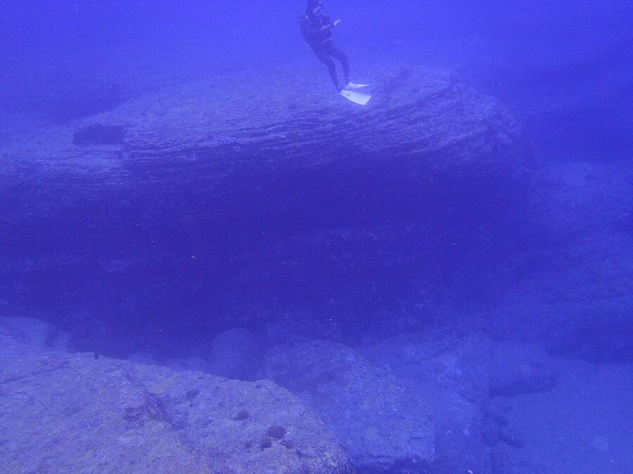
Cape Maeda, near Onna village, is the entry point for the Blue Cave snorkel, the best-known shore-entry snorkel site in the prefecture. The cave runs about 30 m into the cliff and the underwater lighting glows blue-green in mid-morning, when the sun angle is right. Operators run trips from beach huts at the cape (¥4,000–6,000 for a 2-hour group session including gear), or you can swim it from shore if you have your own kit and decent ocean experience. Closes when seas are above 1.5 m, which happens often in winter.
Kouri Island and Kouri Bridge
The Kouri Bridge between Yagaji and Kouri Islands is one of the prefecture’s photo postcards. Drive it slowly. The Heart Rocks at the north end of Kouri Island (a paired pair of wave-eroded boulders) are a cliche but worth the ten-minute walk; come at low tide.
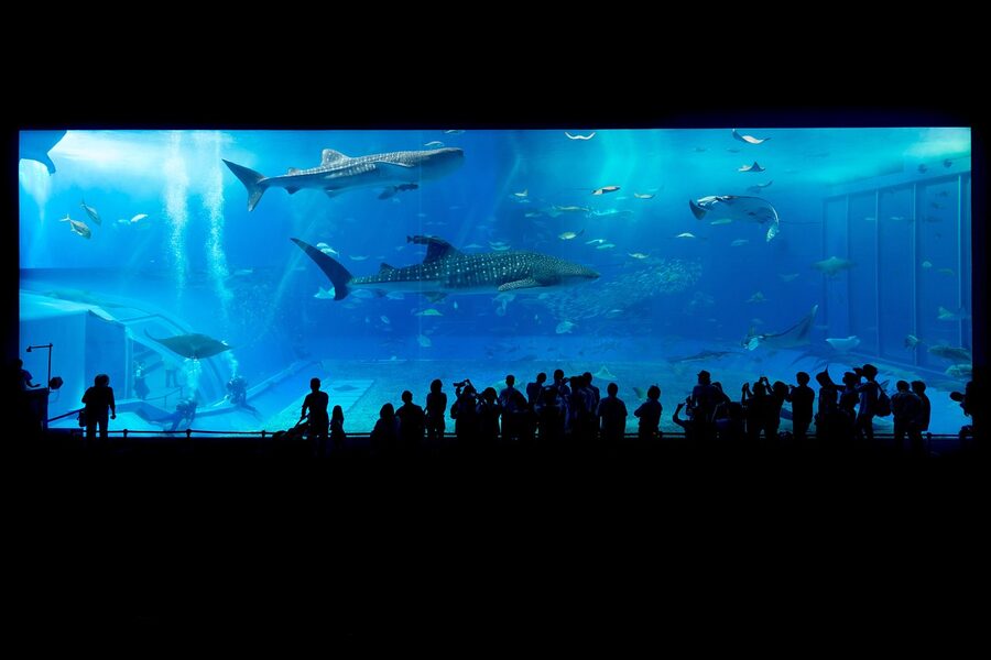
Churaumi Aquarium
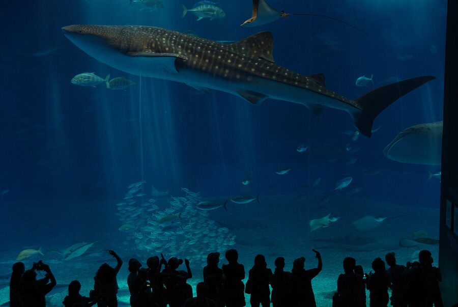
The Churaumi Aquarium, on the Motobu peninsula in the Ocean Expo Park, is the prefecture’s most-visited paid attraction (3.5 million visitors a year). Adult admission is ¥2,180; high school ¥1,440; elementary and junior high ¥710 (verified at churaumi.okinawa, May 2026). Open 08:30, last entry 17:30 in winter, 18:30 in summer; closed the first Wednesday and Thursday of December. The Kuroshio Tank with the whale sharks is the marquee exhibit, but the deep-sea floor and the manatee tanks are the underrated halves of the visit. Allow three hours minimum, four if you bring kids.
Emerald Beach is a five-minute walk from the aquarium gates. Same ticket, no extra charge. If your trip pairs the aquarium with a beach day, this is the obvious lunch stop in between.
Yanbaru, the rainforest tip
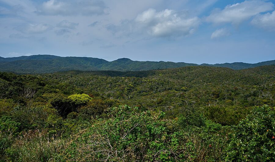
Cape Hedo at the very northern end of Main Island is the geographic limit. From here, on a clear day, you can see Yoron Island in Kagoshima Prefecture about 22 km away. The northern third of Main Island is now the Yanbaru National Park, gazetted 2016 and inscribed as a UNESCO Natural World Heritage Site in 2021 (along with Iriomote and parts of Amami). The Yanbaru kuina (Okinawa rail), a flightless bird endemic to the forest, is the headline species. Don’t expect to see one without a dawn guide. The driving experience itself, road #58 past Hentona and turning inland, is the point: jungle on both sides, no traffic, signs in Japanese only, the occasional habu-snake warning poster on tree trunks. A long day round-trip from Naha is doable but exhausting; a base in Nago at the centre of the island makes more sense.
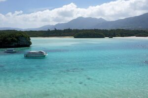
Beaches, coral, the Kerama
The full beach guide is at the Okinawa beaches guide; the regional-hub headline is that the Main Island beaches are merely good and the Kerama beaches are the prefecture’s best for snorkelling. The Kerama Islands National Park is a 30 to 50 minute ferry from Tomari Port (Naha): high-speed Queen Zamami runs Naha-Zamami in 50 min ¥3,200 one-way, slow ferry Ferry Zamami in 2 hours ¥2,150. Booking opens online via Kerama-Marine and at Tomari counter; in peak season (July, August, Golden Week) book at least a week ahead.
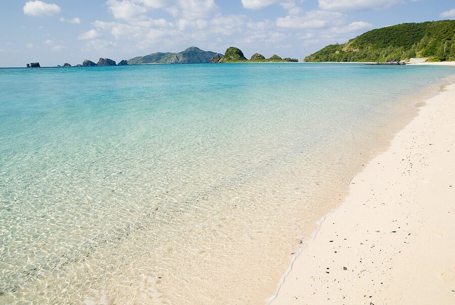
The hard call on the Kerama is day trip versus overnight. Day trips work and a lot of travellers do them, but the islands earn their second day: the morning ferries land at 09:30, you have around six hours before the late-afternoon return, and the snorkel windows are weather-dependent. Stay one night and you double your chances of catching the conditions you came for. Humpback whale watching tours run from Tokashiki and Zamami January through March, ¥5,500–6,500 for a half-day boat trip with sightings essentially guaranteed in February.
The Yaeyama: the version of Okinawa most people miss
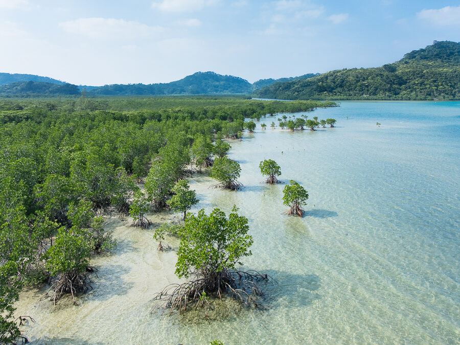
The full Yaeyama deep-dive is at the Yaeyama Islands guide. Headline at this level: an extra one-hour flight south of Naha (or direct from Tokyo Haneda or Osaka Kansai) and you’re on Ishigaki, the gateway to a different version of the prefecture. Water clarity is better. Tourist density is lower. Traditional Ryukyu villages are still inhabited, not just preserved as museum pieces. The Iriomote yamaneko, a wildcat endemic to one island, still lives in the mangroves. The cost is one extra flight; the payoff is everything you’d hoped Okinawa would be.
Ishigaki is the airport hub. From there, the Ishigaki ferry terminal serves all the inhabited Yaeyama: Taketomi (10 minutes, every 30 minutes, ¥750 one-way), Iriomote (40 to 45 minutes, hourly, ¥2,300), Kohama (25 minutes, hourly, ¥1,500), Hateruma (1 hour, 4 daily, ¥4,070, weather-cancelled often), Hatoma (40 minutes, 3 daily, ¥1,860), Kuroshima (25 minutes, 4 daily, ¥1,440). The two operators (Anei Kanko and Yaeyama Kanko Ferry) coordinate a near-shared timetable.
If you’re going to do one of the four island groups beyond Main Island, do this one.
Miyako, the bridge-linked archipelago
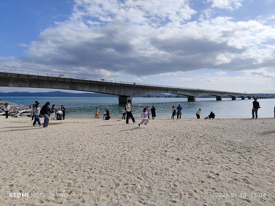
Miyakojima sits between Main Island and the Yaeyama, geographically and stylistically. It’s flat, which makes it a cycling and rental-car island; it’s bridge-linked to Ikemajima, Kurimajima and Irabujima, which means a single rental car covers four islands; and it has the most photographed beach in the prefecture (Yonaha Maehama, “Maehama Beach”, on the southwest coast).
The Irabu Bridge, opened January 2015, runs 3,540 m over open water from Miyakojima to Irabujima, the longest toll-free bridge in Japan. Drive it slowly in the late afternoon when the light flattens out.
Miyako is the easiest island to do as a long-weekend extension: 50-minute flight from Naha or 3 hours direct from Tokyo, three days is enough to circumnavigate the bridge-linked group, beach culture is more developed than on the Yaeyama. If you’ve already done Main Island and you’re back in Okinawa for a second trip, Miyako is the obvious next stop.
The food
Okinawan food is its own cuisine, not a regional dialect of Japanese food. The fundamentals: pork everywhere (rafute, mimiga, tebichi), bitter melon (goya), wheat noodles (Okinawa soba is not buckwheat), tofu in firmer, harder forms than mainland (shima-dofu), island vegetables you don’t see north of Kagoshima (handama, nigana, naagi onion), and a sugar-and-soy braising tradition that runs sweet by mainland standards.
Five dishes that earn their reputation:
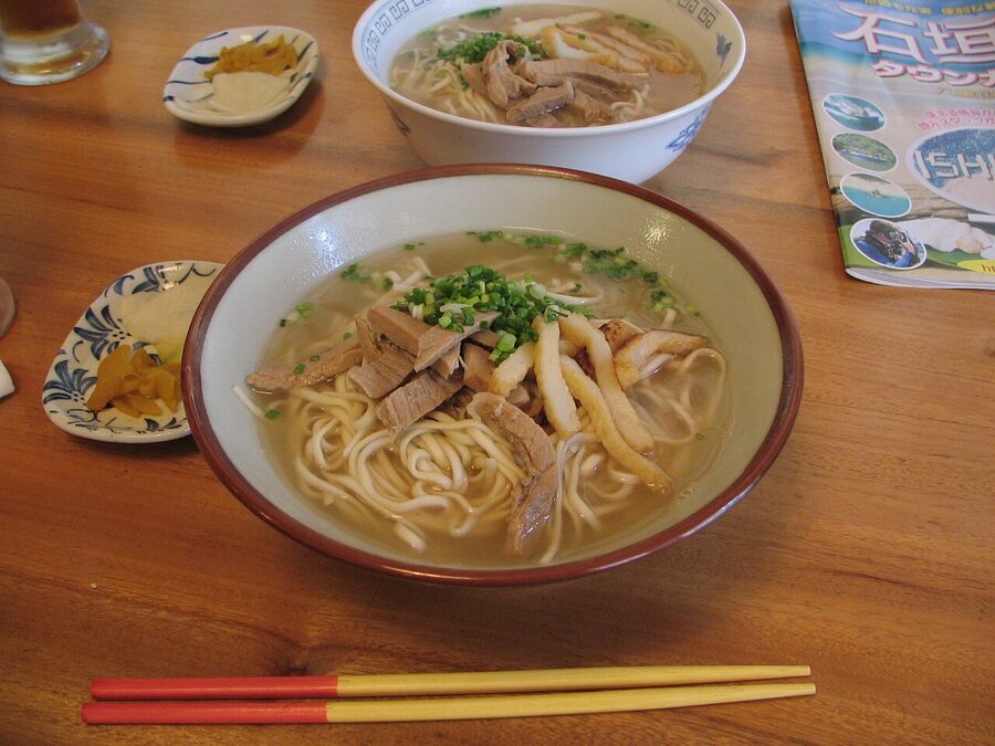
Okinawa soba
The signature noodle dish. Wheat-only noodles, no buckwheat, with a kansui treatment that gives them a yellow colour and a chewy bite closer to ramen than mainland soba. Pork-rib-and-bonito broth, topped with three-layer pork belly (rafute), pink-and-white fish cake, ginger and scallion. Most shops also offer Yaeyama soba (thinner, twisted noodles) and Miyako soba (flat). ¥700 to ¥1,000 a bowl. Eat one in any shokudo at lunchtime; the chains (Goya, Choujirou Soba) are reliable, the family-run shops in side streets are better.
Goya champuru
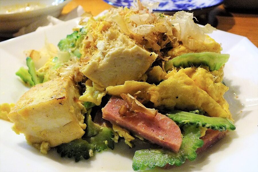
The bitter melon stir-fry is the most-photographed Okinawan dish for a reason: it’s good, it’s everywhere, and the bitter is real. Bitter melon, firm Okinawan tofu, beaten egg, thin pork belly, sometimes Spam (which Okinawans co-opted from US base commissaries in the 1950s and never released), all stir-fried with soy and dashi. Order it once and you’ll figure out whether you want it again. I do.
Sata andagi
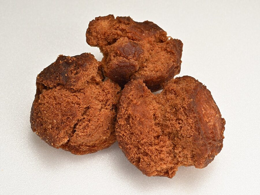
The Okinawan deep-fried donut. Not really a donut; closer to a denser cake-ball deep-fried in golden brown. Cracked exterior, dense interior, simple egg-flour-sugar dough. Found at every market stall and a lot of supermarkets. The brown-sugar version (kokuto-andagi) is the one to try first.
Awamori
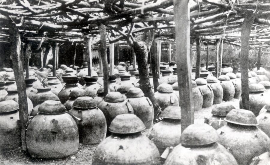
The local distilled spirit: long-grain rice, black koji (kuro-koji-kin, a microbe Okinawa uses where mainland sake brewers use yellow), distilled rather than brewed. The basic stuff hits 25 to 30% ABV; the aged kusu (古酒) runs 40 to 43% and is held in clay pots for three years minimum. Drink it cold and watered for the entry version. Drink it on the rocks once you’ve adjusted. Drink it neat once you’re committed. Avoid mixing into cocktails; it doesn’t survive juice.
Orion beer
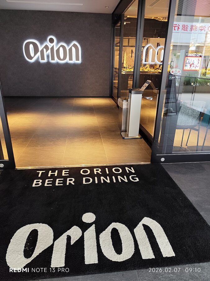
The dominant local lager, brewed in Nago since 1957, holding around 55% of Okinawan beer market share against Asahi and Kirin’s mainland weight. The standard “Orion Draft” pours light and crisp, designed for hot weather, and you’ll see it more often than tap water at festivals. The brewery in Nago does English-language tours (book ahead, ¥500 with a tasting flight at the end). The micro-brewery scene around Naha (Helios, the Okinawa Sango Brewery) has caught up in the last five years and is worth attention.
Culture you’ll see in passing
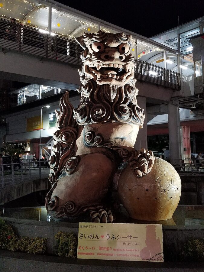
Shisa
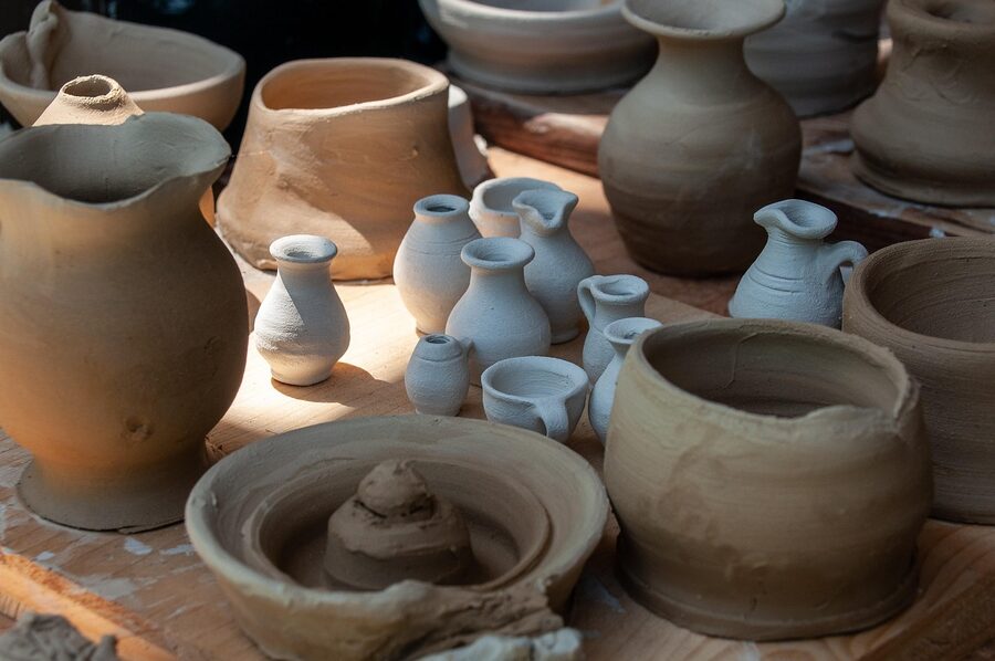
The lion-dog guardian, descended from Chinese guardian lions via Ming-era trade, ubiquitous in pairs on roof corners and gateposts. The pairing is intentional: open mouth (oral, ah) on one side, closed mouth (un) on the other, so together they cover the alpha and omega of the protective alphabet. Souvenir shisa start around ¥1,500 for small ceramic pairs; serious yachimun pieces from named potters run ¥15,000 and up. Tsuboya in Naha and Yomitan in central Main Island are the kiln villages.
Eisa
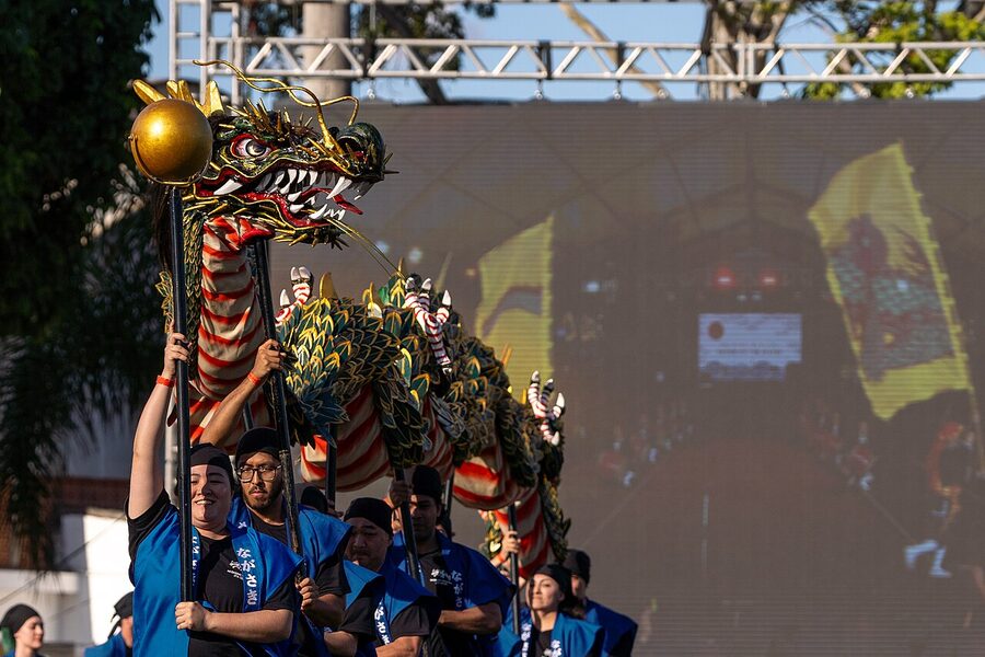
The drum dance unique to Okinawa, performed at the lunar Bon Odori (mid-August) and at year-round tourist showcases. The big odaiko drum and the shoulder-slung shimedaiko drive the rhythm; the front-line dancers wear straw min-saa belts and twirl wooden sticks; sanshin and chanting hold the line. The All-Okinawa Eisa Festival in late August in Okinawa City (the former Koza) draws performers from every village and the bus goes there from Naha for the day. If you’re in the prefecture in mid-August and you don’t catch eisa once, you’ve planned wrong.
Sanshin and Ryukyu music
The three-stringed sanshin is to Okinawan music what the shamisen is to mainland; the two are cousins, with the sanshin older and snake-skin-bodied (mainland shamisen took the same form to Honshu in the 16th century and shifted to cat skin). You’ll hear it in any halfway-decent izakaya in Naha. The Yaeyama and Miyako have their own folk-song traditions distinct from the Main Island form.
The seasons (different from mainland)
Okinawa’s seasonal calendar runs offset from the mainland in two ways: the warm season is much longer, and “spring” and “autumn” as Honshu travellers know them barely exist. Average monthly temperatures in Naha (per the Japan Meteorological Agency):
| Month | Avg low °C | Avg high °C | Sea temp °C | Notes |
|---|---|---|---|---|
| January | 15 | 19 | 21 | Coolest month, cherry blossoms in late Jan |
| February | 15 | 19 | 21 | Whale watching peak in Kerama |
| March | 17 | 21 | 22 | Spring proper, swimwear weather by mid-month |
| April | 19 | 24 | 23 | Beach season opens, hotels still off-peak |
| May | 22 | 27 | 25 | Rainy season starts early May |
| June | 25 | 30 | 27 | Rainy season ends late June; typhoons start |
| July | 27 | 32 | 29 | Peak heat, peak prices, peak typhoons |
| August | 27 | 32 | 29 | Eisa festival mid-month, typhoons frequent |
| September | 26 | 31 | 28 | Hot, frequent typhoons, but quieter |
| October | 23 | 28 | 27 | Excellent value, water still warm |
| November | 20 | 25 | 25 | Best shoulder month for snorkel-and-stay |
| December | 17 | 21 | 23 | Cool, dry, water still swimmable in Yaeyama |
The Okinawa rainy season (May–June)
The local tsuyu rainy season starts in early May and ends in mid-to-late June, about a month earlier than Honshu. It rains hard but not constantly: 200–300 mm a month spread across the period, with afternoon downpours common but mornings often clear. Beaches stay open. Snorkelling is fine between the rains. Hotel prices are noticeably softer than July–August. If you can handle the chance of a wet day, late May and the first half of June are the prefecture’s value sweet spot.
Typhoon season (June–October, peak August–September)
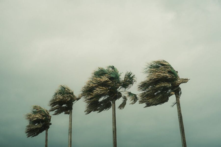
Okinawa is in the most active typhoon corridor in Japan, averaging 7 to 8 passes per season, two to three of them direct or near-direct hits. A direct hit shuts down all ferry services, cancels most domestic flights for 24 to 48 hours, and confines you to your hotel. The probability of a typhoon affecting any given week in August is roughly 30 to 40%. If your trip absolutely must happen in summer, build buffer days. Travel insurance with weather-cancellation cover is a sensible call.
The good news: typhoons typically pass through in 24 to 36 hours, after which conditions clear and the snorkelling water is the best of the year (storm waves churn nutrients out and visibility spikes). The bad news: reschedules during the height of summer are unforgiving because everything else is booked.
Winter (December–February): the underrated season
Okinawan winter sits at 17 to 22°C. The water is 21 to 23°C, which is cool by tropical standards but still swimmable for the determined (a 3 mm shorty is comfortable; the locals just go in). Hotel prices are at year-round lows. The Kerama humpback whale watching season is January through March. The cherry blossoms (kanhizakura, Taiwan cherry, deep pink rather than the mainland’s pale somei-yoshino) bloom in late January at Nago Castle Park and early February at Yaedake on Motobu peninsula. If you’ve already done the mainland’s cherry blossom season in April, Okinawa gives you a second hanami in February.
The trade-off: cold mornings (15°C in January is genuinely cool when you’ve packed for a beach trip), occasional rain weeks, and ferries to outer islands that get cancelled for sea conditions more often than in summer.
What surprises first-timers
A few things consistently catch first-time visitors out:
The distances are bigger than they look
Okinawa Main Island looks like a small island on the map. It is not. From Naha to Cape Hedo at the northern tip is 130 km, around 2h 30m by car on the Okinawa Expressway and ordinary roads. Naha to the Churaumi Aquarium is 96 km, about 1h 50m. Add a coffee stop and a beach detour and the day from Naha to Churaumi and back is six hours of driving plus the visit. A lot of itineraries underestimate this. Plan a base outside Naha (Onna or Nago) if your trip leans north.
English signage is patchy
Naha and the major resort areas are well-signed; the rural east coast and the mountain roads in Yanbaru are not. Google Maps drive directions work essentially perfectly in 2026; if you’re relying on translated road signs, you’ll struggle. Download offline maps before you leave the airport.
Rental cars are normal here, even if you skipped them on the mainland
If you’ve been driven around mainland Japan by trains and you’ve never put yourself behind a wheel, Okinawa is the time to start. Outside Naha, the bus network won’t get you there. Drive on the left, IDP required, parking is plentiful and usually free at attractions. Petrol is around ¥165 per litre as of 2026 (verify on arrival). Compact car rentals from ¥5,500 a day, ETC card ¥500–1,000 deposit if you want to use the expressway.
The Uchinaaguchi language is real but mostly invisible to tourists
Okinawan (Uchinaaguchi, 沖縄口) is a separate language from Japanese, not a dialect, and was actively suppressed in schools after annexation. Today it’s spoken fluently mainly by people over 80, with younger Okinawans using a Japanese-Okinawan hybrid (called uchinaa-yamatu-guchi) that mainland Japanese can mostly understand. As a tourist you’ll see it on shop signs (menso-re for “welcome”, nifedebiru for “thank you”) and almost never in conversation. Learning menso-re and nifedebiru goes a long way; everyone you’ll deal with speaks Japanese, and most under-50s in Naha and the resort coast speak some English.
Okinawa cuisine doesn’t include sushi
The supermarket sushi exists, the restaurant chains exist, but Okinawa is not a sushi destination. The fish here is reef fish, not the red tuna and shellfish of mainland sushi tradition. Eat the things Okinawa actually does well (soba, champuru, agu pork, rafute, sea grapes, awamori) and save sushi for Tokyo or Toyama.
Where to stay, broadly
Three strategies, depending on what you want:
- Naha base, day trips out. Cheap, monorail-connected, food and nightlife on tap. Good for first-timers and short trips. The full Naha guide covers the neighbourhoods (Asato, Tsuboya, Kume, Tomari) and where to stay in each.
- Onna or Motobu resort base, with a Naha couple of nights at the start or end. The west-coast resort hotels (Hyatt Regency Seragaki, ANA InterContinental Manza Beach, Hilton Sesoko, the Halekulani at Onna) are pricey but they earn it for snorkel-and-pool combinations. Drive to Churaumi from here in 30 to 50 minutes.
- Island-hopping, two or three islands, one or two nights each. Higher logistical cost (ferries, transfers, baggage), much higher payoff. The Yaeyama (Ishigaki + Iriomote, or Ishigaki + Taketomi) is the strongest two-island combination.
Hotel guides per cluster are coming. In the meantime, the standard Booking.com inventory is extensive and the Japanese rakuten-travel.co.jp inventory includes the small Okinawa ryokan and pension network that Booking sometimes misses.
One-week sample itinerary
If your only trip to Okinawa is a single seven-day visit and you want a shape that works:
- Day 1. Fly into Naha. Yui Rail to Kencho-mae. Hotel check-in. Walk Kokusai-dori, dinner in a Heiwa-dori izakaya, first Orion.
- Day 2. Naha. Shuri Castle in the morning (Yui Rail), Tamaudun next door, lunch at Shuri-no-Mon udon shop, afternoon at Tsuboya pottery district, evening Makishi market dinner.
- Day 3. Pick up rental car from Naha Airport. Drive south to Peace Memorial Park, Himeyuri, Naval Underground HQ. Loop back via Senagajima for sunset. Evening back in Naha.
- Day 4. Drive north to Onna. Stop at the Ryukyu Mura folk-craft village. Cape Manzamo before lunch. Onna afternoon at Tiger Beach or the Blue Cave. Stay in Onna or Nago.
- Day 5. Churaumi Aquarium morning (08:30 opening). Emerald Beach lunch. Drive to Cape Hedo afternoon (or skip and head south). Stay in Nago or back in Naha.
- Day 6. Day trip ferry to Zamami in the Kerama. Snorkel at Furuzamami Beach. Late ferry back to Naha.
- Day 7. Naha morning, last sata andagi from a Heiwa-dori stall, fly out.
Extend by three days and you’d add Ishigaki and Taketomi at the end, flying Naha-Ishigaki and out via Ishigaki Airport directly to Tokyo. Extend by a week and you’d add Iriomote, Hateruma and Miyako too.
What you came here for
Okinawa earns its week. The first day in Naha is just a gateway, the second is the calibration day where the tropical heat starts feeling normal, and from day three the prefecture starts unfolding sideways: south to the war memorials, north to the resort coast, west to the Kerama for one ferry day, and (if you’ve planned for it) south by plane to the Yaeyama for the version of the trip you’ll talk about when you get back. The 30-day sticker on a Japan Rail Pass won’t get you here. The 7-day sticker on a budget LCC fare will.
Stand at the Cornerstone of Peace at sunset, on the same bluff above the East China Sea where the Imperial Japanese Army’s southern headquarters dug into the limestone in 1945, and read the names cut into the polished granite. American names, Japanese names, Korean names, Taiwanese names, the long unbroken Okinawan rolls of ten thousand and ten thousand and ten thousand more. Then drive twenty minutes back into Naha for dinner. That distance, between what happened here and what’s happening here, is what makes the place worth a week.
.jpg)