Most travellers come to Okinawa for water you can see your toes through, traditional villages, and an island feel mainland Japan can’t deliver. Then they spend the trip on Okinawa Main Island and quietly wonder why the postcards looked so different. The answer is that the postcards were taken on the Yaeyama Islands, 400 kilometres further south, and the Yaeyama deliver more of the Okinawa fantasy than Naha and the main island ever do.
Kabira Bay’s water is the colour Photoshop reaches for. Iriomote’s jungle covers an island the size of metropolitan Tokyo and contains exactly one paved ring road. Taketomi is a Ryukyu village where the streets are crushed coral and the school run still uses water-buffalo carts. Yonaguni sits closer to Taipei than to Naha, and divers come for hammerheads in February when half the country is under snow. The cost of all this is one extra plane ticket, ISG out of Naha or direct from Tokyo or Osaka. Skip the main island and come straight here.
In This Article
- Why the Yaeyama beat the main island
- Which Yaeyama island for which traveller
- Getting to the Yaeyama (and why you don’t connect via Naha)
- Ishigaki: the gateway, and a real island in its own right
- Kabira Bay, and why you can’t swim in it
- The manta-ray snorkel at Manta Scramble
- The rest of Ishigaki: Yonehara, Hirakubo, and the lesser-known north
- Where to eat on Ishigaki, and what to eat
- Iriomote: the jungle island
- Getting to and around Iriomote
- Pinaisara Falls, by kayak
- The Iriomote yamaneko, and the dark sky
- Where to stay on Iriomote
- Taketomi: a Ryukyu village preserved
- The water-buffalo cart, and what it actually is
- Kondoi Beach and the star-sand
- Hateruma: Japan’s southernmost inhabited island
- What you actually do on Hateruma
- Yonaguni: closer to Taipei than to Naha
- The underwater monument, and the controversy
- Hammerheads in winter
- Kohama: the Chura-san island
- Yubujima: the buffalo-cart island connected by sea
- When to come, and what to expect
- Practical bits travellers underestimate
- One last thing
Why the Yaeyama beat the main island
The Yaeyama are 12 inhabited islands plus a string of uninhabited ones, scattered between Ishigaki at the north and Yonaguni at the western tip. The closest of them to Okinawa Main Island still sits more than 400 kilometres away across open Pacific. That distance is the whole point. Visitor density drops, the water clears, the development thins out, and the Ryukyu cultural texture (which was sanded away on the main island during US administration from 1945 to 1972, and the post-reversion construction boom that followed) is still intact in places like Taketomi and Hateruma.
I’ll give you the shortcut. If you are coming to Okinawa for the first time and have a week, fly straight to Ishigaki. Spend three nights on Ishigaki, day-trip Taketomi and ferry across to Iriomote for two nights. Add a night on Hateruma if you want Japan’s southernmost beach to yourself in the morning. If diving is the point, fly Ishigaki to Yonaguni and pencil in three to four nights. The main island is a separate trip; trying to do both in one week will leave you feeling rushed in both halves.
The actual case against the Yaeyama is the typhoon window. June to early October the ferries can shut down for two or three days at a time when a storm tracks through, and the smaller islands (Hateruma, Yonaguni) are the first to be cut off. November to May is the safe window. Winter is 18 to 22°C with usable but cool water; spring is dry and warm; the manta-ray snorkel runs strongest May to October.
Which Yaeyama island for which traveller
The cluster confuses people because the names sound interchangeable. They are not. Each island has a clear character.
| Island | Why come | Time needed |
|---|---|---|
| Ishigaki | The hub. Kabira Bay, manta-ray snorkel, beach drives, restaurants and bars at night. | 2–3 nights |
| Iriomote | Jungle island. Mangrove kayaking, Pinaisara Falls, the Iriomote cat, dark skies. | 2 nights |
| Taketomi | Preserved Ryukyu village, water-buffalo carts, star-sand beach. Day trip or one night. | 1 day or overnight |
| Hateruma | Japan’s southernmost inhabited island. Nishi-no-hama Beach, Southern Cross sky. | 1–2 nights |
| Yonaguni | Westernmost island. Hammerhead diving, the underwater monument, Yonaguni horses. | 3–4 nights, divers only |
| Kohama | Resort island, sugarcane roads, “Chura-san” filming locations. | 1 night, slow pace |
Getting to the Yaeyama (and why you don’t connect via Naha)
Two routes to Ishigaki. Direct flights from Tokyo or Osaka, or transit via Naha.
Direct from Tokyo Haneda or Narita. ANA and JAL run multiple daily flights from Haneda (HND) to New Ishigaki Airport (ISG). The flight takes around 3 hours 5 minutes; Tokyo to Ishigaki is one of the longest single-leg domestic flights in Japan, longer than Tokyo to Sapporo. Fares as of May 2026 sit anywhere from ¥15,000 (off-peak, advance) to ¥45,000 (peak summer or last-minute). Skyscanner and the airlines’ own sites swap rankings constantly.
Direct from Osaka Kansai or Itami. Around 2 hours 30 minutes, similar fare range. If you’re starting in Kyoto or Osaka, this is faster than connecting via Naha.
Via Naha. If you want a stopover on the main island, fly Tokyo or Osaka to Naha, then Naha to Ishigaki on JTA, ANA or RAC, around 1 hour. The Naha leg adds two hours of dead time once you factor in the connection. The only reason to do it is if you genuinely want to see Shuri Castle and Kokusai-dori.
The Japan Rail Pass does not cover any of this. Okinawa has no JR rail at all (only the Yui Rail monorail in Naha, which is a private operator). The full picture for that pass is in my Japan Rail Pass guide; for Yaeyama specifically, budget for separate domestic flights.
One quirk worth knowing: the airport on Ishigaki is called New Ishigaki Airport (also branded “Painushima Ishigaki Airport”), opened in 2013, replacing the old in-town strip whose runway was too short for jets. It sits on the east side of the island, about 30 minutes by bus or rental car from central Ishigaki city. The Karry Kanko airport bus to the ferry terminal in town runs roughly every 30 minutes, ¥540 one-way.
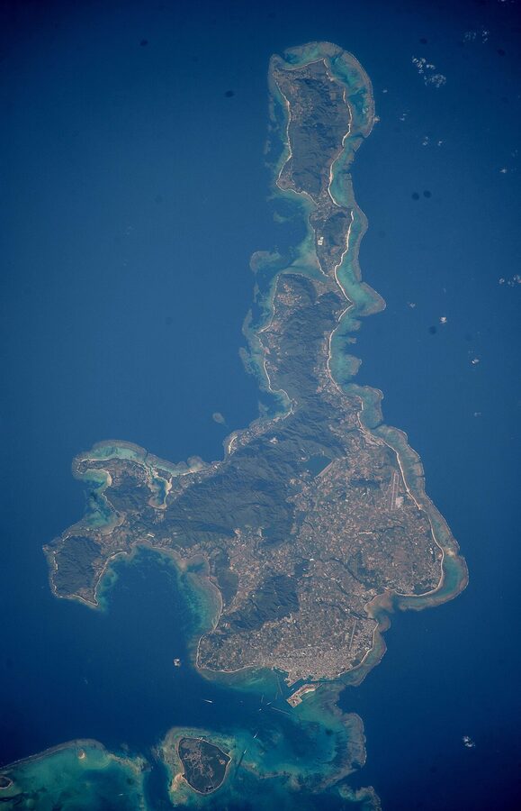
Ishigaki: the gateway, and a real island in its own right
Ishigaki is where you land, where you sleep on most Yaeyama trips, and where you ferry out from to the smaller islands. The island measures roughly 220 square kilometres (about a third the size of Lake Biwa, in mainland Japan terms), with a population around 50,000. It is large enough that doing it justice takes two or three days; small enough that a rental car can lap the whole northern half in a morning.
The town side is concentrated on the south coast, around Ishigaki Port and the ferry terminal. The interior rises to Mount Omoto (526 metres), the highest peak in Okinawa Prefecture. The north and west are agriculture, beaches, and the famous bay.
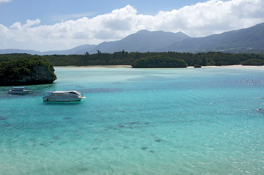
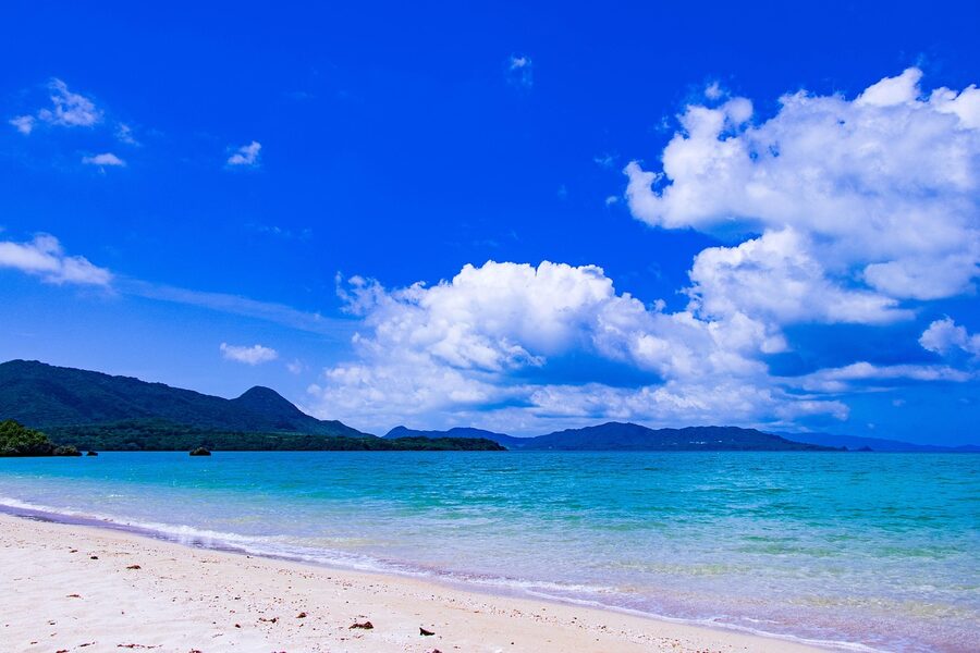
Kabira Bay, and why you can’t swim in it
Kabira Bay (川平湾, Kabirawan) is the postcard. Five small green islets sitting in water that genuinely shifts shade through cyan, jade and turquoise as the tide rises and falls. It made the Michelin Green Guide list at three stars and is one of the country’s hundred designated scenic landscapes. The colour is real. The trade-off is that the bay has a strong tidal current and swimming and snorkelling inside the bay itself are prohibited.
The compromise is the glass-bottom boat. Operators (Kabira Marine, Marine Service Kabira and a few others) run boats every 15 to 30 minutes from the small jetty at the southern end of the bay. As of 2026, ¥1,300 adult, ¥650 child, around 30 minutes, no booking needed if you’re flexible on timing. The boat tracks over coral patches and you watch through the glass floor while a guide names the fish in Japanese. The verdict: it is a glass-bottom boat and it is doing a glass-bottom boat thing. You’re paying for the bay view and the colour, not for the snorkel-grade reef.
For actual snorkelling, head 5 kilometres south to Sukuji Beach (which has a coral patch reef offshore and a beachfront you can swim from), or sign on to a boat trip to Manta Scramble.
The manta-ray snorkel at Manta Scramble
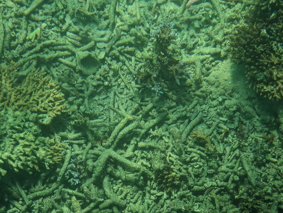
The cleaning station off the north-west coast of Ishigaki is locally called Manta Scramble (マンタスクランブル) or simply the Manta Point. Reef manta rays show up to be cleaned by smaller fish; you snorkel above and watch them do it. The encounter rate is famously high. Operators quote 70 to 90 percent encounter probability in season.
The season runs from late spring to late autumn, with the peak strongest June to September. May and October still produce decent encounters but they get patchy. December to March is essentially off; the mantas are not gone from the water, but the visit pattern at Manta Scramble drops off.
How it works on the day. Operators (the well-known names are Sea-Forest, Umicoza, Marine Service Big Lemon, and the Tom Sawyer ferry-boat outfit) run half-day trips out of Kabira or Ishigaki Port. Pick-up at your hotel, kit fitting, briefing, then a 30 to 60 minute boat ride. Half-day snorkel: roughly ¥9,000 to ¥12,000 per adult including gear and guide as of 2026. Boat snorkellers split the same dive site as scuba groups, and operators stagger entries.
One genuine warning. The site is open ocean, not bay, and the swell can be lively. If you are a nervous swimmer or your kids are small, ask the operator hard questions about wave conditions on the day. The boats run unless conditions are unsafe, but “running” and “comfortable” are not the same thing.
The rest of Ishigaki: Yonehara, Hirakubo, and the lesser-known north
Yonehara Beach (米原ビーチ) sits about halfway up the west coast. The water is shallow and the reef edge is reachable from the beach with a snorkel; this is where many people get their first reef-fish sighting in the Yaeyama. It is also where you’ll see the Yonehara Yaeyama Palm Grove, a designated natural monument and one of two places in the world the Yaeyama palm grows native (the other is Iriomote). Free, drive yourself, no facilities to speak of.
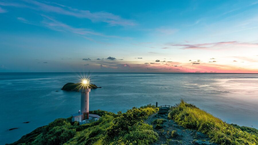
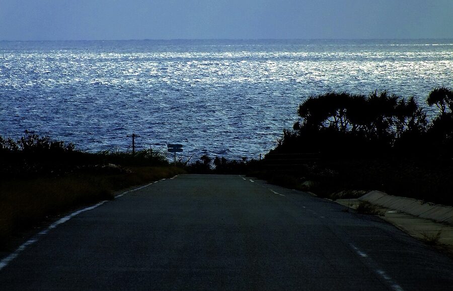
Cape Hirakubo (平久保崎, Hirakubozaki) is the northern tip. The road there from town takes a slow hour, and it ends at a working lighthouse perched on a grass headland with the Pacific on one side and the East China Sea on the other. The drive is the point; the cape itself is twenty minutes of standing and looking. Combine it with the wagyu restaurants on the way back (Ishigaki gyu is a real beef breed and a serious lunch option).
Tamatorizaki Observation Point (玉取崎展望台) on the east coast catches sunrise. Banna Park, the inland forest reserve above town, has a viewpoint that takes in the whole south coast and is a bird-watching spot for the Crested Serpent Eagle (kanmuriwashi).
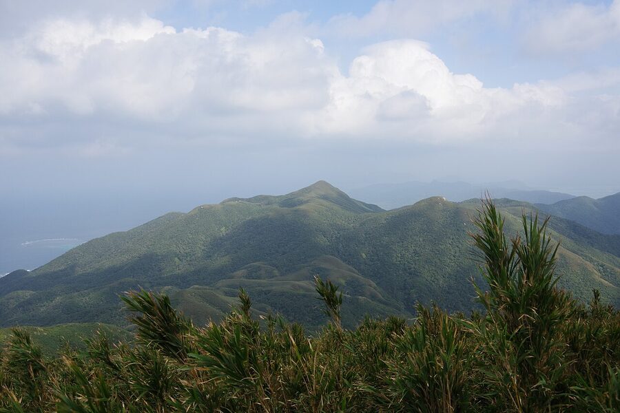
Mount Omoto (於茂登岳, Omotodake) is climbable. The trail runs about 2 kilometres up from the trailhead off Route 87, takes around 90 minutes one way, and rewards with a 360-degree view of Ishigaki and (clear days) the outline of Iriomote. It is forested, humid, and the steeper sections have rope assists; not a casual stroll, but well within capability if you’ve climbed Takao or Mitake.
Where to eat on Ishigaki, and what to eat
Ishigaki has the densest restaurant scene in the Yaeyama by a long way. The town’s Misaki-cho district, ten minutes from the ferry terminal, packs izakaya and Okinawa-soba shops into about six blocks.
The plate to look for is Yaeyama soba, distinct from main-island Okinawa soba: the noodles are rounder, the broth is lighter and pork-bone-based, and the topping is usually shredded pork plus pickled mustard greens. Around ¥800 a bowl at a no-frills place, ¥1,200 at a sit-down.
Then Ishigaki gyu (the prefectural beef breed). Yakiniku Kanafa, Ishigaki Gyu Kinjo, and a handful of other places run the lunch sets at ¥2,500 to ¥4,000 and the proper dinner sets up to ¥10,000. If you’ve eaten Kobe or Matsusaka beef, Ishigaki gyu is recognisably the same heavily marbled style; if you haven’t, this is a reasonable place to start.
And the awamori bars. Awamori is the Okinawa-only spirit, distilled from Thai long-grain rice rather than the short-grain rice used in mainland sake. It is sharp, dry, and ages well. Several bars in town keep their own ageing kura. Eight Brewing brews the local craft beer and runs a tap-room.
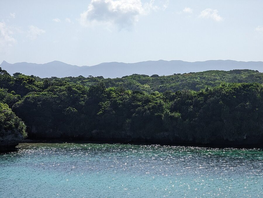
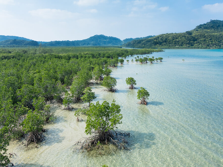
Iriomote: the jungle island
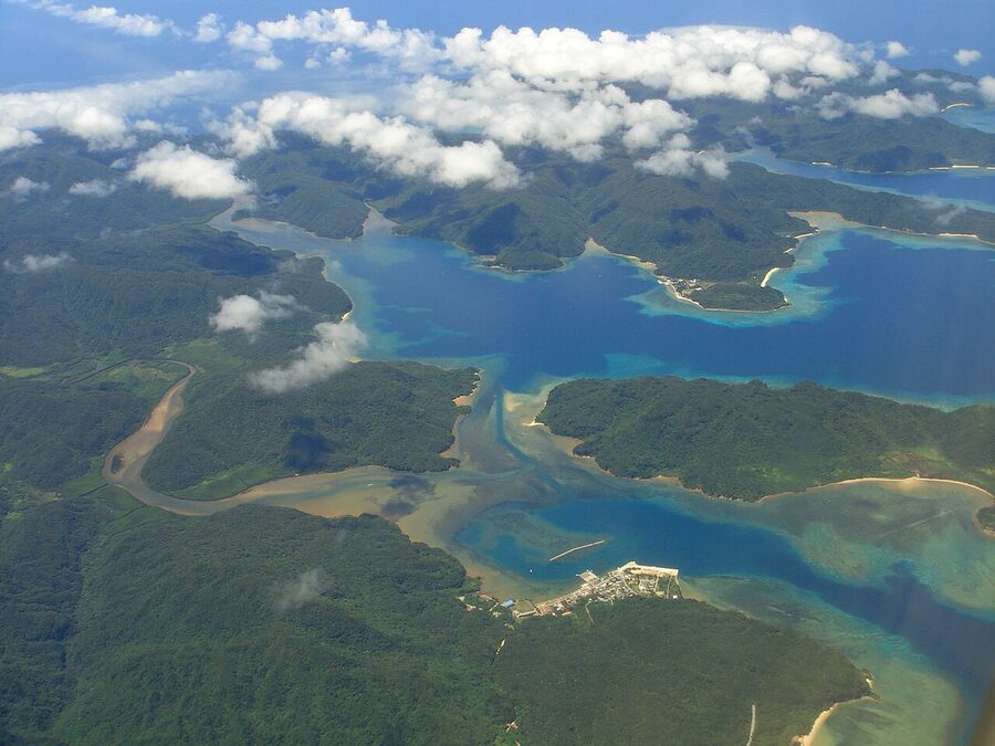
Iriomote (西表島, Iriomotejima) is the second-largest island in Okinawa Prefecture and roughly 90 percent jungle. The interior is uninhabited subtropical rainforest, registered as part of the Iriomote-Ishigaki National Park and (since July 2021) a UNESCO Natural World Heritage Site. The road network sticks to the perimeter; there is no road across the middle. Around 2,400 people live here, all on the coast, and there is precisely one ring road that doesn’t even close the ring.
The geography is the editorial point. Iriomote is a similar landmass to metropolitan central Tokyo (the 23 wards), but instead of 9.5 million people you have 2,400, and instead of train lines and convenience stores you have mangroves, the Iriomote yamaneko wildcat, and rivers wide enough to kayak.
Getting to and around Iriomote
Iriomote has no airport. You ferry across from Ishigaki, 40 to 50 minutes on the high-speed boats run by Yaeyama Kanko Ferry and Anei Kanko. Two ferry ports on Iriomote: Uehara (上原港) on the north coast, which is closer to the kayaking and Pinaisara Falls; and Ohara (大原港) on the south-east coast, which is closer to Yubujima and the cattle country. Many tour operators do their pick-ups at Uehara. Choose your ferry destination by the tour you’ve booked, not the other way round.
Ferry fares as of 2026: roughly ¥2,200 one-way Ishigaki to Uehara, ¥1,830 one-way to Ohara. Round-trip is the obvious buy. Note that the Uehara route is the first to be cancelled in bad weather; if a typhoon is rolling through in summer, expect Uehara closed and Ohara still operating, sometimes for several days.
On Iriomote, you have three transport options. Ring road bus run by Iriomote Kotsu, very infrequent (often only one or two a day each direction). Rental car booked in advance from one of the small operators on the island. Or arranged transfers as part of your eco-tour package. If you are not on a guided package, rent a car. The bus exists but does not connect to the kayaking trailheads.
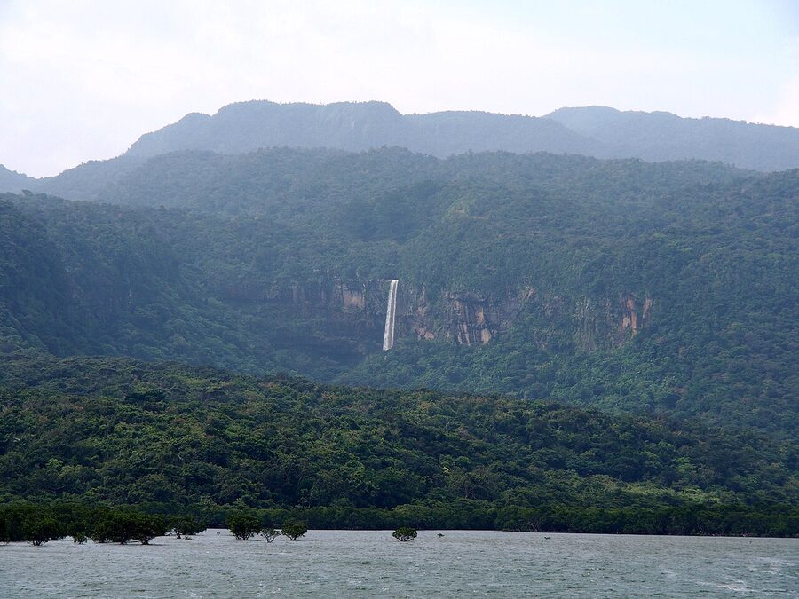
Pinaisara Falls, by kayak
Pinaisara (ピナイサーラの滝) is Okinawa Prefecture’s tallest waterfall, dropping about 55 metres off a sandstone shelf in the interior of north-west Iriomote. You don’t drive to it. The classic route is a half-day kayak up the Hinai River through mangrove channels, beach the boats, then hike about 30 to 40 minutes through forest to the base of the falls. The full-day version continues up to the top of the falls (another 60 to 90 minutes uphill, with rope sections) for a view across the jungle to the sea.
Operator pricing as of 2026, fairly consistent across the dozen-odd Iriomote eco-tour operators: half-day kayak + waterfall base around ¥7,500 to ¥9,000 per adult; full-day kayak + falls top around ¥11,000 to ¥13,000 including a packed lunch. Equipment, dry bags, and a guide are all included. Most operators speak limited English; the bigger ones (Iriomote Osanpo Kibun, Fam Fam Iriomote) have English-capable guides if you book ahead.
The eco-tour permit reality. Iriomote requires that the more sensitive areas (Urauchi River upper reaches, the Pinaisara top section, the Yutsun Falls track) are accessed only with a registered guide who has filed a tour notification under the Okinawa Prefecture eco-tourism rules. You cannot just rock up with your own kayak. Visitor caps apply at certain trailheads in peak season. This is part of why the island has stayed in the state it’s in.
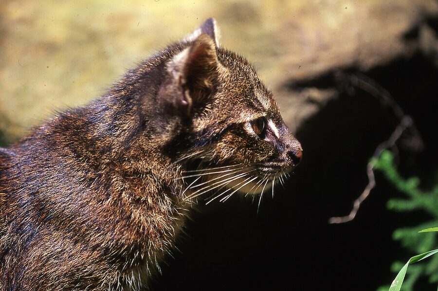
The Iriomote yamaneko, and the dark sky
The Iriomote cat (イリオモテヤマネコ, Prionailurus bengalensis iriomotensis) is a leopard cat subspecies endemic to this island. Roughly the size of a domestic cat, with a long body, low ears and dark spots; the population is estimated at 100 to 110 individuals. You almost certainly will not see one. Even researchers studying them go months between sightings. Road-kill warning signs along the ring road are not theatre, the cat is the most common cause of nocturnal road incidents on the island, so drive slowly after dark.
The Iriomote Wildlife Conservation Centre at Komi (open 10:00–16:00, closed Mondays, free entry) is where you go to learn about the cat without seeing it. There is a stuffed specimen, behaviour videos, a road-kill counter, and rangers who are usually willing to talk if it isn’t busy.
The other reason to spend a night on Iriomote is the sky. The whole island is part of the Iriomote-Ishigaki Dark Sky Park, the first IDA-certified dark sky park in Japan (2018). Light pollution is essentially zero on the interior coast. The Milky Way is unmissable on a clear winter night. Several lodges (Nirakanai Iriomote, the Tsuki-no-Hama places near Uehara) run informal stargazing on their lawns.
Where to stay on Iriomote
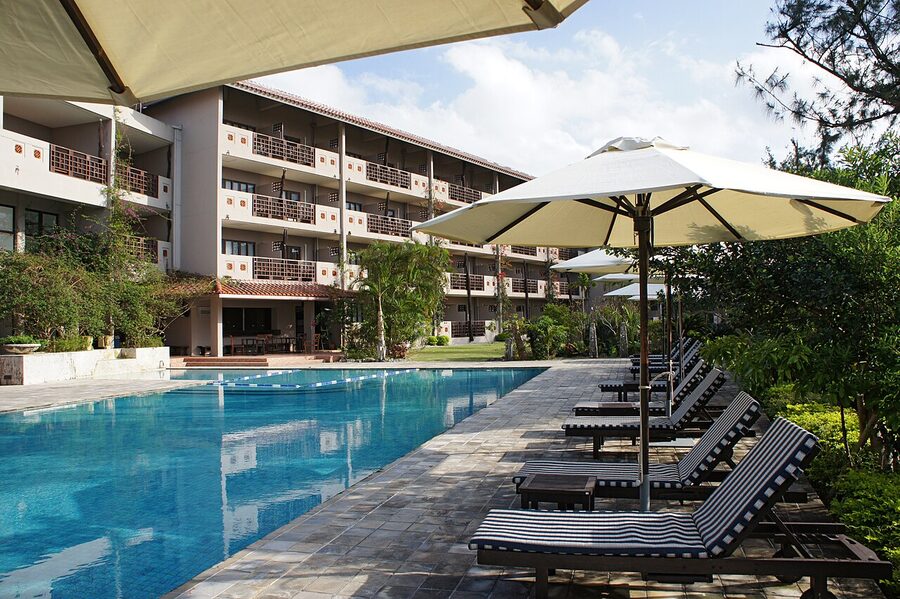
Accommodation is small lodges (minshuku), a handful of mid-range hotels, and exactly one resort. Book early; the island has under 3,000 beds total and weekends sell out months ahead in spring and autumn.
The Hoshino Resort Iriomote on the north coast is the headline property at the top end. Mid-range standbys: Hotel Pine Iriomote in Uehara, La Teada Iriomote Resort, and a clutch of pension-style places along the Tsuki-no-Hama coast. Budget: family-run minshuku in the ¥6,000 to ¥9,000 per person range with two meals included; this is genuinely the best of Iriomote, you eat what the host catches and you get tomorrow’s tour route written on a napkin.
Where to base. Uehara side for kayaking access. Ohara side for Yubujima and easy ferry connection back to Ishigaki on the southern route. The two halves of the island are 60 to 90 minutes apart by road and don’t really interchange.
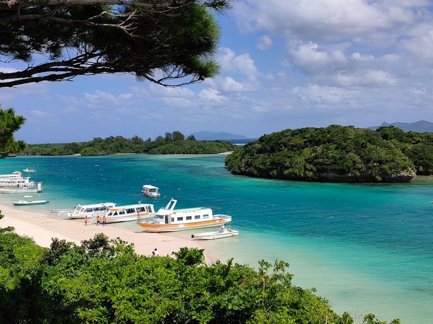
Taketomi: a Ryukyu village preserved
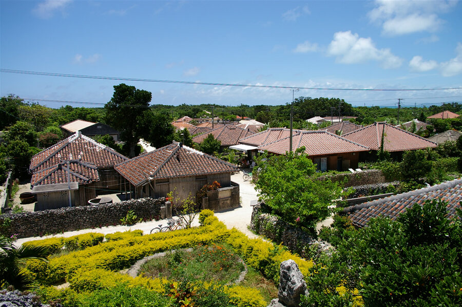
Taketomi (竹富島, Taketomijima) is the day-trip everyone takes from Ishigaki, and one of the few cases where the day-trip lives up to its hype. The island is small, 5.4 square kilometres, population around 350, and the central village is on the national register of preserved historic settlements. That last part is the editorial point. The village is not reconstructed or theme-parked; it is the actual lived-in village, with a Building Preservation Ordinance that bans concrete construction, mandates the red-tile (akagawara) roofs, the white-coral street paving, and the shisa lion-dog statue on each roof ridge.
The result is a 19th-century Ryukyu village frozen as a working community. Households still live in the houses. The water-buffalo carts that work the streets are working transport, sort of (they’re tourism now, but the buffalos pulled the carts here in living memory). The school still operates. The boundary stone walls are coral. The streets, when the sun is high, are reflective enough to make you squint.
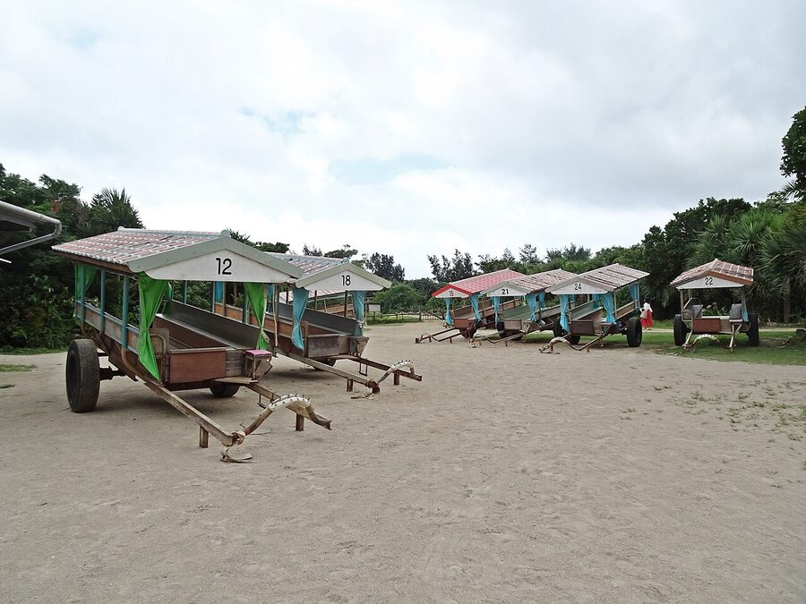
The water-buffalo cart, and what it actually is
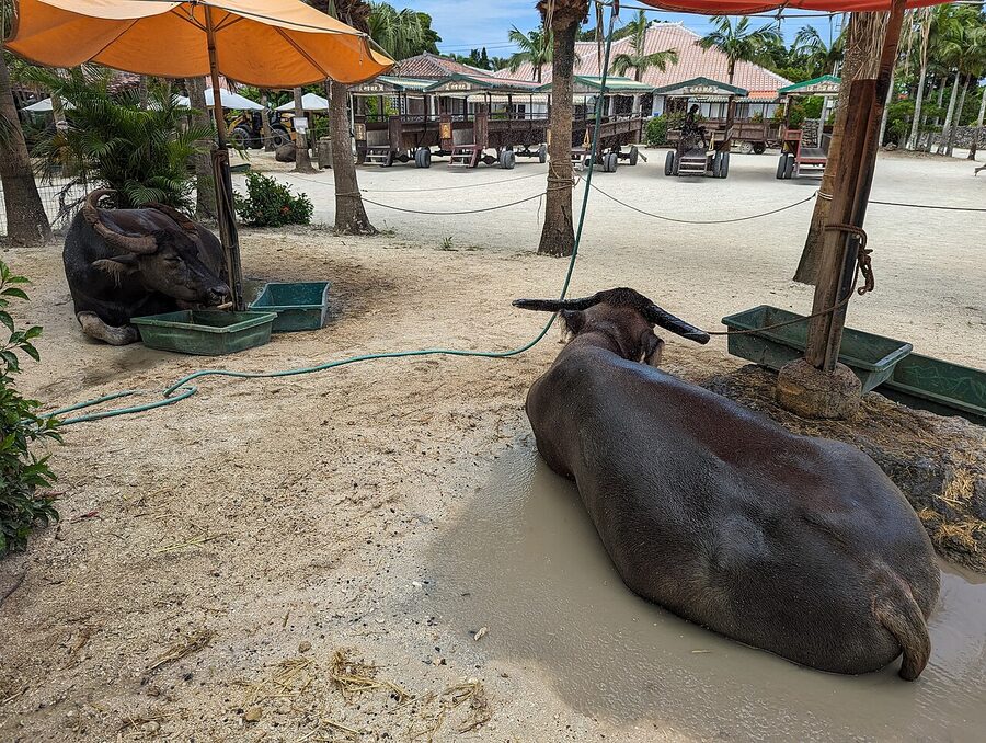
Two operators run cart tours: Nitta Kanko and Yaeyama Kanko Ferry’s affiliate Taketomi-mura cart service. Both run a 30-minute loop through the village, ¥3,200 adult / ¥1,600 child as of 2026 (Yaeyama Kanko’s “Moo-Moo course”). The driver plays the sanshin (the three-stringed Okinawan banjo) and sings a couple of folk songs. The buffalo, who is named, walks the same route eight to ten times a day at his own pace.
The take. It is touristy. It is also genuinely Ryukyu, the cart-and-water-buffalo combination has been used for transport on these islands for centuries. The folk songs are the actual folk songs. The 30 minutes goes quickly. If you arrive on the 9:00 ferry and queue up at 9:30, you’ll be done by 10:15 with the rest of the day clear for the beach.
You can also rent a bike at the ferry terminal (¥500 to ¥800 for two hours, ¥1,500 for the day) and lap the whole island in 90 minutes. The flat terrain and 1.5 kilometre radius make this the best way to see it. Friday Saturday Sunday are crowded; Tuesday and Wednesday are not.
Kondoi Beach and the star-sand
Two beaches on Taketomi worth the bike ride. Kondoi (コンドイビーチ) on the west coast is a long shallow stretch of fine white sand with a tidal sandbar that exposes at low tide; you can wade out a hundred metres in waist-deep water. The reef edge is too far out to reach without flippers, but the sandbar is the reason families come. Free, no facilities, public toilet at the bus stop.
Just south, Kaiji Beach (カイジ浜) is the star-sand beach (星砂の浜, hoshizuna-no-hama). The sand contains Foraminifera shells in the shape of small five-point stars. You can scoop a handful, pick out the stars between your palm lines, and put them back. The beach itself is not great for swimming (rougher reef, current), but the sand is genuinely starry. The bigger and prettier star-sand beach is on Iriomote (Hoshizuna-no-hama, on the northern coast), but this one on Taketomi is much easier to reach.
A note from the locals. Don’t take the star-sand. Both beaches have signs in four languages asking visitors not to remove sand (it accumulates very slowly, and the small shells in your bag won’t survive transport). The shops in Taketomi village sell small bottles of star-sand collected sustainably; that’s the souvenir, not what you scoop yourself.
Hateruma: Japan’s southernmost inhabited island
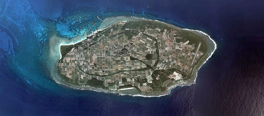
Hateruma (波照間島, Haterumajima) sits 22 kilometres south-west of Iriomote, and is the southernmost inhabited point in Japan. Population around 480, ferry connection only (no airport), one ring road, four small lodges, two restaurants, a primary school. The scale of the place is the editorial point. You arrive, you walk five minutes from the ferry to your lodge, and that is the whole administrative effort of getting to the bottom of Japan.
The ferry from Ishigaki to Hateruma is run by Anei Kanko, takes 60 to 90 minutes one way, and is the most weather-sensitive route in the Yaeyama. Cancellations are common in summer (typhoon swell) and not unusual in winter (north winds). Build a buffer day. As of 2026, around ¥3,090 one-way, ¥5,940 round-trip; book online or at Ishigaki ferry terminal.
What you actually do on Hateruma
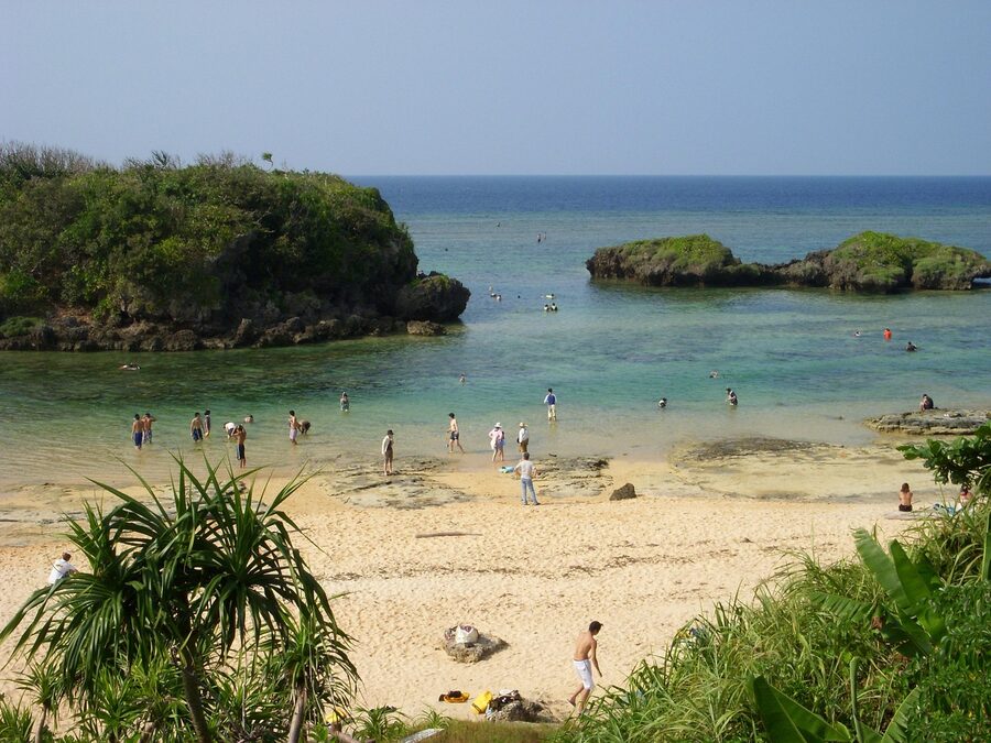
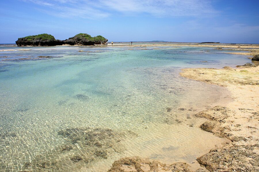
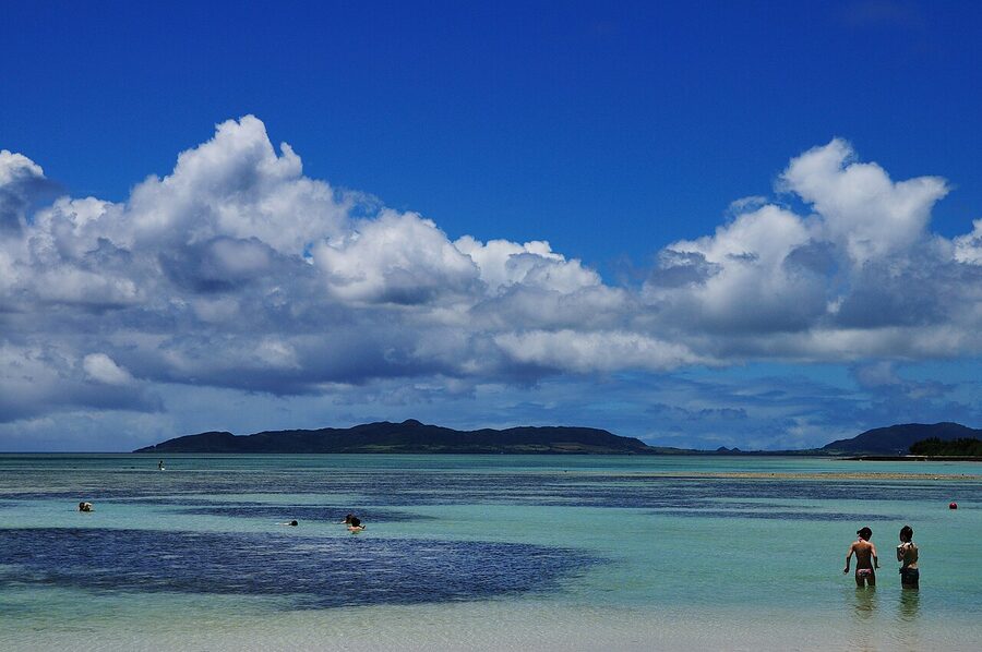
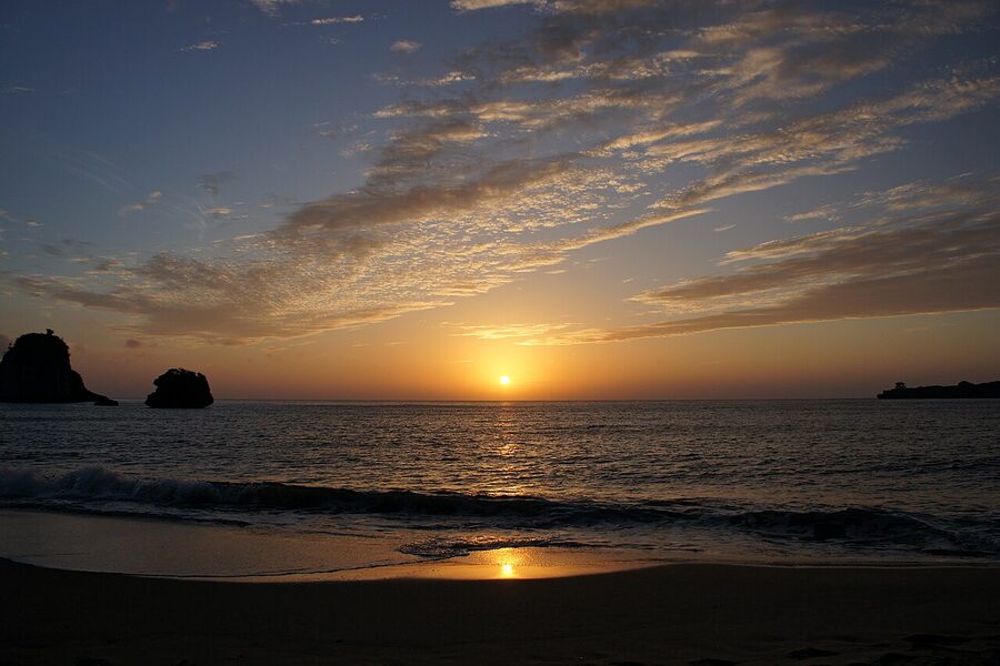
Three things, slowly. Nishi-no-hama (ニシ浜, “north beach” in the local dialect, despite the name kanji), 800 metres of fine white sand with the clearest water in the Yaeyama by most local accounts, and a coral patch reachable from the beach with a snorkel. No facilities. No lifeguards. No food stalls. Bring water and lunch from the lodge.
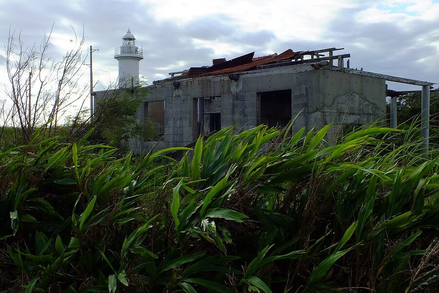
The southernmost point monument (日本最南端の碑, Nihon Saiminantan no Hi) at Takanazaki on the south-east tip is a small concrete obelisk on a bluff. The view is the open ocean and a 1,000 kilometre run of nothing to the next inhabited place (the Philippines or Taiwan, depending on the bearing).
And the Southern Cross. Hateruma is the only inhabited point in Japan from which the Southern Cross is regularly visible (low on the southern horizon, December to June). The Hateruma Star Observation Tower, on the south coast, opens 20:00–22:00 in season. The whole island is essentially zero light pollution; just lie on the beach.
Yonaguni: closer to Taipei than to Naha
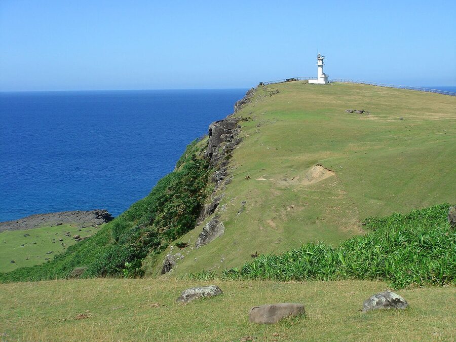
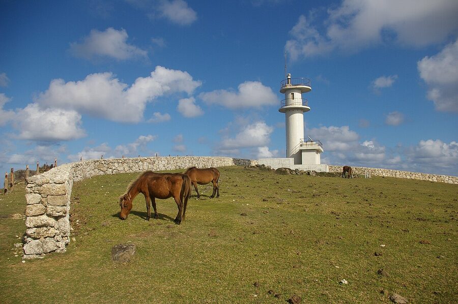
Yonaguni (与那国島, Yonagunijima) is the westernmost inhabited point in Japan. The straight-line distance to Taipei is 111 kilometres; to Naha it is 524 kilometres. On a clear day from Cape Iri-zaki at the western tip, you can sometimes make out the mountains of Taiwan. Yonaguni has its own dialect, its own breed of small native horse (the Yonaguni horse, around 130 head), and a famously stubborn local character that comes from being out here.
Three reasons to come. Hammerhead diving in winter. The underwater monument. And the simple novelty of being at the western tip.
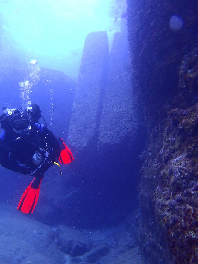
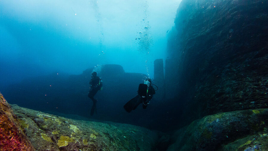
The underwater monument, and the controversy
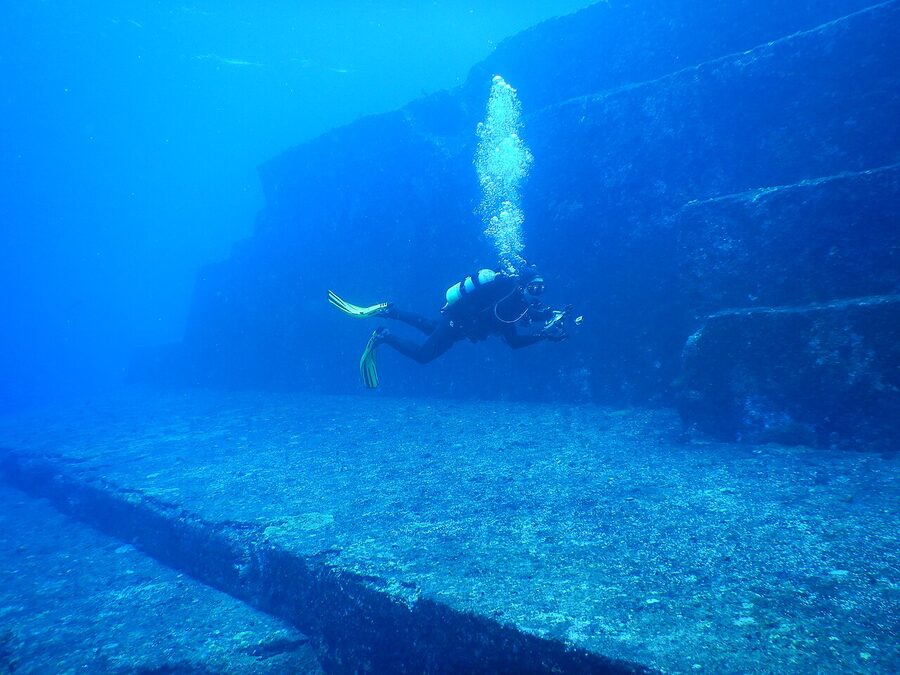
The Yonaguni monument (与那国海底地形, Yonaguni Kaitei Chikei) sits about 25 metres deep off the south coast, near Arakawabana. Discovered by local divers in the 1980s. A series of flat sandstone terraces, right-angle steps, and what look like carved channels and an arch. Two camps argue about it. One says it is a natural geological formation, the result of bedded sandstone weathering along the joint planes. The other says it is human construction, possibly from the Jomon period before sea levels rose.
The Japanese geological consensus tilts natural; some Japanese archaeologists, including Masaaki Kimura, have argued otherwise. From a tourism point of view it doesn’t really matter which side you take. The structure is impressive and unusual; the diving is genuine; you get to make your own call.
Several Yonaguni operators run monument dives: Sou-Wes Yonaguni, Yonaguni Diving Service, the dive shop at Hotel Irifune. As of 2026, single dives for certified divers from around ¥12,000 with gear, transport and guide. Multi-dive packages go up from there. The site is current-prone; it’s not a beginner dive in the usual sense, though a competent open-water diver who handles current is fine. Operators give a frank go/no-go each morning.
Hammerheads in winter
Late November to March, schools of scalloped hammerhead sharks (シュモクザメ) congregate off the western tip of Yonaguni. Encounter rates depend wildly on the day; operators typically quote 60 to 80 percent in the peak January-February window for the dedicated hammerhead points (Hammer Heaven, Hammer Hill). This is open-ocean drift diving in cold-ish water (22°C surface in February, currents that can be sustained), and the sharks rarely come closer than 8 to 10 metres; what you usually see is a wall of silhouettes drifting past in formation.
The trip is for divers, not for snorkellers. Single dive from ¥12,000; a four-day, eleven-dive package with hotel sits around ¥110,000 to ¥150,000 depending on operator. If hammerheads are the reason for the trip, plan a four-night minimum to absorb cancellation days; the wind on the west coast can shut the operation for a day or two in winter.
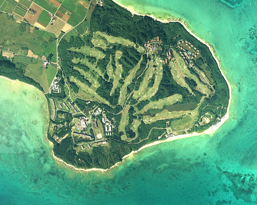
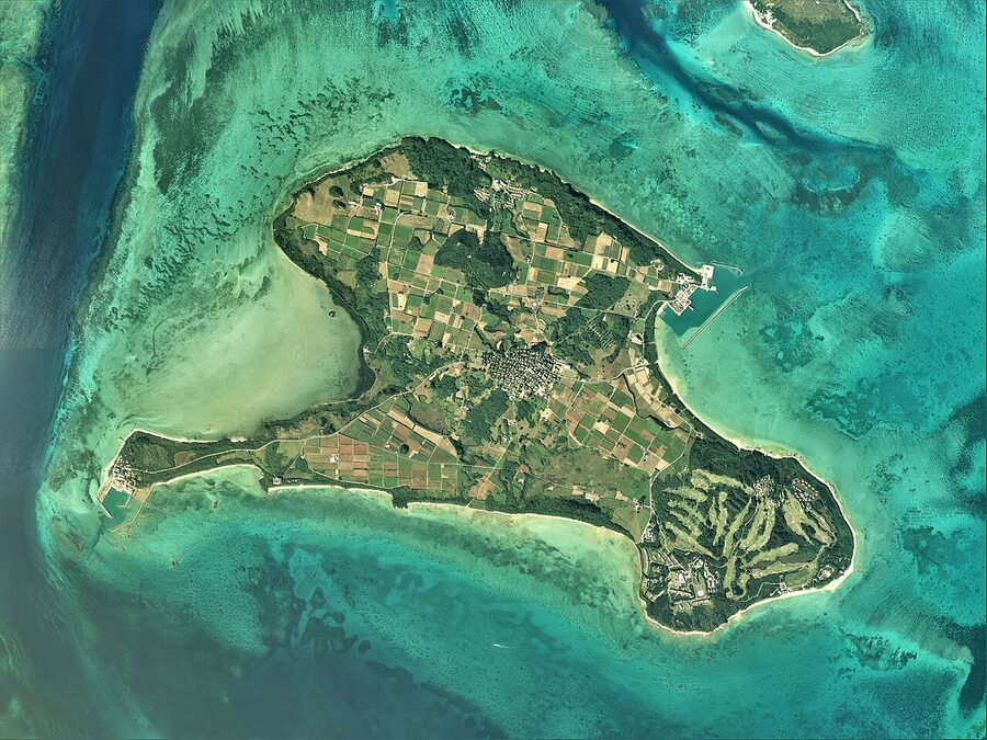
Kohama: the Chura-san island
Kohama (小浜島, Kohamajima) sits in the middle of the Yaeyama, between Iriomote and Taketomi, and gets less attention than either. The big draw for Japanese visitors is that the 2001 NHK morning drama “Chura-san” was filmed here; “Sugar Road” is the long, straight cane-field road the show made famous, and it still does feel like the show. Bicycle is the way to see it. Two and a half hours rounds the whole island.
The island has one resort of size (the Haimurubushi resort, on the south coast), a couple of small minshuku, no convenience store but a small grocery near the ferry. Ferry from Ishigaki around 30 minutes, ¥1,260 one-way as of 2026. The trade-off versus Taketomi: less to do, more relaxed pace, much less foot traffic.
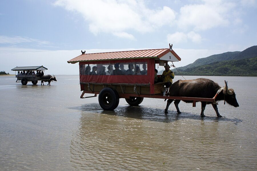
Yubujima: the buffalo-cart island connected by sea
Yubujima (由布島) is the small island linked to Iriomote at low tide by a shallow sandflat, and the unusual thing here is that the connection is crossed by water-buffalo cart. You ride the cart at the south-east coast of Iriomote (Mitsuura, off the Ohara side), the buffalo wades through the shallow sea to Yubujima, you walk around the little botanical garden and butterfly house on the island, then ride the cart back. Roughly 15 minutes each way, ¥2,000 adult, ¥1,000 child as of 2026, including the garden entry. The cart driver sings; it is much like Taketomi but with the sea-crossing detail that makes it specific.
This is the easy add-on if you’re staying near Ohara on Iriomote. Less so if you’re on the Uehara side, the drive across the south coast adds 50 minutes each way.
When to come, and what to expect
The Yaeyama have a different climate from mainland Japan and a different climate even from Okinawa Main Island. Subtropical, wet enough to be lush, hot in summer.
November to early April. The safe window. Air temperature 18 to 24°C, rain spells but no typhoons, water 21 to 24°C (cool for swimming but viable in a shorty wetsuit; serious diving still happens), the hammerhead season at Yonaguni runs through this. The Yaeyama also have Japan’s earliest cherry blossom (kanzakura, the deep-pink January-February variety; covered in detail in the Japan cherry blossom guide). Hotel rates lower outside the New Year peak.
Mid-April to mid-June. The shoulder. Warm, mostly dry, water warming up, manta-ray season starting. The brief Yaeyama rainy season runs roughly mid-May to mid-June, which is shorter than the main island’s. Worth the gamble.
Late June to early October. Peak summer plus typhoon season. Air 30°C plus, water 28°C plus, snorkelling and manta encounters at their best. The risk is the typhoons; assume one or two will track within range during a two-week trip and that one of them might cancel a ferry day. Build buffer days into your itinerary.
Mid-October to early November. The other shoulder. Decent weather, manta still active, water still warm, prices dropping. Fewer crowds. This is the editor’s pick if you can manage the timing.
Practical bits travellers underestimate
Three things first-timers misjudge.
Distance and pace. Ishigaki is a real island, not a small one. Lapping it slowly with stops takes a full day. The interior of Iriomote has no road across it; you cannot just “drive over the mountain”. And the inter-island ferries are not commuter trains, they run on schedules that you build a day around, not around an hour.
Cash matters more than usual. Smaller operators on Iriomote, Hateruma and Yonaguni still prefer cash. The 7-Eleven and Family Mart networks exist on Ishigaki and parts of Iriomote, not on the smaller islands. Withdraw enough at the airport on arrival; the post-office ATMs on Hateruma and Yonaguni keep limited hours and run out at peak times.
English signage is patchy. Ishigaki centre is fine. Iriomote operators have English-capable guides if you book with one of the bigger names. On Taketomi the village runs on Japanese, with the cart drivers managing greetings in English. Hateruma and Yonaguni essentially Japanese-only on the ground; bring a translation app and patience. None of this is a blocker, but it is worth knowing.
The accommodation books out further ahead than you’d expect. Especially the popular minshuku on Iriomote and Hateruma in spring and autumn. Six to eight weeks out is the safe window; for Golden Week (early May) and the autumn weekends, three months out.
One last thing
The Yaeyama are not a beach holiday in the Maldives sense. The water is glorious, the beaches are real, the diving is world-class. But the texture of the place comes from the Ryukyu cultural details (the white-coral streets in Taketomi, the sanshin coming out of someone’s living room window after dark, the stubborn local independence on Yonaguni) and from the unfilled-in feel of an archipelago where most islands have populations under a thousand. Treat it as cultural travel that happens to involve manta rays. Plan five nights minimum; seven is better. And come back when you’ve been once, because nobody does the Yaeyama justice on a first trip. Most of the rest of Okinawa waits for the second.
.jpg)