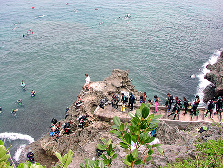
06:30 at Cape Maeda, the carpark still half-empty, and the cliff stairs down to the dive platform feel cold in flip-flops. The Blue Cave entrance is a black slot at the foot of the cliff, the morning sun cutting in low across the water so you can see straight through to the limestone chamber beyond. The first dive boats are still being rigged at the top of the steps. By 09:00 they will be lined up to the carpark fence and the cave will be a queue. For now the only sound is the surge against the rocks, and a snorkeller from the previous boat-load floating face-down twenty metres out, watching the reef wake up.
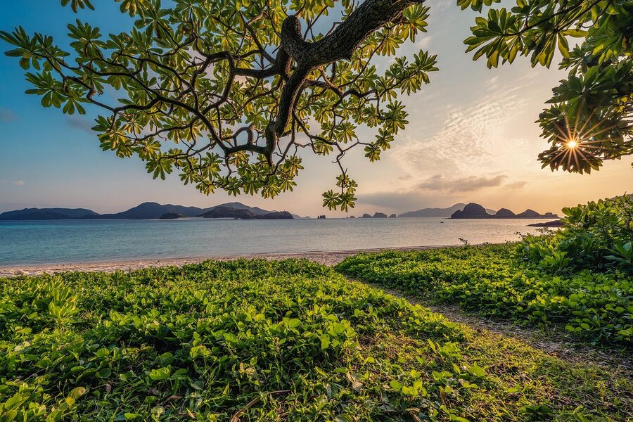
Okinawa beaches are a different planet from the rest of Japan. The water is the colour postcards keep promising and never deliver, the coral starts where the white sand stops, and the islands that are actually worth the ferry are not the ones the package tours photograph. This is the editorial map of the lot, from the easy main-island day-trip beaches you can reach with a rental car, to the Kerama national park 30-50 minutes off Tomari Port where the snorkel is honestly world-class. Plus what to do about the aquarium, and what to do about the rules, and where the jellyfish kill the August swim.
In This Article
- The shape of an Okinawa beach trip
- How to get to a beach (the rental-car reality)
- Main island beaches worth the drive
- Cape Manzamo and the Manza coast
- Cape Maeda and the Blue Cave
- Emerald Beach at the Ocean Expo Park
- Kouri Bridge and Kouri Island
- Sesoko Island
- Mibaru Beach in the south
- The Churaumi Aquarium, briefly
- The Kerama Islands, where the snorkel actually delivers
- Getting there: Tomari Port and the ferries
- Booking the ferry
- Zamami: the most-developed Kerama
- Aka: the quietest of the three
- Tokashiki: largest island, biggest beaches
- Cape Hedo and the far north
- Yanbaru National Park, the rainforest behind the beaches
- The water itself: when, where, what to know
- Best months for the swim
- The jellyfish and the habu-tang
- Reef-friendly sunscreen rules
- Marine reserve and snorkel rules
- Where to stay near the beaches
- Onna village for west-coast main-island beaches
- Motobu peninsula for Churaumi and the north
- On a Kerama island
- The day-trip plan if you only have a day
- What to combine the beaches with
- One last note before the ferry
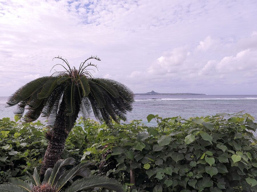
The shape of an Okinawa beach trip
Two things to internalise before you book anything. First, distances on the main island are bigger than the map suggests. Naha to Cape Maeda is roughly 60 km and a 90-minute drive once Naha traffic catches you. Naha to Cape Hedo at the very north is about 130 km and a three-hour drive each way, which makes Cape Hedo a whole day, not an afternoon. Second, the Kerama Islands are reached by ferry from Tomari Port in central Naha, not from the airport, and the ferries fill up. Book at least a week ahead in summer, longer over Golden Week and Obon.
The clean editorial split is this: the main island has a few beaches that are genuinely good, plus the Churaumi Aquarium and Cape Hedo and Yanbaru rainforest as side missions. Most of those are doable on a road-trip with a rental car. The Kerama Islands are where the real water lives, and they need a ferry plus, ideally, a night on the island. Skipping Kerama because you already drove to a main-island beach is the mistake most first-timers make.
If Okinawa is brand-new to you, the Okinawa regional guide covers the wider geography, the Ryukyu Kingdom history, and how the prefecture sits across 1,000 km of Pacific. Naha is your base for everything in this article. The Yaeyama Islands are a separate trip altogether, an extra flight south from Naha, and the contrarian case for why they might be the better beach trip is in their own piece. The Japan Rail Pass does not cover Okinawa at all (no JR network here), so factor that into the budget if you came expecting it to.
How to get to a beach (the rental-car reality)
The bus network on the main island will get you to a few headline spots, including Cape Manzamo and the Churaumi Aquarium, but it will not get you to the good beaches efficiently. The schedules are hourly at best, half the buses do not run on weekends, and a single mis-timed connection erases an afternoon.
If you are doing more than one day of beach hopping, rent a car. The big four (Toyota Rent a Car, Nippon Rent-a-Car, Times Car Rental, OTS) all have desks at Naha Airport and at the offices around Asahibashi monorail station. Day rates start around ¥5,000 for a kei car (yellow plates, the smallest legal class) and go up from there. International Driving Permit (Geneva 1949 convention) is mandatory for non-Japanese licences, and the rental desk will refuse you without one. Domestic drivers from Taiwan, China, Vietnam, Indonesia and a few other countries cannot rely on the IDP and need an official Japanese translation of their licence instead. Check the JAF site before you fly.
The Okinawa Expressway runs north from Naha to Kyoda Interchange near Nago. It is genuinely useful if you are heading to Motobu, Kouri or beyond. South of Naha the road network is local and slow, so allow more time than the kilometres suggest. Petrol is roughly ¥180 per litre as of 2026, slightly above the Honshu average.
The other reality: parking. Beach carparks in summer fill by 10:00 on weekends, and again from 13:00 after the morning shift clears. Manzamo, Kouri, Cape Maeda and the Ocean Expo Park all charge between ¥100 and ¥500 for the day. Cape Hedo and Sesoko have free parking. Bring small change.
Main island beaches worth the drive
Six beaches that earn the visit, north to south, with the local catches.
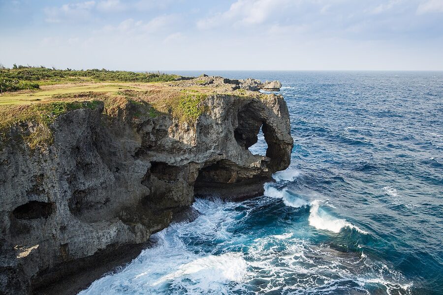
Cape Manzamo and the Manza coast
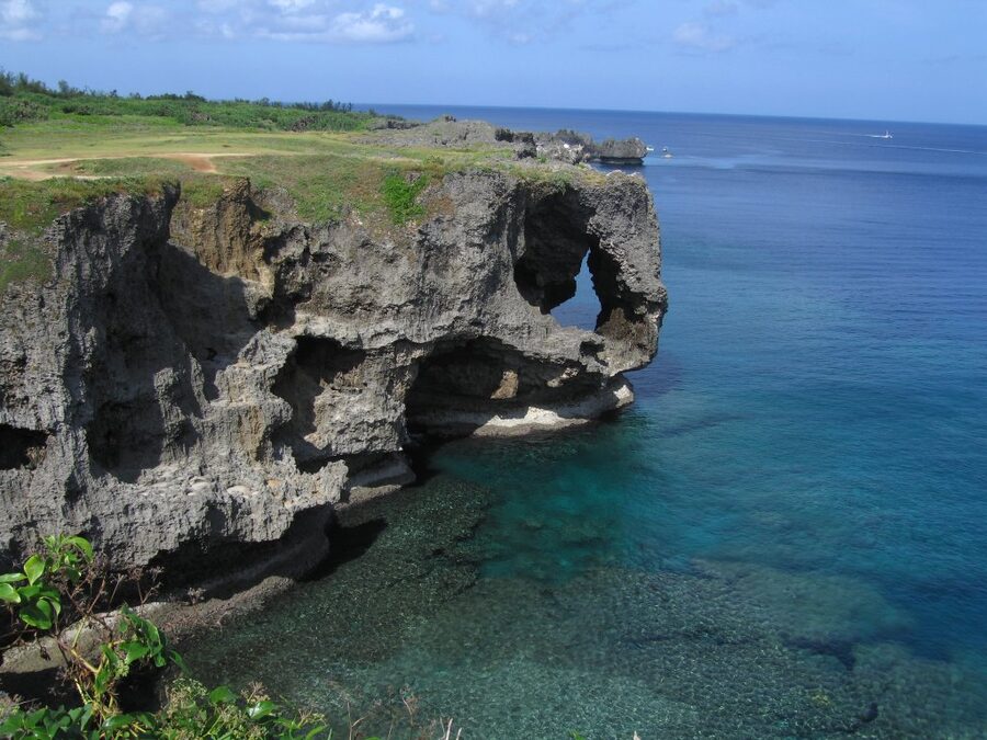
Manzamo is not a beach, it is a 20-metre limestone cliff with an elephant-trunk arch that frames the East China Sea. The walking loop takes 20 minutes and the viewpoint costs ¥100 per adult since the 2018 redevelopment, current as of 2026. Come at 06:00 for the sunrise on a clear day, or after 17:30 when the cruise-bus crowd has cleared. The new visitor centre at the carpark has a passable Okinawa-soba canteen for ¥850.
The actual beach within walking distance is Manza Beach, attached to the ANA InterContinental resort. Day-use access for non-guests is around ¥1,500 in 2026, which buys you a parasol and a buoyed swim area but no shade and no shower kit beyond the public stalls. If you are not staying at the resort, this is a skip. Drive 20 minutes south instead, to Cape Maeda.
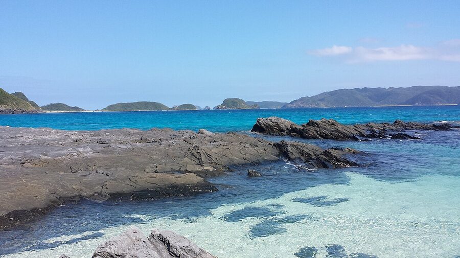
Cape Maeda and the Blue Cave
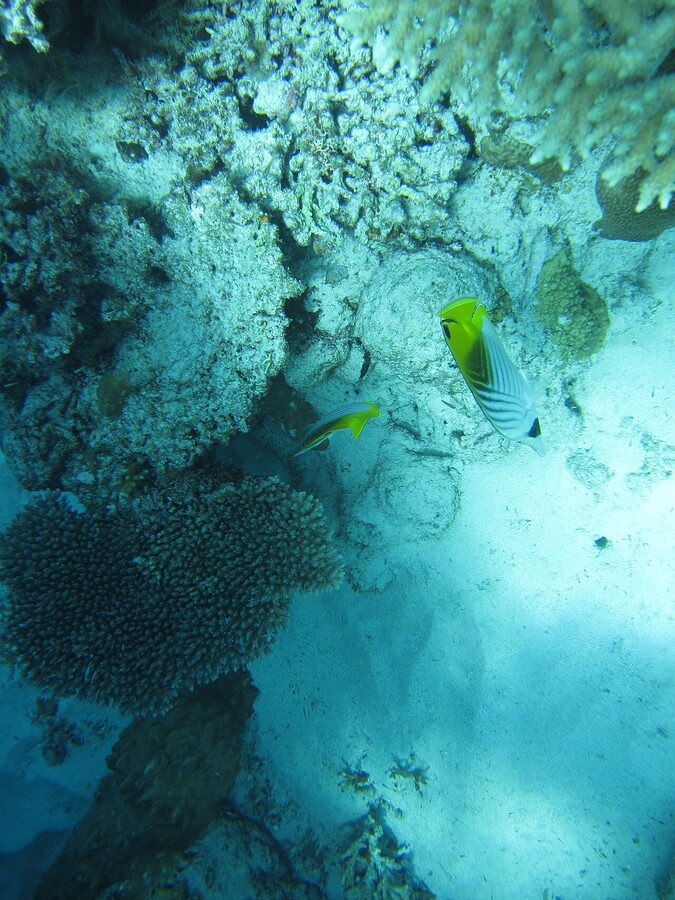
Cape Maeda is the closest thing the main island has to a snorkel destination. The Blue Cave is a sea-cut chamber at the foot of the headland, and the water inside refracts the morning sun so it glows electric blue from the floor. You do not need to be a diver. Most operators run a guided snorkel including wetsuit, mask, fins and a 50-metre swim into the cave for around ¥3,500–5,500, with a hot shower and group photos included. The English-friendly outfits are mostly clustered at the top of the cliff, ten metres from the carpark.
If you can dive, the Blue Cave by tank is materially better than the snorkel, and the dive shops know it. Discover-Diving (no licence required, instructor-led) runs ¥10,500 to ¥13,000. A licensed two-tank package at Cape Maeda is around ¥15,000. Visibility on a calm day is 25-30 metres. The cave gets blown out by north winds in winter, so check the forecast and have a flexible day.
Practical: the staircase down to the dive platform is steep, slippery in rain, and does not have a handrail on the seaward side. Hold the kit, not your phone. Toilets and outdoor showers are at the top, free. The carpark is ¥100 per hour, capped at ¥500 the day, and fills by 09:30 in July and August.
Emerald Beach at the Ocean Expo Park
This one is engineered, not natural, and it does not pretend otherwise. Emerald Beach was reclaimed inside the Ocean Expo Park on the Motobu peninsula, and the swim area is broken into three crescent coves protected by breakwaters. Entry is free. The water is shallow, the sand is white, the lifeguards are present in season, and the showers are clean. It is the easiest beach swim on the main island.
Combine it with the Churaumi Aquarium, which is in the same park (separate ticket, see below). The park has its own internal trolley, ¥300 per ride or ¥500 for a day pass, that loops between the aquarium, Emerald Beach, the dolphin pool and the main carpark. Walking the lot end to end is a kilometre uphill in the heat, so the trolley earns its money.
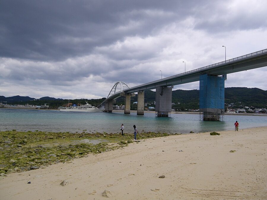
Kouri Bridge and Kouri Island
Kouri Ohashi is a 1,960-metre toll-free bridge that connects Yagaji Island to Kouri Island, with a turquoise straight-line shot across the strait that is one of the iconic main-island photographs. You drive it in two minutes. You stop at the carpark at the south end (Yagaji side) for the wide shot, and again at the north end (Kouri side) for Kouri Beach, the white-sand crescent directly below the bridge.
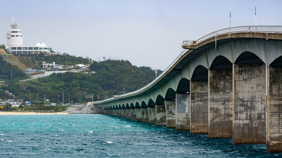
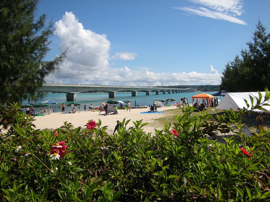
Kouri Beach is fine for a paddle, mediocre for snorkelling. The marquee shot on the island is Heart Rock at Tinu Beach, ten minutes by car from the bridge. Two limestone stacks, eroded so the gap between them forms a heart shape from one specific angle. Go at low tide. Parking is privately operated, ¥500. The beach itself is tidal-flat at low water and not a swim destination. The Heart Rock is a twenty-minute photograph and a drive on.
Sesoko Island
Sesoko is reached by a free 762-metre bridge from Motobu town, ten minutes south of the Ocean Expo Park. The reason to come is Sesoko Beach on the west side of the island, genuinely natural sand running for 800 metres with a coral edge that makes it the best snorkelling beach within driving distance of Naha. Parking is ¥1,000 per car, gear rental is around ¥1,500 for a snorkel set, and the lifeguarded swim season runs roughly mid-April to October.
The Hilton Okinawa Sesoko Resort sits on the south end of the island. Day-use access to the Hilton beach for non-guests is around ¥3,000 in 2026 and is honestly not worth it when the public beach is right there.
Mibaru Beach in the south
Most of this article points you north of Naha, because that is where the postcard beaches live. Mibaru is the exception in the south, on the Pacific side of the Nanjo peninsula. The beach itself is long, white, and lined with traditional sabani outrigger boats that double as glass-bottom-boat rides for ¥1,500. The water is shallow for 50 metres out, which makes it brilliant for kids and pointless for swimming laps.
Combine Mibaru with Sefa-utaki, the most sacred Ryukyu prayer site, ten minutes inland and worth the diversion for the cultural register more than the photographs. The Mibaru carpark is ¥500. Avoid the weekends.
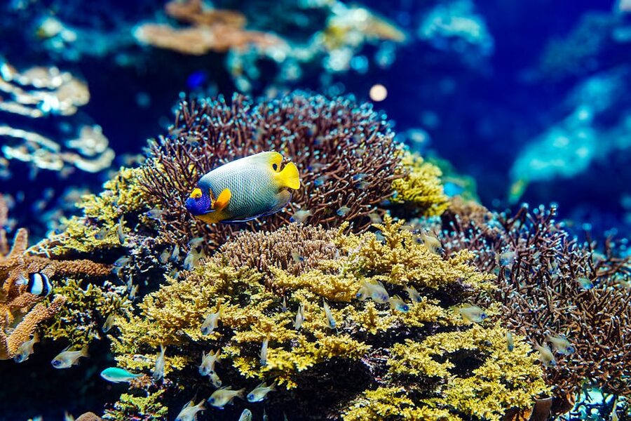
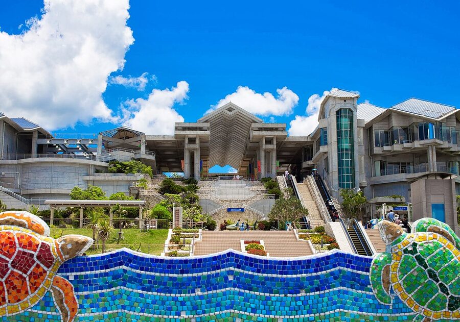
The Churaumi Aquarium, briefly
The Okinawa Churaumi Aquarium (沖縄美ら海水族館) sits inside the Ocean Expo Park and is the headline indoor attraction on the main island. It is a separate ticket from the park, ¥2,180 for adults, ¥1,440 for high-school students, ¥710 for elementary and junior-high, free under six, current as of 2026 (verified at the official churaumi.okinawa fee page).
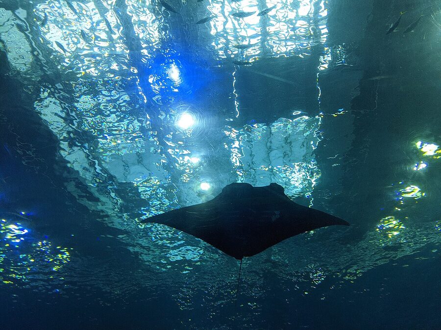
The headline tank is the Kuroshio Sea, a 7,500-cubic-metre acrylic-walled tank that runs across the main exhibit hall. Three whale sharks circle on a slow loop, and the manta rays glide overhead. There is a 17:00 close-of-day feeding viewing if you time it right, and a dedicated Kuroshio Cafe with bench seats inside the tank wall, ¥500 cover charge, the best mid-afternoon escape from the heat. Sit there for an hour. The whole thing is genuinely worth the ¥2,180.
An after-16:00 admission ticket drops to ¥1,510 for adults and is sold at the gate. If your only goal is the Kuroshio Tank, this is a real saving. The trade-off is that the dolphin show ends at 17:00, so the Oki-chan dolphin programme is only worth it on a full ticket.
Practical: the aquarium is at the far north end of the Ocean Expo Park. From the main carpark it is a 600-metre walk downhill, or two stops on the trolley. Plan three hours for a full visit including the dolphin pool, the Tropical Dream Centre and Emerald Beach. The carpark is free.
One honest verdict: the Churaumi is excellent at what it does, but the place is busy. School groups in the morning, cruise-ship buses in the afternoon. The 16:00 ticket is the smart-traveller move because it dodges both. Avoid Tuesdays, when school groups peak.
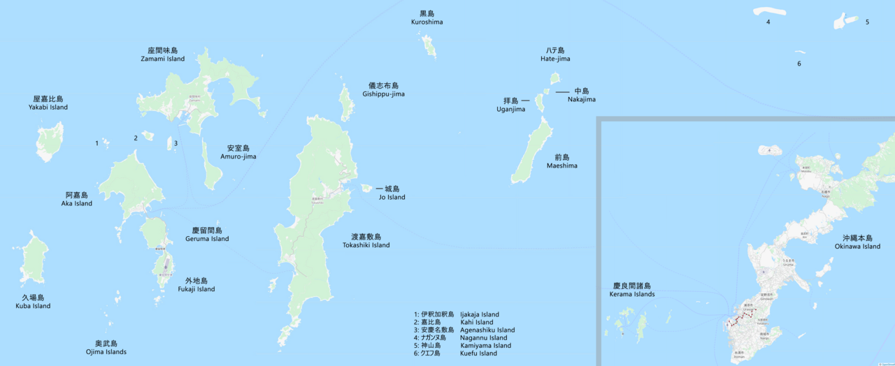
The Kerama Islands, where the snorkel actually delivers
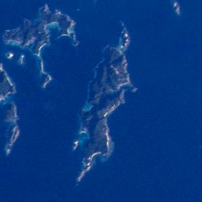
The Kerama Islands sit about 40 kilometres west of Naha. The cluster is 36 islands and uninhabited islets, four of which have year-round populations: Tokashiki, Zamami, Aka and Geruma (Geruma is connected to Aka by bridge, no separate ferry). The whole archipelago became Keramashoto National Park in 2014, and the official line on the water visibility, 50 metres on a calm day, holds up. The water has its own promotional adjective: Kerama Blue (ケラマブルー). Once you see it the marketing earns it.
The day-trip case for the Kerama: take the high-speed ferry from Tomari, two or three islands by lunchtime, snorkel one beach, last ferry back. It works. The overnight case is materially better: you get the early-morning beach before the first ferry-load arrives, and the sunset off the west coast which the day-trippers never see. If you have one Okinawa day to spend on a beach, give it to a Kerama overnight.
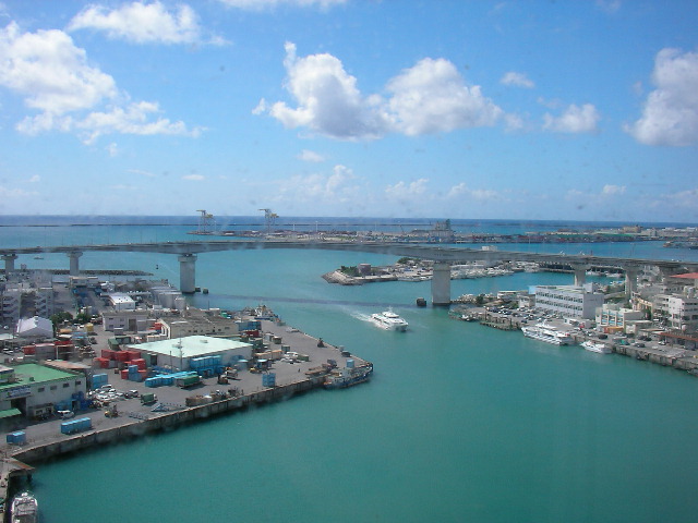
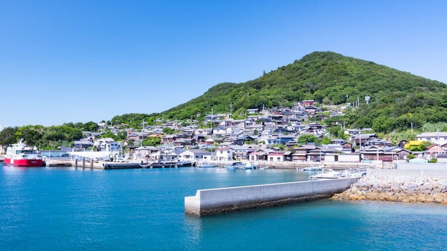
Getting there: Tomari Port and the ferries
All Kerama ferries leave from Tomari Port (泊港) in central Naha, not the airport. The terminal building is called Tomarin (とまりん). Yui Rail to Miebashi station, then a 10-minute walk north. Or a ¥1,500 taxi from the airport, 15 minutes. There is paid parking at the terminal (¥1,500 per day) but the rental-car logic stops here: leave the car in Naha and pick a ferry.
Verified 2026 fares from the operators (Zamami Village and Tokashiki Village ferry pages, checked May 2026):
- Zamami / Aka (Zamamison Mura ferry): high-speed Queen Zamami ¥3,950 adult one-way / ¥7,510 round-trip; regular Ferry Zamami ¥2,900 adult one-way / ¥5,510 round-trip. Crossing time 50–70 minutes high-speed, 90–120 minutes regular.
- Tokashiki (Tokashiki Village ferry): high-speed Marine Liner Tokashiki ¥2,530 adult one-way / ¥4,810 round-trip; regular Ferry Tokashiki ¥1,690 adult one-way / ¥3,210 round-trip. Crossing time 35–40 minutes high-speed, 70 minutes regular.
- An extra ¥100 environmental cooperation tax (環境協力税) applies per adult passenger over 16, paid at the ticket counter.
Schedules vary by season, with two to three high-speed sailings per day in summer and just one or two in winter. Both islands publish a monthly timetable on the village website (vill.zamami.okinawa.jp / vill.tokashiki.okinawa.jp). The 08:00 daily-decision rule is the one to know: the ferry company calls go/no-go at 08:00 each morning based on swell and wind, and a no-go can strand you for the day.
Booking the ferry
Two channels. In person at the Tomari Port ticket office, where the queue opens at 07:00 and is the only way to get same-day tickets when capacity is tight. Or online up to one month in advance via the village booking portals: zamami-island.com for Zamami / Aka, ferry.tokashiki-portal.jp for Tokashiki. The online portals are reliable and have an English flow now, but they cap at the ferry-line capacity (around 200 seats high-speed, 500 ferry).
Reserve at least a week ahead in summer. Two weeks ahead for Golden Week (29 April–5 May), Obon (mid-August) and the September weekends. Cancellations are free up to three days before, then 10–30%. If you cannot get a high-speed seat, the regular ferry is rarely sold out and the extra 30 minutes is a fair trade for a guaranteed crossing.
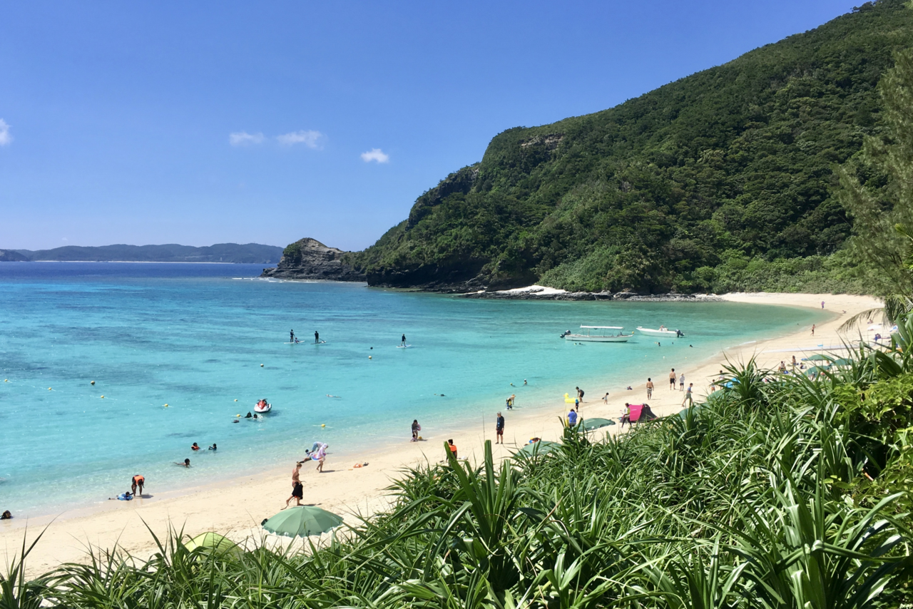
Zamami: the most-developed Kerama
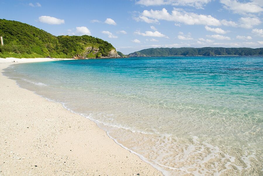
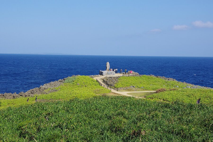
Zamami (座間味島) is the largest of the three day-trip-viable islands, with a population of about 600 and a port village that genuinely caters to overnight visitors. Two beaches make the case. Furuzamami Beach (古座間味ビーチ) is a 1.4-kilometre walk south-east of the port, white-sand crescent, full snorkel-rental shack, restaurant, parasols. Officially open for swimming roughly 1 April to 31 October, lifeguarded.
Ama Beach (阿真ビーチ), about 1.5 kilometres west of the port, is the other one. Less polished, no restaurant, but green sea turtles graze the seagrass beds within ten metres of shore between roughly May and September. You will see them. The Zamami Whale Watching Association also goes out from Ama in winter (January through to early April). Tour cost in 2026: ¥5,500 for a half-day, the boats run at 10:30 and 13:00.
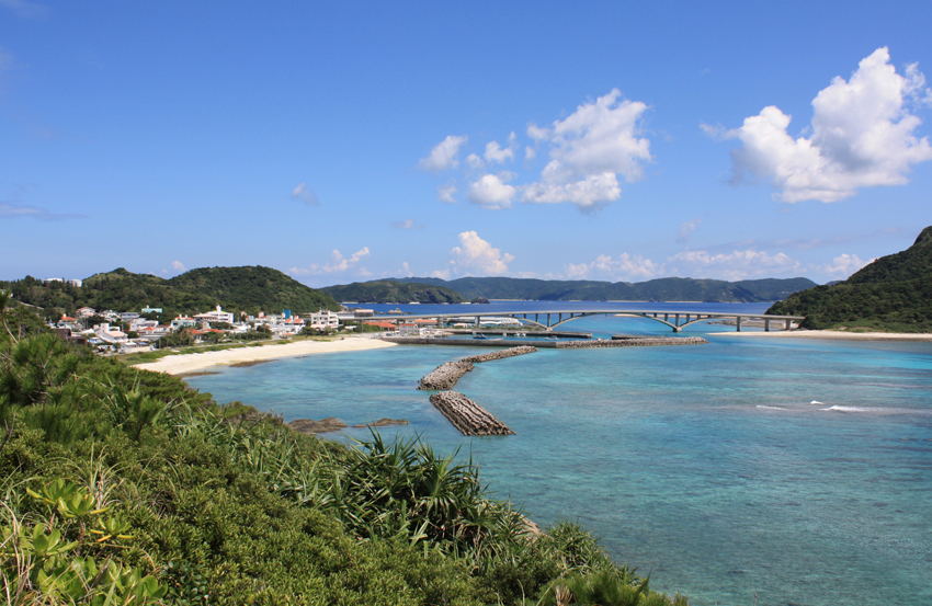
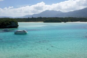
If you stay overnight, walk the 25 minutes up to Takatsuki-yama observatory (高月山展望台) for the sunrise. The shot in the figure above is from there. There are also two smaller observatories on the south coast that get the sunset; ask the guesthouse to point them out.
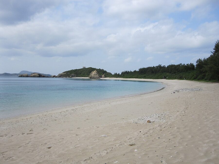
Aka: the quietest of the three
Aka (阿嘉島) is ten minutes from Zamami by inter-island ferry, fifteen by speedboat, and fifty minutes from Tomari direct. The population is around 300. The headline beach is Nishihama (北浜), 1.5 kilometres from the port, also called Kitahama in some materials. White-sand crescent, coral edge, rare crowds even in August. No restaurant on the beach, no rental hut. Bring water and snorkel kit from the port.
The other Aka thing: Kerama deer (慶良間鹿), a small subspecies of Japanese deer that swims between the islands and turns up on Aka, Geruma, Fukaji and Yakabi. They are roughly half the size of Honshu deer and noticeably darker. There is a viewing platform at the Nishihama trail junction; an evening visit raises the odds. Keep distance, do not feed.
Aka has perhaps four guesthouses and two restaurants. If you want unbroken quiet and you are happy to bring a bento for lunch, this is the island. Also the diving outfits here run trips to uninhabited Geruma and Fukaji that are arguably the best snorkel boats in the park.
Tokashiki: largest island, biggest beaches
Tokashiki (渡嘉敷島) is the closest Kerama to Naha and the most popular for day trips, especially with younger Japanese travellers. Population around 700, two main beaches, both excellent.
Aharen Beach (阿波連ビーチ) is the headline. 800 metres of white sand, in the bay on the west coast of the island, 4 kilometres from the port. A dedicated village shuttle bus meets each ferry, ¥500 each way to Aharen, 15 minutes. Full rental hut, restaurants, kayak hire, glass-bottom boat (¥1,800 for 30 minutes). The reef sits about 80 metres offshore.
Tokashiku Beach (とかしくビーチ) is two kilometres north of Aharen, calmer water, fewer day-trippers, sea turtles in residence almost year-round. The shuttle stops at Tokashiku-mae before continuing to Aharen, so you can split the day between the two with no extra fare.
One Tokashiki note that competitors miss: the village charges a ¥100 environmental cooperation tax (環境協力税) per adult arrival, collected at the port on arrival. It funds beach maintenance and waste removal. Have coins ready.
Cape Hedo and the far north
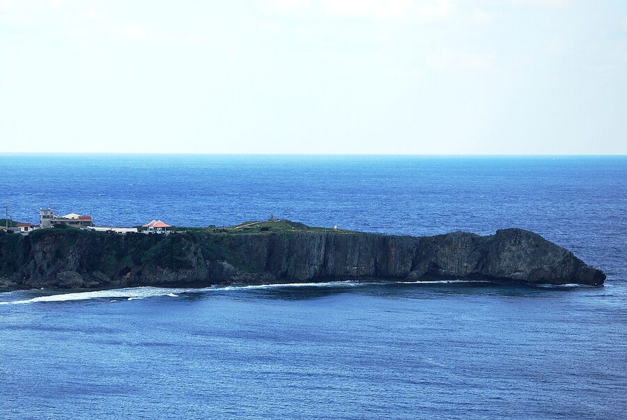
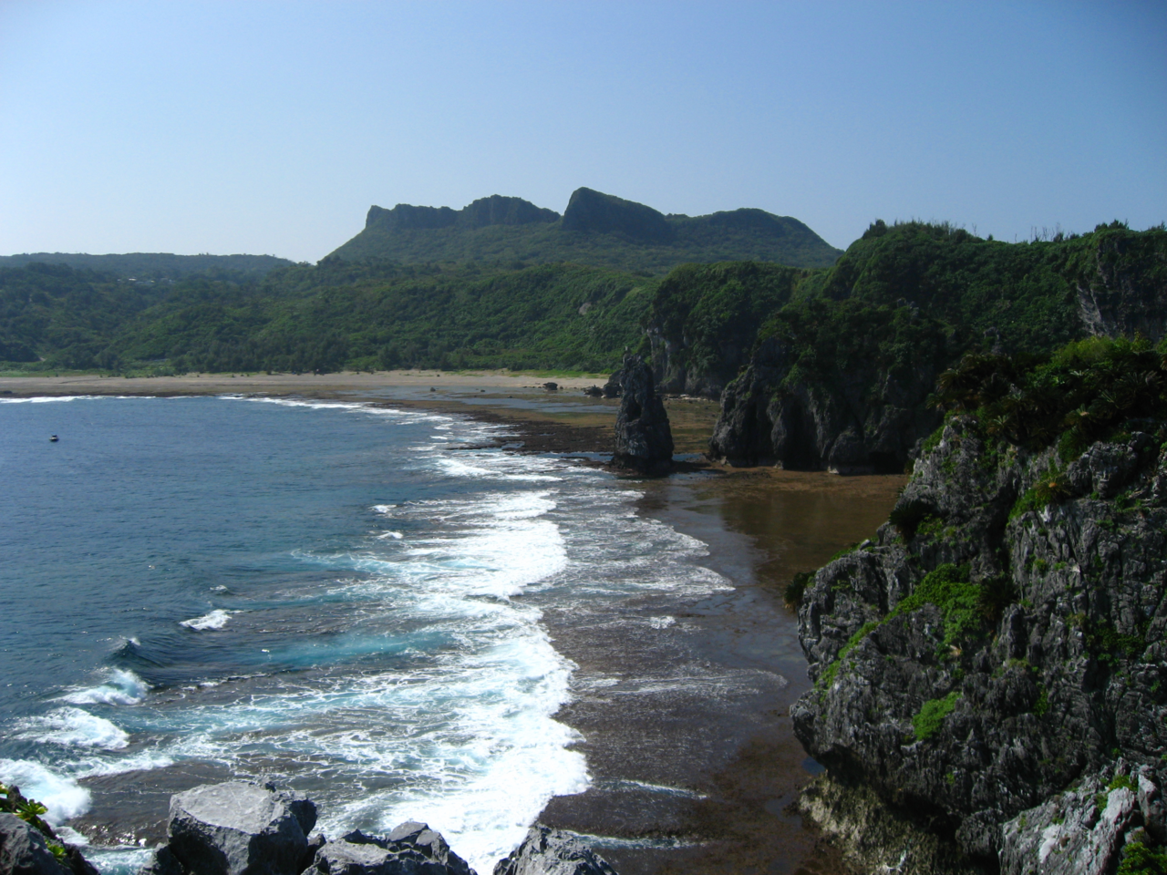
Cape Hedo (辺戸岬, Hedo-misaki) is the very northern tip of Okinawa Main Island. Three hours from Naha by car if traffic is kind, four if it is not. It is not a beach. It is a hard limestone cape with a 60-metre cliff over a powerful sea, marked by a small monument that, on a genuinely clear day, looks across the 22-kilometre strait at Yoron-jima. There is a pull-off carpark, free, a small shrine, a couple of food trucks at peak hours, and a network of paths along the headland.
The reason Cape Hedo earns its day in this article is what is around it. The drive from the Ocean Expo Park to the cape takes you up the west coast through Kunigami village, with a string of small fishing harbours and pulled-off coral coves where the absence of any infrastructure makes the swimming better than anywhere closer to Naha. Stop at any of them. There are no signs in English. Park sensibly, do not block the fishing boats.
The detour worth knowing about: Daisekirinzan (大石林山), 15 minutes south of the cape, a karst-rock formation park with three short interpretive trails through ancient ryukyu limestone. ¥1,200 adult, open 09:30–17:30 in 2026. The pinnacle-rock loop is a 40-minute walk and surprisingly absorbing. Combine it with Cape Hedo to make the long drive worth it.
Yanbaru National Park, the rainforest behind the beaches
The northern third of Okinawa Main Island is Yanbaru National Park (やんばる国立公園), designated 2016 and inscribed on the UNESCO World Heritage list in 2021 for its endemic species. It is rainforest. The Okinawa rail (yanbaru-kuina), a flightless bird found nowhere else on earth, lives here. So does the Okinawa woodpecker, the Ryukyu long-furred rat, and a frog endemic to one specific stream system.
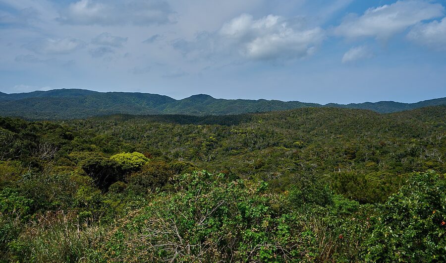
The park has a low-bar hiking option (the Hiji Falls trail, 1.5 km each way, ¥500 entry, open 09:00–16:00 in 2026) and a high-bar option that needs a guide (kayak ascents of the Aha Dam tributaries, river-trekking the Fungawa River). The Hiji Falls hike takes about 90 minutes return, includes a 30-metre suspension bridge, and ends at a 25-metre waterfall with a swim pool that is open to swimmers in summer. This is the realistic Yanbaru introduction for most visitors.
If you want the rail bird, the Ufugi Visitor Centre in Kunigami is the place to ask about current sighting hot-spots. The bird is most active 06:00–08:00 and 16:00–18:00. The roads through Yanbaru have rail-strike warning signs and a 40 km/h limit at dusk; respect both. About one in twelve rail-bird road deaths happens to a tourist driving too fast at the wrong hour.
The water itself: when, where, what to know
Best months for the swim
The standard answer is mid-June to early October, but Okinawa swimming is a longer season than that suggests. Most beaches officially open the swim area on 1 April and close it 31 October, lifeguards on duty in the same window. The water is warm enough to swim from late March through to mid-November for anyone tolerant of 23°C. December through February is wetsuit weather, and the cold front swells will close the smaller bays for days at a time.
The two real watch-outs:
- Late June to mid-July rainy season (沖縄の梅雨, Okinawa-no-tsuyu). Not a torrential affair like June in Honshu, but the visibility takes a hit and the ferries cancel more often.
- Late August to late September typhoon window. One typhoon per year is normal, and a single bad one will close every Kerama ferry for three to five days. Build flex into the itinerary in this window. Travel insurance with cancellation cover is honestly worth it.
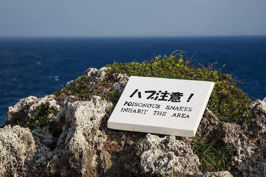
The jellyfish and the habu-tang
Two creatures the article will not skip on. The box jellyfish (ハブクラゲ, habu-kurage) lives in Okinawa waters from June to early October. The sting is medical-emergency serious, not a minor nuisance. Almost every public beach has anti-jellyfish nets up in season, marked with red and yellow buoys. Swim inside them. The deserted local-favourite spots without nets are off the swim list in summer.
The habu-tang fish is a stonefish-relative with venomous dorsal spines, hard to spot on a coral floor. Wear reef-safe water shoes when you wade across rock-and-coral mix. Do not put a hand down to push off the bottom.
If a sting happens, vinegar is the immediate treatment for box jellyfish. Most lifeguarded beaches keep a vinegar bottle at the lifeguard hut. After vinegar, the casualty needs to get to a hospital. The 119 emergency number is the ambulance.

Reef-friendly sunscreen rules
Okinawa Prefecture started a reef-safe sunscreen campaign in 2018. There is no legal ban yet, unlike Hawaii and Palau, but several Kerama beaches and almost every dive shop now hand out lists of which sunscreens are accepted. The key compounds to avoid are oxybenzone, octinoxate and octocrylene. Mineral sunscreens (zinc oxide, titanium dioxide) are universally OK.
If your sunscreen is borderline, the Naha pharmacies on Kokusai-dori sell mineral options for ¥1,200–2,000. The eco-conscious dive operators on Cape Maeda will refuse to lend kit if your existing sunscreen is on the bad-list, so swap before you arrive.
Marine reserve and snorkel rules
Standing on coral is the one thing every snorkel hut on every island warns you about, repeatedly, and tourists do anyway. Coral takes decades to grow back. Wear fins, float horizontally, and never stand to clear your mask. The buoyed snorkel zones at Furuzamami, Aharen and Tokashiku all enforce the no-touch rule and the no-feed rule (do not feed the fish, even with bread). Independent snorkelling outside the buoyed zones is allowed but the operators consistently advise against it on safety grounds, and on rough days the swim out of a bay can carry serious current.
The Kerama Islands are also a humpback whale calving ground. Whale watching tours have a 100-metre approach rule and a 30-minute time limit per pod, both enforced by the Zamami Whale Watching Association. The boats are small, take seasickness pills if you are a candidate.
Where to stay near the beaches
Three sensible bases depending on what you came for.
Onna village for west-coast main-island beaches
Onna (恩納村) is the resort strip on the west-central main island, the closest base to Cape Maeda, Manzamo and the dive operators. The big-resort cluster has the Halekulani Okinawa, the Hyatt Regency Seragaki, the ANA InterContinental Manza, and a string of Sheraton, Hilton and Renaissance properties. Rooms run ¥25,000–55,000 a night in summer for a sea-view double, ¥15,000–30,000 in winter. The mid-tier guesthouse equivalent (Onna no Eki area, family-run minshuku) is ¥7,000–12,000 per person and easier on a beach-day budget.
Motobu peninsula for Churaumi and the north
If your trip is built around the aquarium, Emerald Beach, Sesoko and Kouri, base on the Motobu peninsula instead. Hotel Orion Motobu Resort & Spa sits 600 metres from the aquarium gate (great for a 09:30 opening run, awful at 11:00 when the buses arrive). Smaller properties near Bise village and the Bise Fukugi Tree Road give you bicycle-distance access to Emerald Beach without the resort price tag, ¥9,000–15,000 per person.
On a Kerama island
Tokashiki, Zamami and Aka all have small guesthouses (民宿, minshuku) and a handful of pension-style hotels. The booking rhythm is different from main-island Japan: many places do not appear on Booking or Agoda at all, and you book by phone or email through the village tourism associations. Zamami Tourist Association (zamami.tourism.org) and Tokashiki Tourist Association are the easiest English-language entry points. Rates run ¥6,000–9,000 per person including breakfast, ¥9,000–13,000 with two meals. The two-meal rate is honestly worth taking on islands where the four restaurants close at 21:00.
One of the more memorable places on Tokashiki is the Pension Spirits at the Aharen Beach end of the island, with a deck right over the bay. Book it three months ahead in summer. If everything is sold out, Aka has more capacity than its size suggests; consider the inter-island ferry from Aka to a Zamami day trip rather than fighting for a Zamami room.
The day-trip plan if you only have a day
Three honest day-trip options, ranked.
- Tokashiki via the high-speed Marine Liner. 09:00 ferry from Tomari, arrive 09:35. Shuttle to Aharen, swim and snorkel until 14:30, shuttle back, 16:00 ferry returns by 16:35. Total cost: ¥4,810 ferry round-trip + ¥1,000 bus + ¥200 environmental tax = roughly ¥6,000 plus food. The strongest single-day Kerama experience for non-divers.
- Zamami via Queen Zamami high-speed. 09:00 from Tomari, arrive 10:00. Furuzamami in the morning, lunch at a port cafe, Ama Beach for the turtle hour 14:00–15:30, 16:00 ferry returns by 17:00. Cost ¥7,510 round-trip + ¥200 tax. Slightly more rushed than the Tokashiki version, but if you are travelling solo the Zamami port village is a friendlier hub for an unaccompanied day-tripper.
- The whale-watching hybrid (January to early April). Same Tokashiki or Zamami ferry, with a 10:30 whale-watch bolt-on (¥5,500). Less swimming, more humpbacks. The Zamami operators have a 90% sighting rate published for the season; in seven seasons of editorial reports it is the most consistently delivered statistic in Okinawa tourism.
The day-trip-killing mistake is trying to pair a Kerama ferry with the Churaumi Aquarium in the same day. Both are full-day commitments. Save the aquarium for a main-island day with a rental car.
What to combine the beaches with
Two final connections. The cluster is part of the wider Okinawa regional guide, which sets the geography and history if you came in cold. Naha has the city-side detail (Shuri Castle reconstruction, Kokusai-dori, Makishi market) for the rest of the trip. And the Yaeyama Islands are the contrarian alternative for travellers who want even more of what the Kerama deliver, with the trade-off of an extra flight south to Ishigaki.
Two cluster pieces from elsewhere on the site that connect: the Japan Rail Pass guide spells out why a national JR Pass is wasted on an Okinawa-only trip, and the cherry blossom calendar in the cherry blossom guide notes that Okinawa flowers in late January, weeks before Honshu, which makes a January Kerama whale-and-sakura trip a genuine pairing.
One last note before the ferry
The 06:30 Cape Maeda morning at the top of this article is not unusual for an Okinawa beach trip. Most of the best moments here happen before 09:00 and after 17:00, in the windows the cruise-bus circuit cannot reach. Get up early. Stay one extra night somewhere. The 50-metre Kerama visibility, the empty Furuzamami at 07:00, the Cape Hedo wind at sunset; none of those are accessible from a coach itinerary, but every one of them is twenty minutes of effort from a person with a rental car or a ferry ticket and a willingness to leave the hotel before breakfast.
_-_October_2015.jpg)
.jpg)