Hokkaido is the size of Austria with a quarter of the population, and most travellers from Honshu underestimate the distances and overestimate the public-transit network. The first time you check Google Maps for the drive from Sapporo to the Shiretoko Peninsula and see eight hours, the trip is suddenly not the long-weekend add-on you thought it was.
I have a soft spot for Hokkaido, but I have also watched plenty of friends arrive with five days for the whole island, plan to “do” Sapporo, Hakodate, Furano and Niseko, and leave a week later having mostly seen rural-highway service stations. Five days here covers one of six regions properly. The whole island deserves something closer to two weeks. Plan against that, not for it, and the trip starts to make sense.
In This Article
- What Hokkaido actually is, and why it sits apart
- The four-season swing is bigger here
- Where to base, by trip length
- The six regions
- Sapporo and the west
- Hakodate and the south
- Central Hokkaido: Furano, Biei, Asahidake
- The east: Shiretoko, Akan, Kushiro
- The far north: Wakkanai, Rishiri-Rebun
- How to get there
- By air to New Chitose
- By Hokkaido Shinkansen
- By ferry from Aomori
- Within Hokkaido
- The food primer
- Seasonal highlights
- Winter (December to March)
- Spring (April to early June)
- Summer (June to August)
- Autumn (mid-September to October)
- What surprises first-timers
- Three cities, three different trips
- Sapporo: the food-and-festivals city
- Hakodate: the historical port
- Niseko: the international ski town
- For repeat visitors
- The closing scene
What Hokkaido actually is, and why it sits apart
Hokkaido is the second-largest of Japan’s four main islands and the only one above the 41st parallel. It joined Japan late, in administrative terms: settler agriculture, the railway grid and the prefectural capital all date from the Meiji period of the 1870s and 1880s, which makes Sapporo and Hakodate feel structurally newer than the older centres of Honshu. The grid streets, the wide boulevards, the brick warehouses, the dairy: a lot of what surprises a first-time visitor about Hokkaido is the by-product of a frontier built on a US-influenced template.
The other thing that sets it apart is geography. Hokkaido has six recognisable sub-regions, and they have very different feels. The west, anchored by Sapporo, is the populated arc that takes in Otaru and the Niseko ski area. The south is the Oshima peninsula, with Hakodate at its tip and a Hokkaido Shinkansen station that lands you 20 minutes north of the city centre. Central Hokkaido is the Furano and Biei farmland and, behind it, the Daisetsuzan massif, which contains the highest peaks on the island. The east splits in two: the Shiretoko Peninsula, a UNESCO World Heritage site at the eastern tip; and the Akan-Mashu lake district plus the Kushiro marshlands further south. The far north is the empty Soya peninsula and the offshore islands of Rishiri and Rebun. You can spend weeks in any one of these and not exhaust it.
The four-season swing is bigger here
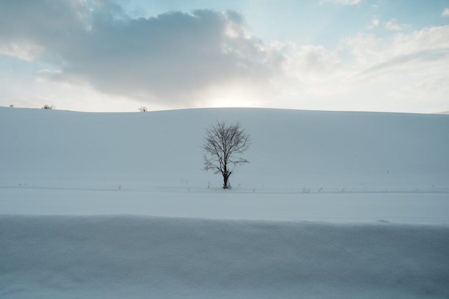
If you have travelled in mainland Japan, the season variations you know from there are only a starting point on Hokkaido. Winter is genuinely Siberian, with multi-metre snow accumulating from late November to late March in the interior and on the west coast. Summer days are warm but rarely humid, and overnight temperatures stay cool enough to need a layer; this is one of the very few parts of Japan you can travel through in August without sweating through everything you packed. Spring is short and crowded into a 2 to 3 week window in late April and early May, which is when the Hokkaido sakura you may have heard about actually happens. Autumn arrives in mid-September on the high ground, six weeks ahead of Tokyo, and trickles down to sea level by late October.
The practical version of this: pick a season, pick a region, and don’t try to mix winter snow festivals with lavender fields on the same trip. They are not compatible.
Where to base, by trip length
Hokkaido has a few different “right answers” depending on how long you have. The table below is what I tell people who ask me to plan a first Hokkaido trip on a deadline.
| Days | Where to base | What you actually see | Best for |
|---|---|---|---|
| 3 | Sapporo only | Odori Park, Susukino food, Otaru day trip, Mt Moiwa night view | City visitor, food first, winter weekend tied to a festival |
| 4–5 | Sapporo + Hakodate | Add the Hokkaido Shinkansen south, Goryokaku, Motomachi, Hakodate night view, morning market | First-time visitor, history and views, late April for cherry blossoms |
| 5–7 | Sapporo + Niseko or Furano | Add a ski week or a summer flower-fields week, plus Otaru | Skier, summer landscape photographer, second-time visitor |
| 7–10 | Sapporo + Hakodate + Daisetsuzan | Add Asahidake, Sounkyo gorge, Furano-Biei, Asahiyama Zoo | Hiker, autumn-leaf hunter, anyone who likes mountains |
| 10–14 | Full circle: west + south + central + east | Add Shiretoko, Akan-Mashu, Kushiro, the Sea of Okhotsk drift ice in winter | Wildlife, photographers, road-trippers, anyone returning |
| 14+ | As above plus Rishiri-Rebun or extended east | Soya peninsula, the offshore islands in summer, deep east in winter | Repeat visitors, Japan-residents on a long break |
The six regions
Each one of these earns a separate guide. The thumbnails here are just enough to plan around.
Sapporo and the west
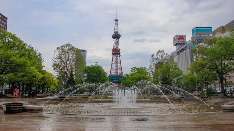
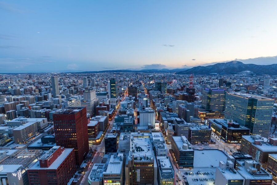
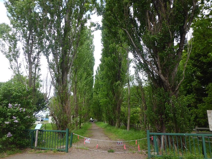
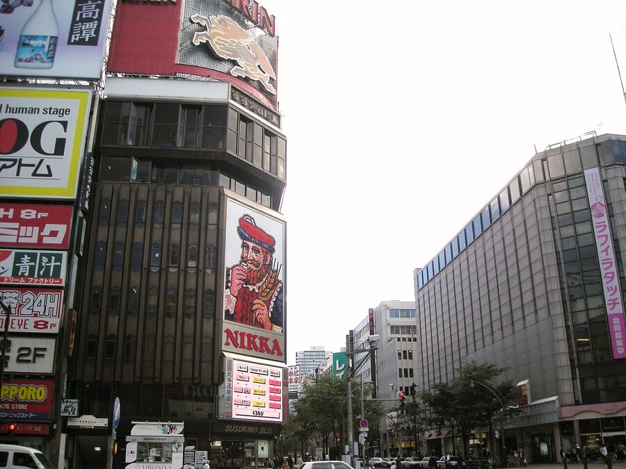
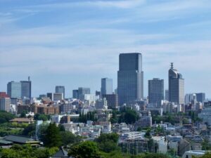
Sapporo is the only city on Hokkaido that feels like a national-tier city, and at 1.95 million people it is bigger than Manchester or Munich. The grid plan makes navigation embarrassingly easy: streets are numbered N1, N2, S1, W4 and so on outward from the TV Tower. Odori Park is the central spine, eight blocks east-west; the food and nightlife district of Susukino is two stops south on the green subway line; the historic Hokudai campus, with its poplar avenue and silver-birch dorms, is north of the station. I cover the city in detail in the Sapporo guide; if you have only one Hokkaido city, it is this one.
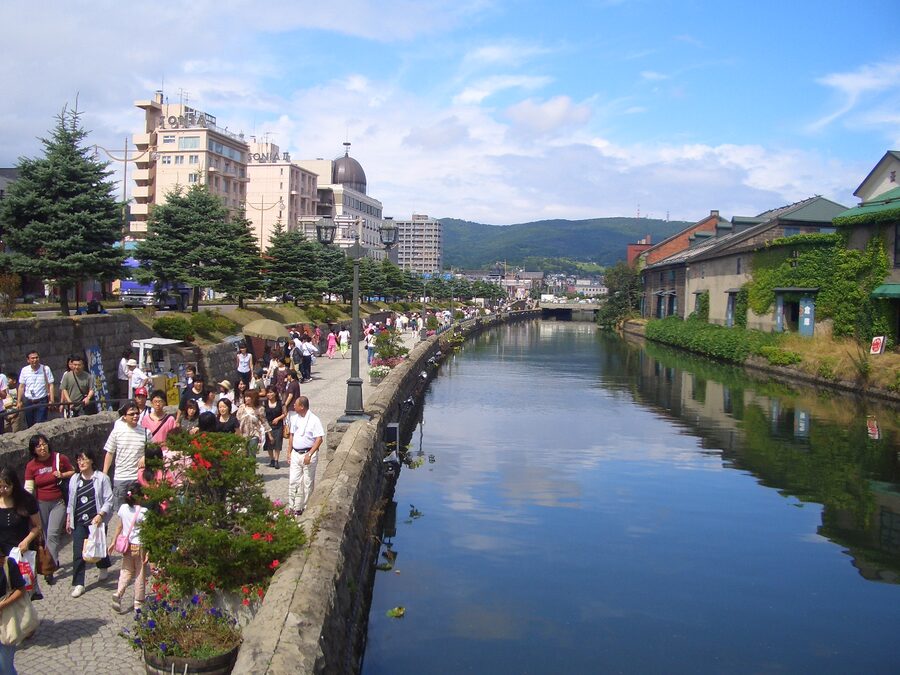
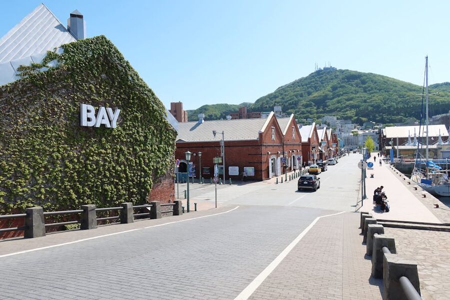
An hour west by JR rapid train, Otaru is the day trip that does itself. The 1.1km canal is the postcard image, but the better reason to come is the sushi: Otaru sits on the Sea of Japan side of the island, has a working fishing port, and the per-piece price for the same uni or hotate as Tokyo is roughly half. Music boxes, glassworks and the Romi Romi chocolate factory are a tier of the Otaru experience I find more touristy than rewarding, but the LeTAO double-fromage cheesecake (¥2,160 for the whole thing as of 2026, sold beside the canal) is genuinely worth the queue. South-west of Otaru, in the same hour-circle from Sapporo, are the Niseko ski areas, which are big enough to deserve their own section below.
Hakodate and the south
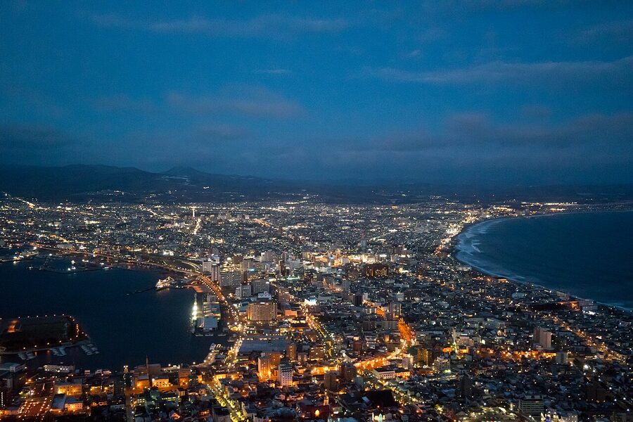
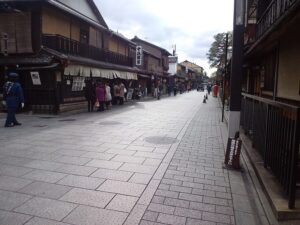
Hakodate sits at the southern tip of the Oshima peninsula, on the narrow neck between the Tsugaru Strait and the Pacific. The shape is what makes the night view: the lights on each shoreline pinch together as your eye runs from the volcanic peninsulas inland. It is one of the three classic night views of Japan, alongside Nagasaki and Kobe, and on a clear night it earns the cliché.
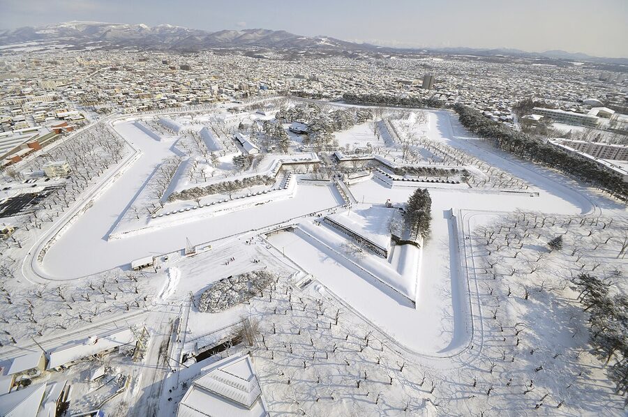
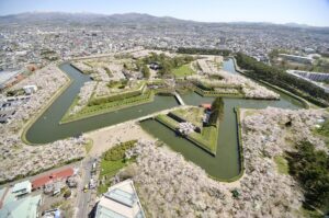
Beyond the night view, Hakodate has the only star-shaped fort in Japan (Goryokaku, built 1864 to 1866), the country’s oldest morning market still operating in something like its original form, and the only district outside the treaty ports where Russian Orthodox, Catholic and Anglican churches sit within five blocks of each other. As an underrated city in Japan, Hakodate is approaching consensus. The Hakodate guide covers the timing on the rope-way, which seafood place at the morning market is worth the queue, and where to stay if you want a tatami room with the night view from the bath.
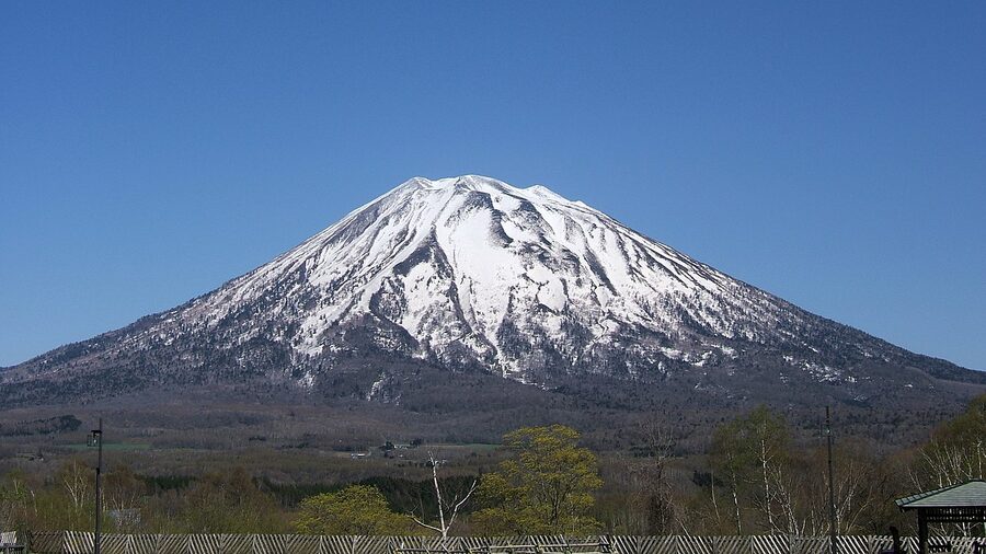
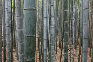
Central Hokkaido: Furano, Biei, Asahidake
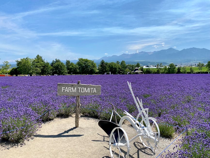
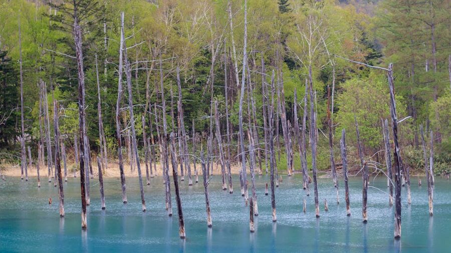
Furano and Biei are the rolling-hills bit of Hokkaido, the patchwork of fields you have seen on a million Japan-tourism Instagram posts. The reality is more limited and more rewarding than the image: Farm Tomita lavender is genuinely worth the trip during the 3-week window in mid-July, and looks like wallpaper-design the rest of the year. Biei’s patchwork hills, the Shirogane Blue Pond, and the Christmas tree-shaped solitary larch tree are all within an hour’s drive of each other. The pond itself is small (about 200m across) and on cloudy days it just looks like a pond. Aim for sun, between 10:00 and 14:00.
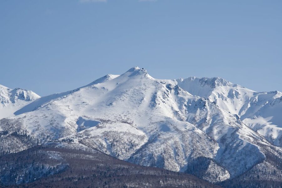
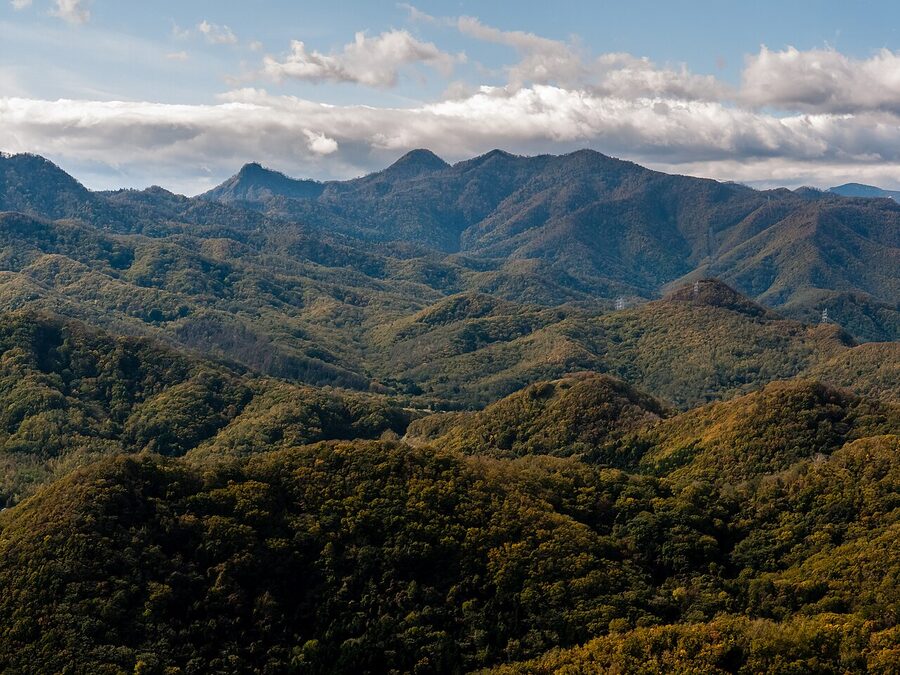
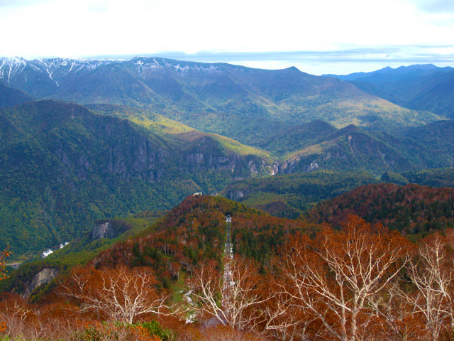
Behind the farmland sits Daisetsuzan, the mountain block that gives Hokkaido most of its highest summits and its best autumn colour. Asahidake (2,291m) is the headline peak. The Asahidake Ropeway runs year-round, gets you to 1,600m in 10 minutes, and from there the volcanic plateau is a three-hour loop on a clear day. Mid-September is the optimal week for autumn leaves up here; by the third week of October the snow is starting and the high paths are closed. Sounkyo, north-east of Asahidake, is the gorge village to base in for the lower-altitude colour.
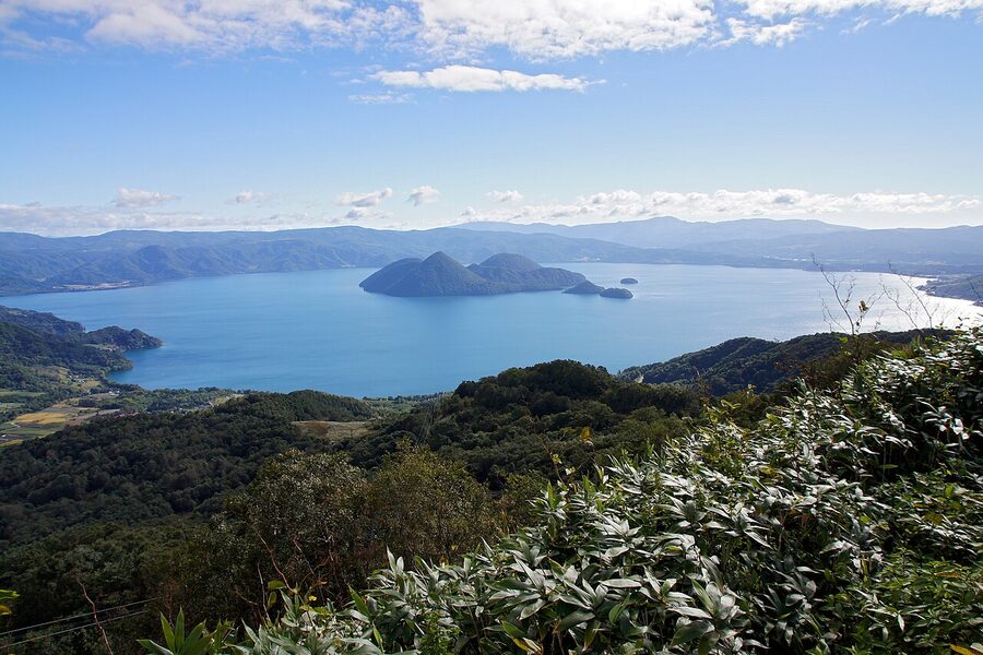
The east: Shiretoko, Akan, Kushiro
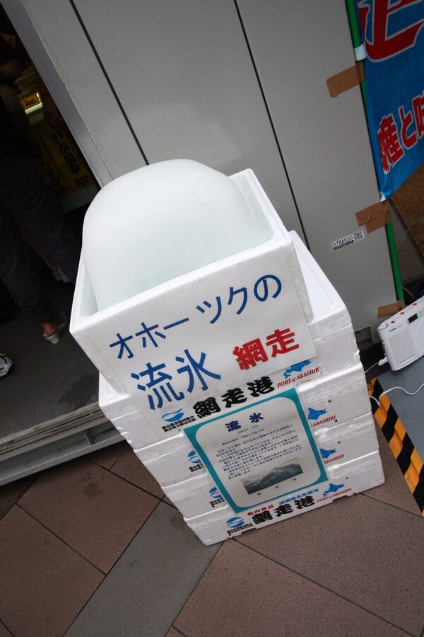
Eastern Hokkaido is where the island becomes wilderness in the proper sense. Shiretoko Peninsula is a UNESCO Natural Heritage site and the place I tell repeat-visitors to spend three days. The Shiretoko Goko (the Five Lakes loop) gives you brown bear country on the raised boardwalk; the Kamuiwakka hot waterfall is shoes-off, swim-up onsen-meets-river, and is sublime in late summer. The road past the lakes closes in winter; in February, you go in by icebreaker from Abashiri or Monbetsu instead.
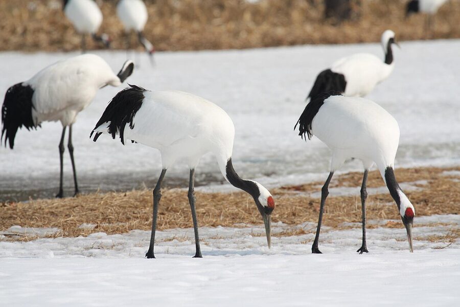
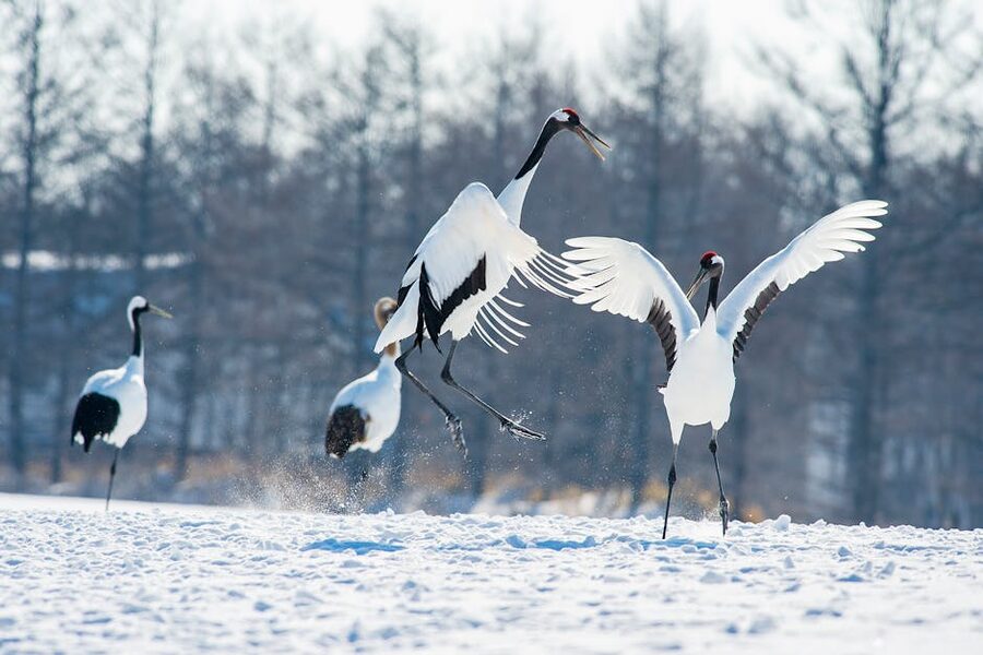
South-west of Shiretoko, Akan-Mashu National Park has three of Hokkaido’s most photographed lakes (Akan, Mashu, Kussharo) and the largest Ainu kotan (settlement) on the island. Further south again, Kushiro is the gateway to the Kushiro-shitsugen marshlands, and from December to March the wintering ground for the Japanese red-crowned crane: about 1,500 birds at peak, almost the entire global population.
The far north: Wakkanai, Rishiri-Rebun
Wakkanai is the last station on the JR Soya Main Line and the northernmost city in Japan. The town itself is small and treeless, but Cape Soya 30km north-east is the country’s northernmost point and on a clear day you can see Sakhalin across the strait. The real reason to come up here is the ferry to Rishiri and Rebun, two offshore islands that, in July and August, are some of the wildest country in Japan: alpine flowers at sea level, virtually no tourist development, working fishing villages and hiking trails up the cone of Rishiri-Fuji (1,721m). I would not bring a first-time Japan trip up here. I would bring a fifth-time Japan trip up here in a heartbeat.
How to get there
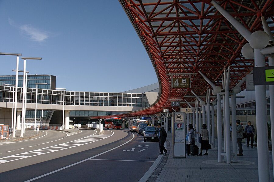
By air to New Chitose
Almost everyone flies in. New Chitose Airport (CTS) is 50 minutes by JR Rapid Airport train south of Sapporo Station, a flat ¥1,150 with reserved seats available for a small upcharge, with departures every 12 to 15 minutes from 06:30 to 23:00. ANA, JAL, Peach, Skymark, Jetstar Japan, Spring Airlines and AirDo all fly Tokyo-Sapporo: 90 minutes from Haneda or Narita, every 20 minutes most of the day, fares from around ¥6,000 one-way on the LCCs and ¥15,000 to ¥20,000 on the legacy carriers. From elsewhere in Japan there are direct flights from Osaka (Itami and Kansai), Nagoya, Fukuoka, Sendai and Hiroshima.
By Hokkaido Shinkansen
The Hokkaido Shinkansen runs from Tokyo through Sendai and Aomori, then under the Tsugaru Strait through the 53.85km Seikan Tunnel to Shin-Hakodate-Hokuto. The fastest Hayabusa service does Tokyo to Shin-Hakodate-Hokuto in 3h 57m, with reserved seats only and a one-way fare of ¥24,200 as of 2026. The line is being extended to Sapporo, but the Sapporo extension has slipped and is now expected in 2030 or 2031, not before. Until then, anyone travelling onward from Shin-Hakodate to Sapporo by rail switches to the Hokuto limited express, which adds 3h 30m and another ¥9,440 to the journey, total around 7h 30m and ¥33,640. Most people fly that leg.
Where the Shinkansen is genuinely the right answer: Tokyo to Hakodate as a destination in its own right, or as part of an east-coast route from Tokyo through Tohoku into Hakodate. The Hokkaido Shinkansen is also covered by the nationwide Japan Rail Pass and the JR East South Hokkaido Rail Pass (¥40,000 adult, 6 days flexible within 14, valid as of January 2026). The dedicated JR East and South Hokkaido pass guide goes into the maths on whether either is worth the spend.
By ferry from Aomori
The Tsugaru Kaikyo Ferry runs Aomori to Hakodate in 3h 40m, eight times a day, from ¥2,860 in basic class. It is the cheap way to bring a vehicle across the strait, and the journey through the strait itself, between the volcanic capes of Aomori and the harbour-mouth of Hakodate, is one of the more unusually beautiful sea legs in Japan. Slower, but on a sunny day in summer worth choosing.
Within Hokkaido
JR Hokkaido runs the rail network and it is sparser than anywhere else in mainland Japan. The Hakodate Main Line and the Sekisho-Sekihoku route eastwards are the spine; almost everything else is a single-track local. Limited expresses are the way to do longer distances: Sapporo-Asahikawa is 1h 25m, ¥5,220 reserved; Sapporo-Hakodate is 3h 30m, ¥9,440; Sapporo-Kushiro is 4h 25m, ¥9,990. The JR Hokkaido Rail Pass at ¥40,000 for 7 consecutive days (or ¥22,000 for 5 flexible days within a 10-day window) is good value if you do three or more of those legs. For a single round trip with a side-trip, point-to-point tickets work out cheaper.
Outside the rail spine, you are looking at intercity buses (Hokkaido Chuo Bus, Sosogo, the Donan Bus from Sapporo to Niseko) or a rental car. Renting a car is the quietly correct answer for any of central, eastern, or far-northern Hokkaido. Roads are good, traffic is light, parking is plentiful and free at most attractions. The catch is winter driving: from December to March, even the main highways will be packed snow, and unless you have driven in snow before with proper studless tyres (yuki tyres, fitted as standard at every rental counter on Hokkaido), this is a hard place to learn. International driving permit is mandatory; carry your home licence too.
The food primer
Hokkaido is one of the few parts of Japan where I would happily eat ramen for breakfast, lunch and dinner three days running. Six dishes you should look for, roughly in the order an outsider should try them.
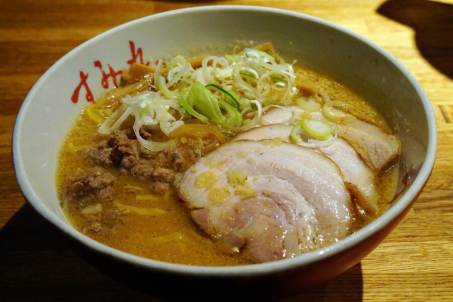
Sapporo miso ramen. Hokkaido invented miso ramen in the 1950s, in a Susukino shop called Aji no Sanpei. The classic bowl: thick yellow noodles, miso-based broth, butter, sweetcorn, beansprouts, sometimes a sliver of pork. Cold-climate food, designed to give you 1,000 calories in under ten minutes. Hakodate, by contrast, does shio (salt) ramen, the cleanest broth on the island; Asahikawa specialises in shoyu (soy) ramen with double-strength stock. You can do a Hokkaido ramen pilgrimage and it is the cheapest pilgrimage in Japan, about ¥1,100 a bowl.
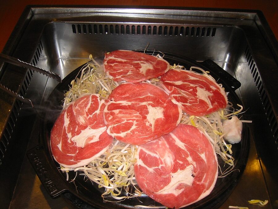
Jingisukan. Lamb on a domed grill, named after Genghis Khan because the dome is supposed to look like his helmet. This is Hokkaido-only food in mainland Japan: outside the island, lamb is a niche ingredient. Inside it, jingisukan is the mid-priced sit-down dinner that feels most local. The Sapporo Beer Garden does it inside the historic Sapporo Beer factory, all you can eat for around ¥5,000; Daruma in Susukino does the locals’ version, no English menu, no reservations, queue from 18:00.
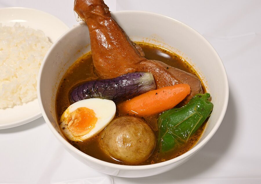
Soup curry. Soup curry is also Sapporo-invented, late 1970s, and is genuinely different from Japanese curry-rice elsewhere. It is a thin, spice-heavy broth (think Sri Lankan more than supermarket Japanese), with a piece of chicken or vegetables, served separately from a bowl of rice. The standard order: chicken leg, choose your spice level 1 to 10. Suage in Susukino is the well-known beginner pick; Garaku is the chef’s choice. Around ¥1,500 a bowl, lunch only at most places.
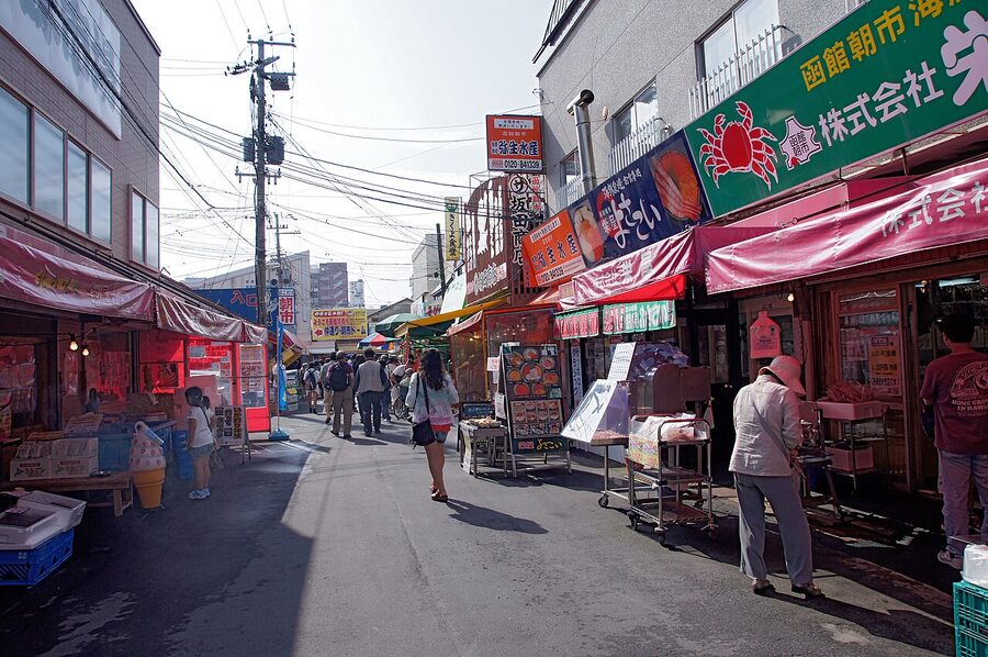
Kaisendon and the morning markets. Hokkaido does the seafood-on-rice bowl better than anywhere else in Japan, and the place to eat it is the morning market in either Hakodate or Otaru. A serious uni-ikura-hotate kaisendon (sea urchin, salmon roe, scallop) runs ¥3,000 to ¥5,500 in 2026 depending on the season; the Hakodate version with fresh hairy crab adds another ¥1,500 to that. You queue, you eat, you leave; this is not lingering food.
Hokkaido dairy. The cleanest milk-and-cream supply in Japan comes from the pastures of Tokachi and the Niseko area. The expressed-form ranges from soft serve (¥400 a cone, available at every dairy farm gate) to LeTAO’s double-fromage cheesecake (Otaru) to the Hokkaido-only butter-corn ramen topping. Stock up at the airport on the way out: Royce’ chocolate, Rokkatei’s marusei butter sandwich (¥160 each, the airport bestseller), and the white chocolate Shiroi Koibito biscuits.
Yubari melon. The premium green-fleshed melon variety from the town of Yubari is genuinely the best melon in the world, and at the post-harvest auctions in May the first crate routinely fetches ¥3 million. By the time it reaches a Sapporo department store the price is closer to ¥15,000 to ¥30,000 for a single fruit, which is the kind of mark-up that triggers reflexive eye-rolling, but if you have eaten one in season the eye-rolling stops. Mid-June to August is the window. The Yubari Melon Festival, late June, gives you small sample portions for a few hundred yen.
Seasonal highlights
Winter (December to March)
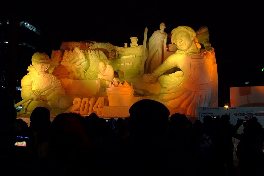
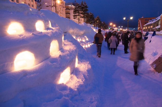
The Sapporo Snow Festival is the headline event, traditionally first or second week of February: large snow sculptures along the central spine of Odori Park, an ice-sculpture site in Susukino, and projection-mapping shows after dark. The 75th edition ran 4 to 11 February 2026; the 76th will be early February 2027 (dates are usually announced the previous summer; the Tsudome family site has been suspended for the most recent editions). Outside Sapporo, the Otaru Yuki Akari no Michi (Snow Light Path) festival runs the same week, with thousands of candle-in-snow lanterns lining the canal.
Skiing and snowboarding peak from mid-January to mid-February. Niseko is the international name; Rusutsu, Furano, Tomamu, Kiroro and Sahoro are the bigger Japanese-domestic resorts. Off the slopes: the Asahikawa Winter Festival in early February (the world’s largest snow sculpture event, in the Guinness records), the Lake Shikotsu Ice Festival (last week of January through mid-February), the Sounkyo Hyobaku Festival (the gorge with frozen waterfalls lit at night), and, in eastern Hokkaido, the Garinko-go and Aurora icebreaker cruises out of Monbetsu and Abashiri from mid-January to early March.
Spring (April to early June)
Hokkaido sakura is the late edition: cherry blossoms reach Hakodate around 24 April, Sapporo around 30 April, and Asahikawa in the first week of May. The standout viewing spot is Goryokaku Park in Hakodate, where about 1,500 Yoshino cherries fill the moats. Matsumae Castle, an hour south of Hakodate, holds the only working Japanese castle on the island and runs a cherry-blossom festival until the third week of May. The dedicated Hokkaido cherry-blossom guide covers all three viewing spots in detail.
From mid-May, Sapporo’s Lilac Festival fills Odori Park; from late May into early June, the Sapporo Spring Fest converts the central park into a beer-garden forecourt. Outside the cities, this is the green-up window for the central farmlands: the Furano-Biei area finishes its snow-melt around 15 May, and the patchwork hills are a deep green by the start of June. Lavender comes later; full bloom is mid-July.
Summer (June to August)
Mid-July to mid-August is when the entire mountain interior is open: trails up Asahidake, the Daisetsuzan traverse, the Shiretoko Goko boardwalk, the Rishiri-Fuji and Rebun-dake hikes. This is the main hiking window. The lavender at Furano peaks 5 to 25 July; the flower fields outside that window go through poppies, sunflowers, salvia and cosmos in waves. Cycling: the central farmland is set up for it, with the Furano-Biei area as the standout route. Cycle hire from Furano Station, around ¥1,500 for a day.
July and August also bring the Otaru Ushio Festival (last weekend of July, 100,000 dancers and a fireworks finale over the canal), the Hakodate Port Festival (first week of August), and the Yosakoi Soran Festival in Sapporo (early June, the more energetic version of Kochi’s yosakoi). For wildlife, eastern Hokkaido is the better summer call: brown bear in Shiretoko, the red-crowned crane in their summer breeding grounds in the Kushiro marsh, sika deer everywhere.
Autumn (mid-September to October)
Daisetsuzan colours first, around 15 September; Sounkyo and the Kurodake ropeway by month-end; Lake Akan, Lake Mashu and Onuma Park by 10 October; the Sapporo lowland and Hakodate by early November. This is the calmest season to be on the island: schools are back, the summer crowds are gone, and the weather is reliably bright. For first-time visitors with the timing flexibility, late September into early October is what I recommend.
What surprises first-timers
The distances are bigger than you think. Sapporo to Hakodate by limited express is 3h 30m. Sapporo to Asahikawa is 1h 25m. Sapporo to the Shiretoko peninsula is 6h+ and you usually break it overnight. The mental model of “I can do day trips from anywhere” that works in central Honshu does not work here.
The convenience-store density is lower. Outside Sapporo and Hakodate, you can drive 30 minutes between Seven-Elevens or Lawsons. The local Hokkaido chain Seicomart fills the gaps, and is genuinely good (the Hot Chef hot food counter is a step up from the big-three’s equivalent), but the Tokyo habit of “I will pick up dinner at a convenience store on the way” needs revising.
The roads are rural. Hokkaido drives like the upper Midwest of the United States, not like Honshu. Two-lane highways, long straights, very little traffic, regular passing-lane sections; almost no toll-free expressway outside the Sapporo-Hakodate spine. Average speed on a clear stretch is genuinely 80km/h. In winter, halve it.
The accommodation runs hot or cold. Sapporo hotels start around ¥9,000 a night for a clean business hotel and run to ¥31,000+ for a downtown four-star. Niseko in peak ski week is ¥60,000+ a night for a chalet or hotel; the same chalet in May is ¥15,000. Eastern Hokkaido has long stretches with only minshuku and ryokan, which is exactly the right way to do it; book ahead, especially for the Shiretoko Goko area in July and August.
Bears are real but rare. Hokkaido has Japan’s only population of brown bears (higuma), about 12,000 of them. Encounters on hikes happen, and the rules are taken seriously: bear bells, no food residue at huts, group hiking on the high traverse routes. The risk is genuinely low if you stay on marked trails. The signs are not paranoid; they are local.
The Ainu presence is back. Hokkaido’s indigenous Ainu population was suppressed for most of the Meiji and Showa periods, with the language declared moribund by 1990. The 21st century has seen an Ainu cultural revival, and the Upopoy National Ainu Museum in Shiraoi (a town between Sapporo and Hakodate, opened 2020, ¥1,200 admission) is the central place to start understanding it. The Akanko Ainu Kotan, on Lake Akan, is the largest of the historic Ainu villages and worth a half-day if you are in the eastern Hokkaido lake district.
Three cities, three different trips
Each of these earns a dedicated guide. The thumbnail-level summary, then a link to the deeper guide.
Sapporo: the food-and-festivals city
Sapporo is the everyday city. Spend three days here and you have done the Snow Festival (in season), the Sapporo Beer Museum, the Hokudai poplar avenue, Mt Moiwa for the night view, an Otaru day trip and enough ramen-jingisukan-soup curry rotations to feel like a regular. The city is built for visitors and signposted in English on every train and most restaurants. The Sapporo guide has the named restaurants, which Susukino bars to sit at, and the timing on the subway-and-walk routings.
Hakodate: the historical port
Hakodate is calmer, more historical, more atmospheric. The morning market starts at 05:00 and is winding down by 11:00; the rope-way up the mountain runs late into the night; the trams along the seafront are an attraction in their own right. Two days is the right amount; one is not enough. The Hakodate guide covers the timing on Goryokaku for cherry-blossom week, the Hakodate-style salt ramen places, and how to do the night view without the queue.
Niseko: the international ski town
Niseko is the powder-snow international ski destination, but it is genuinely four interlinked ski areas (Grand Hirafu, Hanazono, Niseko Village, An’nupuri) on the same mountain (Niseko Annupuri, 1,308m), each owned separately, with a single all-mountain pass at ¥12,000 a day in 2025-26 that switches you between them. Mid-January to mid-February is the powder window; the rest of the season is good skiing without the marketing intensity. Summer is also worth a trip: rafting on the Shiribetsu River, hiking Yotei or Annupuri, dairy-farm cycling. The Niseko guide goes into which area to base in (Hirafu if you want bars and English; An’nupuri if you want quiet and locals), the lift-pass maths, and where to stay if you are not on a tour package.
For repeat visitors
If you have been to Hokkaido once, the second visit usually means going further off the spine. A few specific recommendations.
Rishiri-Rebun in late July, going up Rishiri-Fuji on a clear day. The hike is 9 to 10 hours up and back, technical only at the very top, and the summit view in good weather is one of the best in Japan. Stay at a minshuku in Oshidomari or Kutsugata.
The Tokachi plain in mid-September. Less travelled than the Furano-Biei block, more agriculturally varied, and the food is the best on the island for what it is: dairy, beef, beans, sugar beet. Obihiro Station is the start; the Tokachi Mukashi-banashi country roads radiate out from there.
The Shiretoko Goko boardwalk in late September. Bears are still active, the colour has just started, the boardwalk is half-empty, and you can finish the hike in time to catch the sunset off Cape Furepe.
The Sea of Okhotsk drift ice in mid-February. Two hours of ice-walking out of Utoro on the Shiretoko side; cheaper, and arguably more atmospheric, is the icebreaker out of Monbetsu. The Garinko-go II makes this an accessible day trip if you base in Abashiri.
Onuma Quasi-National Park in October. A 30-minute Shinkansen-plus-local-train hop north from Hakodate, mostly empty in autumn, and easily one of the best small-lake areas in Japan for a half-day cycle.
The closing scene
I tend to leave Hokkaido feeling that I have over-planned and under-stayed. There is a moment, usually in the last evening, when the Hokuto express is pulling out of Hakodate Station and the Tsugaru Strait is going indigo on the right and the volcanic peaks of Komagatake are catching the last light, and you do the maths and realise that even the longest trip you can plausibly take here would barely cover the headlines.
That is not a complaint. It is the point. Plan five days for one region the first time, then the next time, plan two weeks. The Sapporo, Hakodate and Niseko guides go deeper on the three places most first-timers actually base in. The Japan Rail Pass guide covers whether the pass is worth it for a Hokkaido-anchored trip. And the Hokkaido cherry-blossom guide is the one to read in February if you are timing a late-April trip around the bloom.
.jpg)
.jpg)
.jpg)
.jpg)
.jpg)