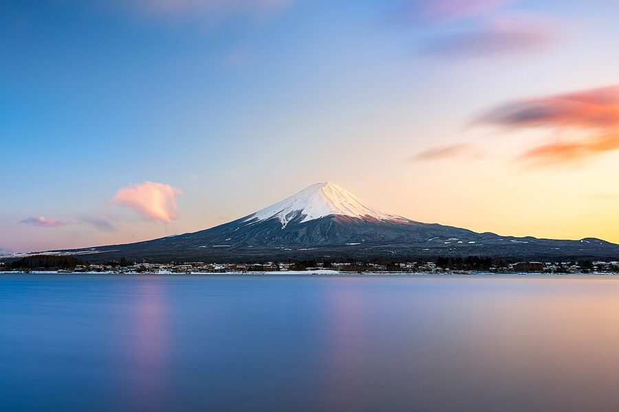
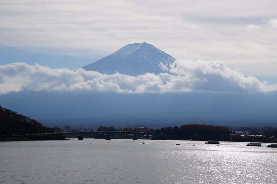
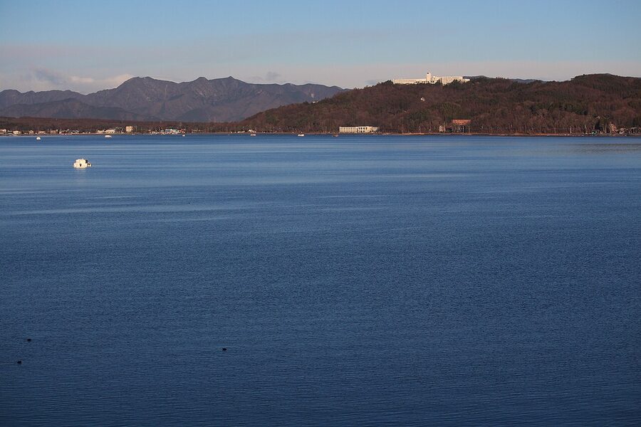
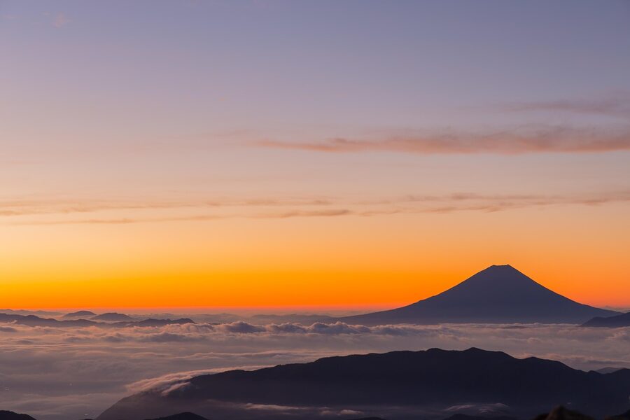
It’s 04:36 at Lake Kawaguchi and the air is so cold my breath is fogging the rented bike’s handlebars. Mt. Fuji is doing the thing it only does for ten or fifteen minutes a year: the snow on the cone is catching the first rim of sunrise pink, the lake is a slab of black mirror with one orange line drawn across it, and a cormorant breaks the surface and ruins the reflection. Two minutes later the cloud comes back. By 05:00 the mountain is gone for the day. I keep cycling.
If you want a single piece of advice for visiting Mt. Fuji, here it is: assume you will not see the mountain. Visibility from the most popular viewpoints averages around 30 percent on summer days, and it gets better in winter, not worse. Almost every Mt. Fuji guide on the internet talks about the climb, the Chureito Pagoda photo, and the Hakone hot springs. None of them tell you that the mountain itself is essentially a weather condition. You can spend three nights at Lake Kawaguchi in July and never see it. You can also stand on a Tokyo office balcony in late January and have it sitting there at the end of the street like a postcard somebody printed and propped up.
This guide is the regional anchor: how to think about the whole Mt. Fuji area, when to come, where the views actually are, and how the Yamanashi side and the Shizuoka side differ. For the climb itself, the day-trip routing from Tokyo, and the Hakone alternative, I’ve split those out into separate guides linked through this one. What follows is the piece I wish I’d had on my first trip.
In This Article
- The mountain is a weather condition. Plan around that.
- Yamanashi vs Shizuoka: which side?
- The viewpoints worth the trip
- Chureito Pagoda (Arakurayama Sengen Park)
- Lake Kawaguchi (河口湖)
- Lake Yamanaka (山中湖)
- The three other lakes: Saiko, Shoji, Motosu
- Oshino Hakkai (忍野八海)
- Hakone (Lake Ashi)
- Miho-no-Matsubara (三保松原)
- How to actually get there
- Climbing season vs viewing season
- The Yoshida Trail and the four routes (a brief summary)
- Where to stay (and how the geography decides for you)
- Lake Kawaguchi (north shore)
- Yamanaka and Yamanakako village
- Hakone
- What to actually do (besides looking at the mountain)
- Cycle the lakeshores
- Eat hoto noodles
- Fuji-Q Highland
- Kachi Kachi Yama Ropeway
- The Fuji-Q-Saiko ice and wind caves
- The kanji ambiguity, the romanisations, and the small things
- Cherry blossom, autumn leaves, and the seasonal accidents that make a trip
- The winter case
- The Hokusai problem
- Some honest blockers and downsides
- How to put a trip together
- And on a clear morning
The mountain is a weather condition. Plan around that.
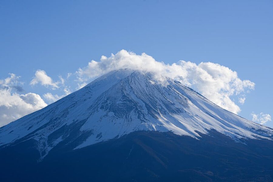
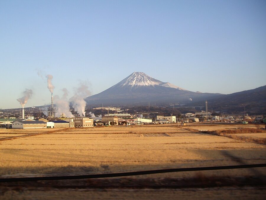
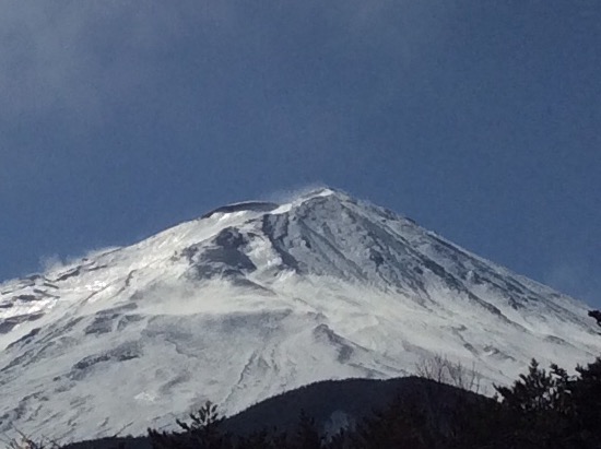
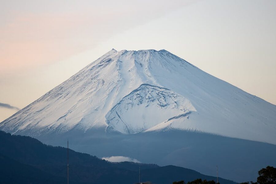
Mt. Fuji is 3,776 metres high and stands alone, which means it makes its own weather. Warm, humid air from the Pacific hits the cone, gets pushed straight up, cools, and condenses into cloud. In summer, that process kicks in by mid-morning. Most clear summit photos taken in July and August are taken before 09:00 or after about 18:00, with not much in the middle. In winter, dry continental air keeps the cone naked and the visibility cycles run longer.
The shorthand I use, after enough trips that I’ve stopped counting:
- December to early March: the highest hit rate for clear summit views. Cold, dry air, and a fully snow-capped cone. Crowds at all the headline viewpoints are a fraction of summer levels. The mountain is closed to climbing.
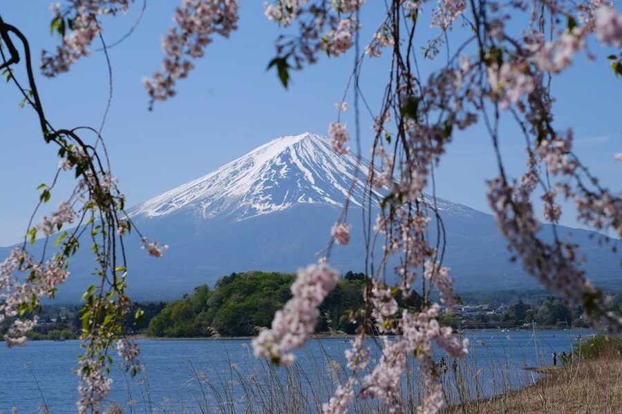
- Late March to mid-April: sakura season collides with Mt. Fuji at Chureito Pagoda and Lake Kawaguchi. The most photographed two weeks of the year, and the most crowded. Visibility is fickle.
- Late April to early June: still good visibility most mornings. Lake Motosuko shibazakura in late April. Lavender at Oishi Park starts late June.
- July to early September: climbing season. Visibility from the lakes drops. Photograph before 09:00 or accept overcast shots.
- October to November: autumn foliage at Lake Kawaguchi’s Maples Corridor and around Lake Yamanaka. Visibility recovers as the Pacific air dries out.
If your only fixed dates are summer, that’s fine, but plan for two viewing windows per day rather than one, and accept that one of them might be cloud. If you have flexibility, come in late November or any clear week between Christmas and the end of February. You’ll see the mountain.
Yamanashi vs Shizuoka: which side?
Mt. Fuji sits on the prefectural border. The Yamanashi (north) side has the lakes, the pagoda, the package-tour buses from Tokyo, and the most internationally recognised photographs. The Shizuoka (south) side has the coastal viewpoints, the original Mt. Fuji World Heritage shrines, the tea fields, and the Tokaido Shinkansen passing in the foreground. They are different trips.
On the Yamanashi side, the geography is the Fuji Five Lakes (Fujigoko): Kawaguchi, Yamanaka, Saiko, Shoji, Motosu. From east to west they sit in a rough arc north of the mountain. Kawaguchi is the most accessible and most developed. Yamanaka is the largest and the closest to Mt. Fuji. The other three are smaller, quieter, and harder to reach by bus. Kawaguchiko Station and Fujisan Station are both on the Fujikyu Railway, which connects to the JR Chuo Line at Otsuki and to direct limited expresses from Shinjuku.
On the Shizuoka side, the iconic angle is Miho-no-Matsubara, a coastal pine grove south of Shizuoka city that catches the mountain over the bay. The Fujinomiya 5th Station is the highest of the four climbing trailheads. There’s also Nihondaira, an observation deck on a tea-field hillside with a clean view of Mt. Fuji rising above Suruga Bay. Shizuoka city itself is a stop on the Tokaido Shinkansen between Tokyo and Nagoya, so reaching the south side is direct from either end of the bullet train.
Yamanashi side wins on lake reflections, the pagoda, hot-spring ryokan, the pop-culture viewpoints, and ease of access from Tokyo. Shizuoka side wins on photographic novelty (the bay and the pine grove are an angle most travellers never see), tea, and proximity to the Tokaido corridor. If you only have one full day for the mountain region, Yamanashi is the obvious pick. If you have a week and you want angles your friends don’t have, give two of those days to Shizuoka.
The viewpoints worth the trip
This is the core of the article. The same mountain, photographed from very different positions, looks like very different mountains. Picking which viewpoint suits your trip matters more than picking the day, because most viewpoints are 90 minutes apart by bus and you can usually only do two well in a single day.
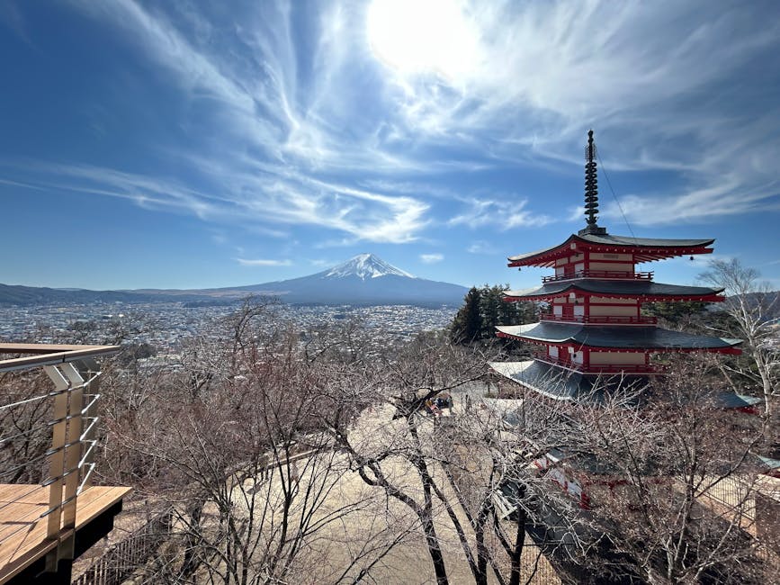
Chureito Pagoda (Arakurayama Sengen Park)
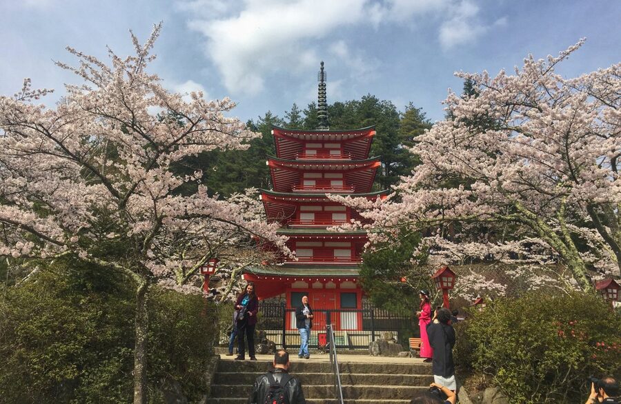
The most photographed Mt. Fuji view in the world. Five-storey pagoda in the foreground, snow-capped cone behind, sakura or autumn foliage as the seasonal dressing. The pagoda itself sits high on the slope of Arakurayama, reached by a 397-step climb from Arakura Fuji Sengen Jinja (the shrine at the base). The closest train station is Shimoyoshida on the Fujikyu Railway, ten minutes south of Kawaguchiko.
The thing nobody tells you: the iconic photo is taken from a small wooden viewing deck above and behind the pagoda, not from the pagoda itself. There’s a queue. In sakura season they limit each photographer to a couple of minutes at the prime spot. If you want the shot without a crowd in your frame, be at the bottom of the steps before sunrise. By 09:00 the queue is fifty deep and the morning light has gone.
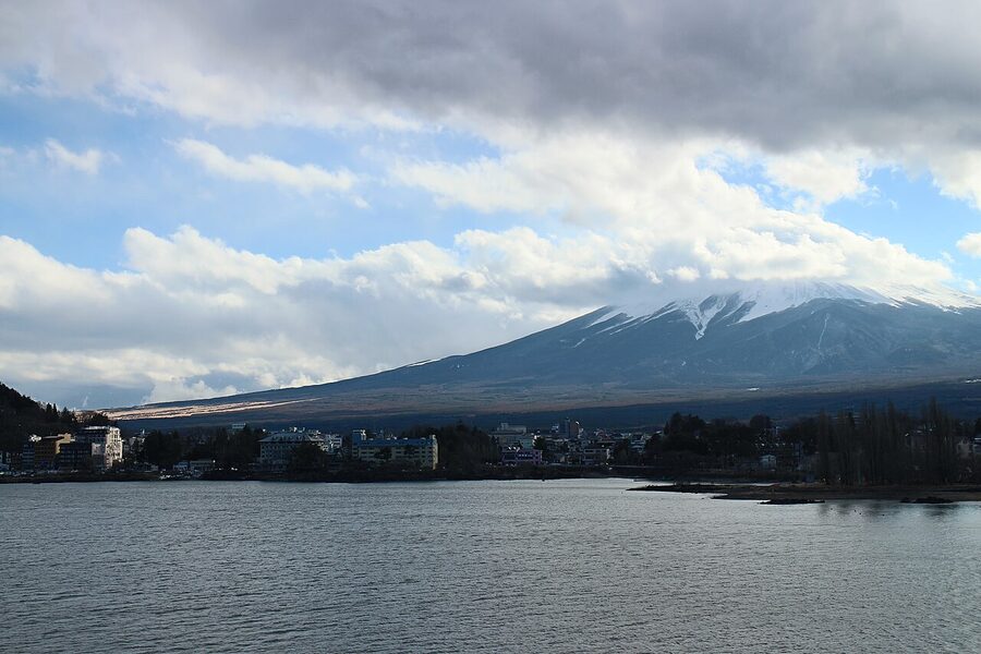
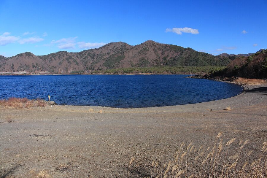
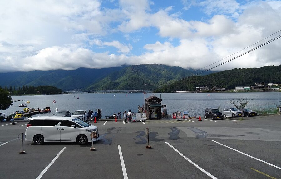
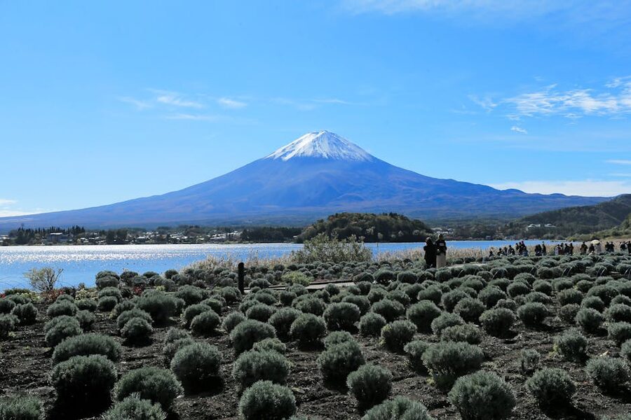
Lake Kawaguchi (河口湖)
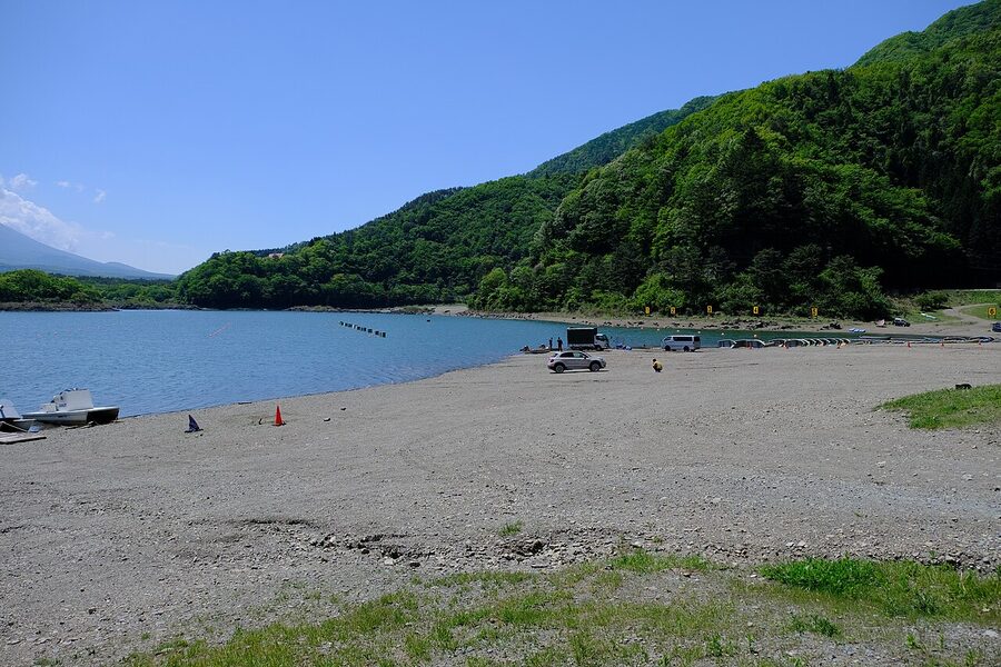
The most accessible of the Five Lakes and the obvious base if you want a single hub. The whole lake is roughly 5km across, and the best Fuji-reflection viewpoints are along the northern shore: Oishi Park, the Maples Corridor, Ubuyagasaki, and Nagasaki Park. The Kawaguchiko Sightseeing Bus runs three colour-coded loops, and a one-day pass costs ¥1,500 (verified with japan-guide.com timetable, October 2025), with a two-day pass at ¥2,000.
For pure photography, the rule is wind. Reflection only works when the lake surface is still, which usually means before 08:00 in summer or pretty much any winter morning. On weekends in cherry blossom season the lakeshore is a tripod scrum from 05:30. Walk an extra five minutes from the obvious spot and you’ll usually find an empty bench.
Sleep on the lake’s north shore, not the south. South-shore hotels look uphill and miss the angle entirely. There’s an excellent Bunkamura-area cluster of mid-range Japanese-style hotels, and a small Ubuya / Shuhokaku Kogetsu group at the high end that builds rooms around the view.
Lake Yamanaka (山中湖)
The largest of the Five Lakes and the closest to the mountain (around 9km from cone to lakeshore). Yamanaka draws fewer day-trippers because the public transport from Kawaguchiko is fiddly, but it’s the lake locals tend to choose for swans, sunset, and lake-side cycling. Hana no Miyako, a flower park on the lake’s northern bank, layers Mt. Fuji over rolling fields of sunflowers in summer and cosmos in autumn. Worth pairing with a slow lakeside lunch.
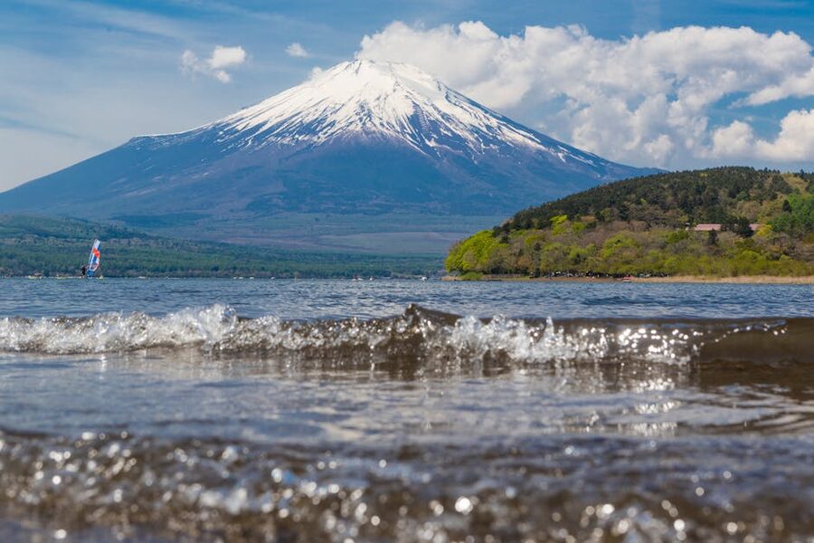
The Diamond Fuji phenomenon, when the rising or setting sun aligns precisely with the summit, is best timed from the Yamanaka side in mid-October to mid-February. There are dedicated viewpoints with annual schedules at the Yamanakako Information Plaza Kirara.
The three other lakes: Saiko, Shoji, Motosu
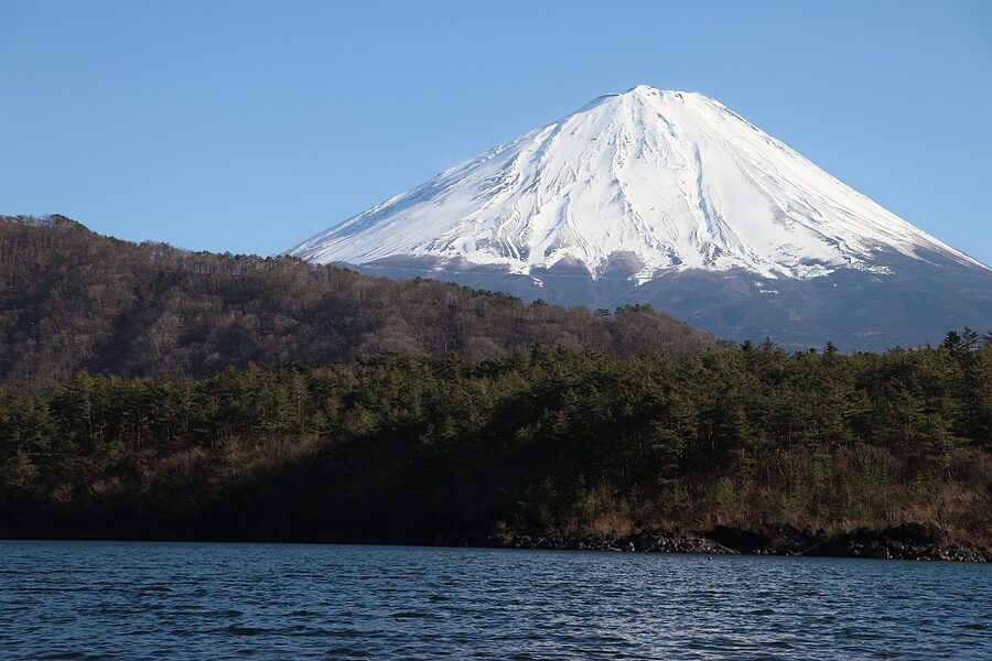
Lake Saiko is small, quiet, and ringed by cliffs that block the view from most of the shore. Walk to the western side, near Nenmahama beach, for the only Fuji-clear angle. Worth pairing with the Saiko Iyashi-no-Sato Nenba thatched-cottage village just up the road, which is a recreated traditional hamlet of kayabuki-yane roofs that was buried by a typhoon-triggered landslide in 1966 and rebuilt in 2006 as an open-air folk museum.
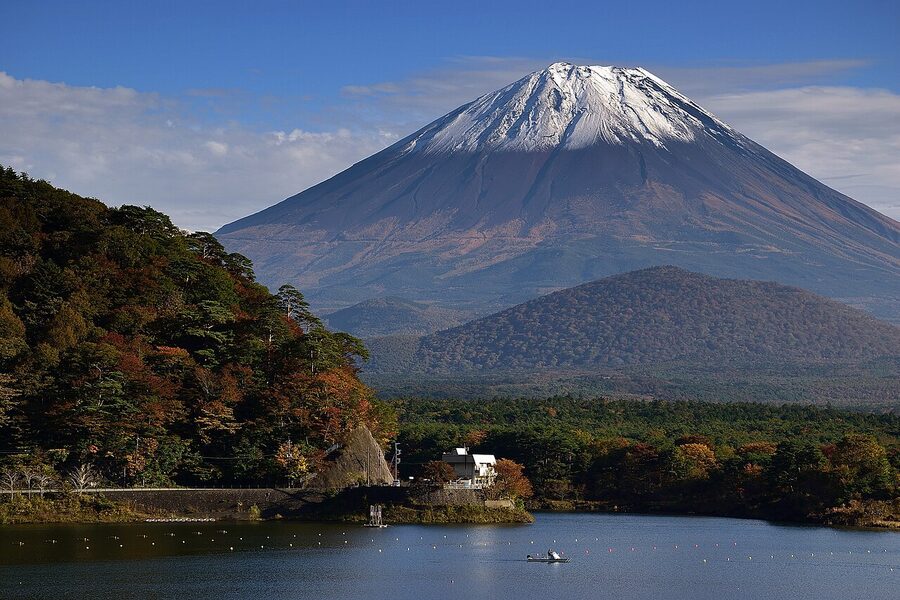
Lake Shoji is the smallest of the five and feels like the lake the development forgot. There are about three inns and one small viewing point at Panoramadai, a hillside above the lake reached by a 90-minute hike from the Panorama-dai-shita bus stop. The view is the same composition as the more famous Lake Motosu shot, but with the smaller lake’s geometry.
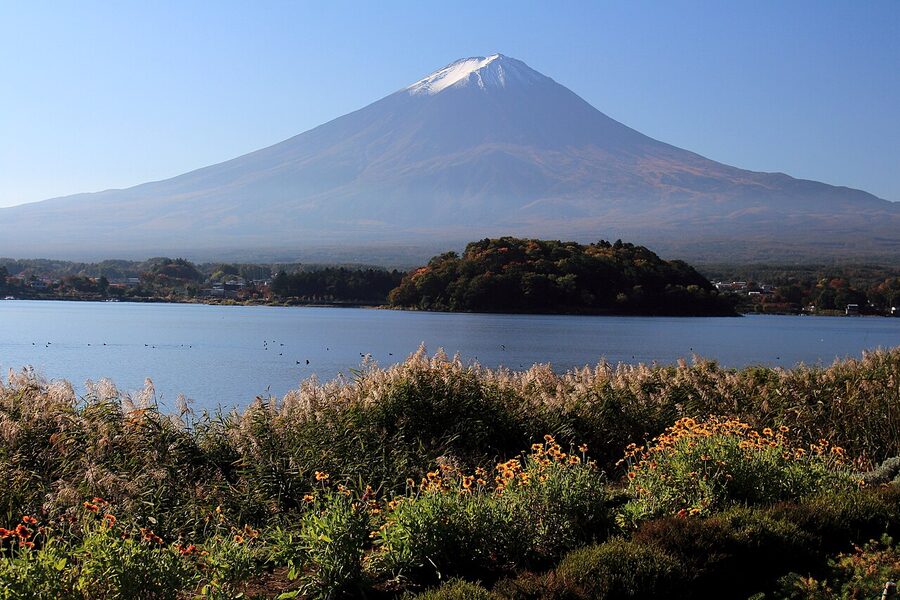
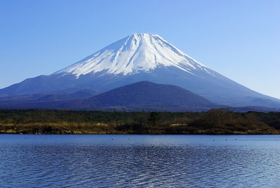
Lake Motosu is the westernmost and deepest of the Five (138m, deeper than the Pacific drops directly off the Boso peninsula), and it’s the one whose view sits on the back of the ¥1,000 banknote. The exact spot is along the northern shore, near the Mt. Fuji Cinema viewpoint. Late April brings the Fuji Shibazakura Festival on the lake’s southwest side, where rolling beds of pink moss phlox layer over a cone that’s still snow-capped.
Oshino Hakkai (忍野八海)
Eight spring-fed ponds in a small farming hamlet between Lake Kawaguchi and Lake Yamanaka. The water is glass-clear and the koi look suspended in mid-air. The village itself is a working hamlet with thatched-roof preserved houses, water mills, and a couple of pilgrimage-related shrines tied to historic Mt. Fuji ascents. Aim for opening hours (around 09:00) and skip the gift-shop strip in the centre, which has been overrun by tourist coaches and feels nothing like the rest of the village.
From Kawaguchiko Station, the Fujikko-go bus runs to Oshino Hakkai in about 25 minutes. From Yamanakako side, the same bus loops the route in the other direction.
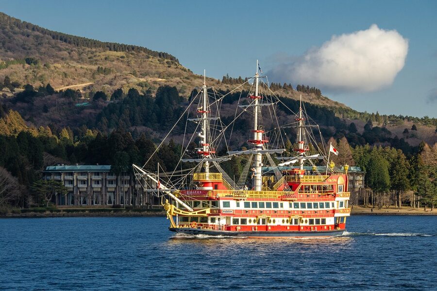
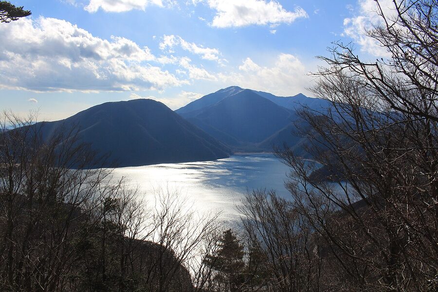
Hakone (Lake Ashi)
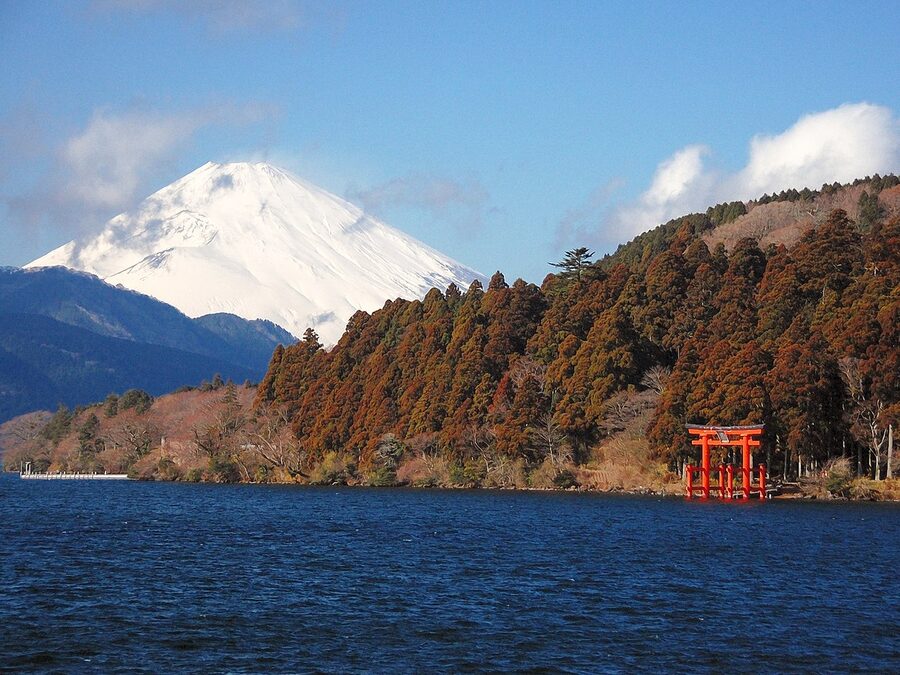
Hakone is the alternative base for travellers who want hot springs alongside Mt. Fuji views, and it’s much closer to Tokyo than the Yamanashi side, with the Odakyu Romance Car running directly from Shinjuku to Hakone-Yumoto. The viewing geography here is Lake Ashi, with the floating Hakone Shrine torii in the foreground and Mt. Fuji rising above the far ridgeline. The catch is that Hakone is a lower-altitude basin facing south, which means more cloud days and more obstructed views than the Yamanashi side.
The Hakone Free Pass from Shinjuku costs ¥7,100 for adults and ¥1,600 for children for the 2-day version (verified on the Odakyu official site, May 2026). It covers the Romance Car connection (with a ¥1,200 surcharge for a reserved seat one-way), all eight Hakone-area transport modes (Hakone Tozan Railway, Hakone Tozan Cable Car, Hakone Ropeway, Hakone Sightseeing Cruise, Hakone Tozan Bus, Odakyu Hakone Highway Bus, Tokai Bus Orange Shuttle, Numazu Tozan Tokai Bus), and admission discounts at most museums on the route. For travellers based in Tokyo, the Romance Car plus Hakone Free Pass combination is the cleanest way to do the whole circuit. I’ve covered the contrarian take on the day trip in the Hakone day trip guide.
Miho-no-Matsubara (三保松原)
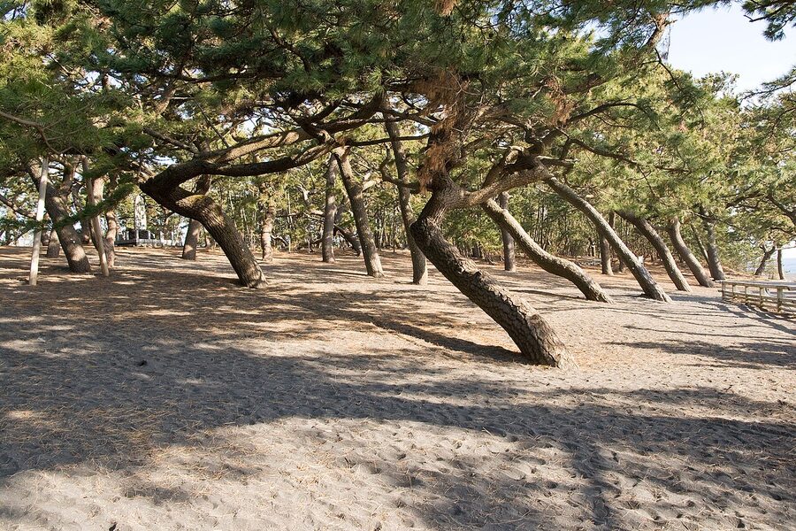
The Shizuoka-side angle. A 7km strip of black-pine grove on a peninsula reaching into Suruga Bay, with Mt. Fuji rising 60km north across the water. The Edo-period painters worked from this angle. So did the Tokugawa-era woodblock artists. The viewpoint is named in the same World Heritage inscription as the mountain itself, but it draws maybe 5 percent of the visitor traffic the Yamanashi side gets.
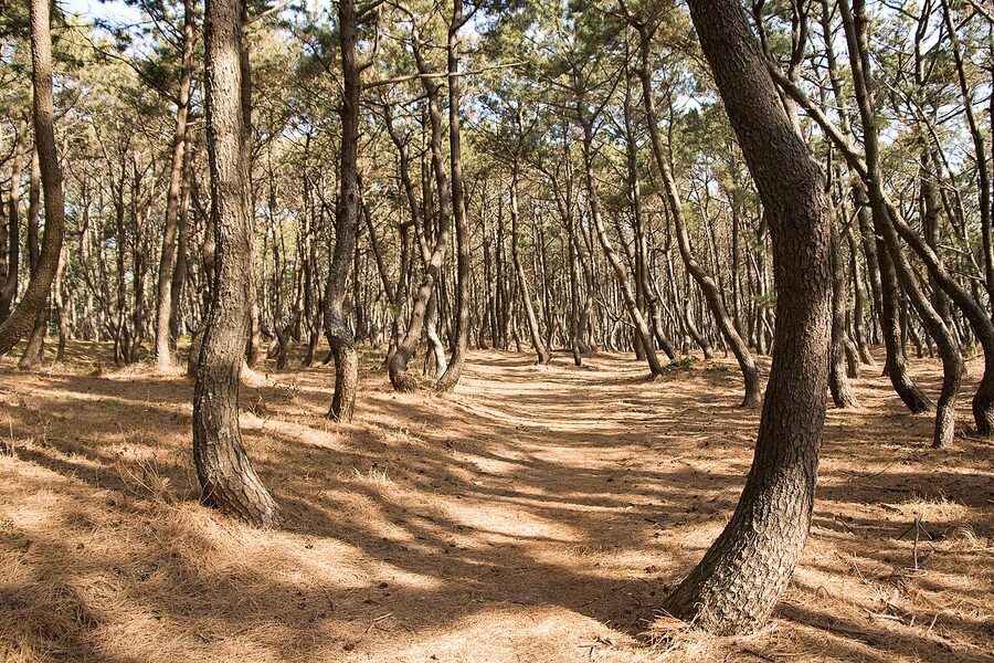
From Shizuoka Station (Tokaido Shinkansen, two hours from Tokyo) take the JR Tokaido Line two stops to Shimizu, then either the Shimizu Sightseeing Bus or a 25-minute taxi to the Miho Pine Grove park. The walk through the grove to the shoreline is about 15 minutes. Best in winter for guaranteed clear-day visibility. Avoid weekends if you can; even with the lower volumes, the bus loop gets crowded.
How to actually get there
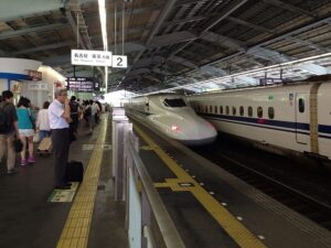
The Yamanashi side is reached from Tokyo by either highway bus or rail. The fastest, cheapest option for most travellers: Fujikyu Highway Bus from Shinjuku Expressway Bus Terminal (Busta Shinjuku) to Kawaguchiko Station, ¥2,200 one-way, 1h 45m. The bus runs roughly every 30 minutes and is significantly cheaper than rail. Verified on the highway-buses.jp / JNTO timetable PDF dated 2026-04-01.
The rail option is the JR Chuo Line direct limited express Fuji Excursion (Fujikaiyu) from Shinjuku to Kawaguchiko, which runs three times daily at ¥4,130 one-way and takes around two hours. If you have a JR Pass it covers the JR portion through Otsuki but not the Fujikyu Railway segment from Otsuki to Kawaguchiko, which costs an extra ¥1,170 plus a small limited express surcharge. For most one-day visitors the bus is the more reliable choice; rail wins if you have heavy luggage or a JR Pass already in hand. There’s a full breakdown in the Mt. Fuji from Tokyo guide.
For Hakone, the Odakyu Romance Car from Shinjuku to Hakone-Yumoto is roughly 85 minutes for ¥2,470 (base fare plus reserved seat surcharge), and is included in the Hakone Free Pass with the ¥1,200 surcharge mentioned above.
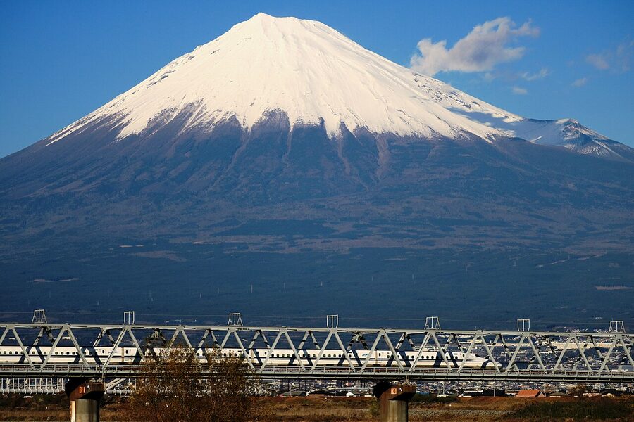
For the Shizuoka side, take the Tokaido Shinkansen from Tokyo to Shizuoka (one hour, ¥6,470 unreserved). The shinkansen itself is a viewpoint: between Shin-Yokohama and Mishima, on the right-hand side of the train, Mt. Fuji passes the window for about three minutes around 40 minutes into the trip. On a clear winter morning the framing is the same as Hokusai’s woodblocks; on a summer afternoon you get a roof of cloud and a forest.
Climbing season vs viewing season
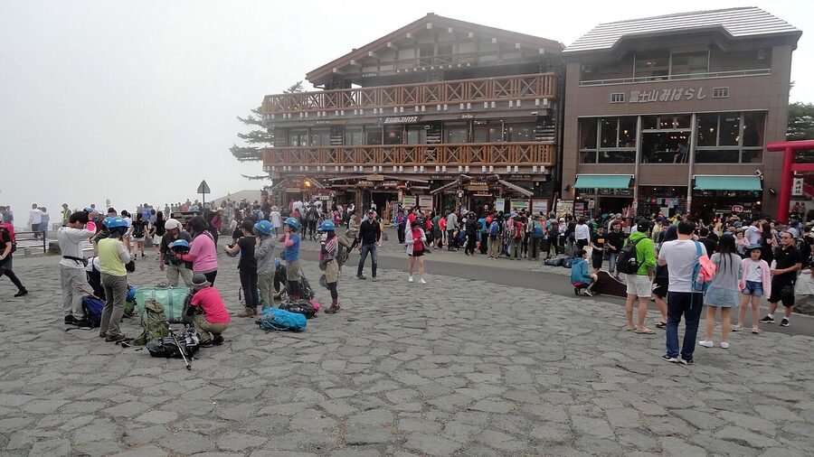
The mountain is officially open to climbers from 1 July to 10 September on the Yoshida and Subashiri trails, with Fujinomiya and Gotemba opening 10 July (verified on fujisan-climb.jp, 13 March 2026 announcement). Outside that window, the trails are closed and the mountain huts are shut. Don’t hike off-season; rescue helicopters charge by the minute and your travel insurance probably won’t cover an out-of-season climb.
For 2026, all four routes require a ¥4,000 hiking fee per climb, paid in advance via the Mt. Fuji Passage Reservation system, with a daily cap of 4,000 climbers on the Yoshida route to manage congestion. Gates close from 14:00 to 03:00 the following day for non-overnight hikers. The fee is double the 2024 amount and is the largest piece of the Yamanashi prefecture’s overcrowding response. The full breakdown of routes, timing, hut bookings, and what actually goes wrong is in the Mt. Fuji climbing guide.
Crucially, the climbing window is the worst window for viewing the mountain from the lakes. July and August have the highest cloud cover, the most haze, and the most thermal lift pushing condensation up the cone. If your goal is summit photos rather than a summit attempt, climbing season is the wrong time to come.
The Yoshida Trail and the four routes (a brief summary)
For full coverage of climbing logistics, see the dedicated climbing guide. Here’s the one-paragraph version readers of the regional hub usually want:
Four trails run to the summit. Yoshida from the Yamanashi side at 2,305m is the most popular, the most crowded, and the one with the most mountain huts. Subashiri from the Shizuoka side at 2,000m is quieter, has a forested first section, and joins the Yoshida route near the summit, which is the climb experienced hikers tend to recommend. Fujinomiya at 2,400m is the highest trailhead and the shortest climb, but the steepest. Gotemba at 1,440m is the longest by a margin, mostly volcanic gravel, and the route serious mountain runners use for descent. The fee is the same on all four. Hut accommodation costs ¥9,000 to ¥14,000 per person depending on the meal package. Book directly through the hut websites or the official Mt. Fuji booking system, not third-party aggregators.
Where to stay (and how the geography decides for you)
Where you sleep is more decisive than where you eat or what you do during the day, because the mountain only does its show in narrow time windows that line up badly with day-tripper bus schedules.
Lake Kawaguchi (north shore)
The default base. North shore puts you on the right side of the lake for the reflection shot at dawn. Properties cluster in three tiers:
- Mid-range ryokan with onsen and lake-facing rooms: Taiheikan, Kawaguchiko Lakeside Hotel, Konanso. Expect ¥25,000 to ¥45,000 per night for two with breakfast and dinner. Booking links: Taiheikan (Booking.com); Kawaguchiko Lakeside Hotel (Booking.com).
- Luxury, view-built rooms: Hoshinoya Fuji (the glamping concept), Fufu Kawaguchiko, Shuhokaku Kogetsu. ¥80,000 to ¥200,000+ per night. Worth one of those nights if you can afford it; rooms are designed around the view, with floor-to-ceiling windows aligned to the mountain.
- Budget guesthouses and minshuku: K’s House Mt Fuji, Kawaguchiko Station Inn, Hostel Michael’s. ¥3,500 to ¥9,000 per dorm bed. Walking distance to the station and the lake, basic but comfortable.
Skip south-shore properties. The view from a south-shore window points uphill at the wrong angle.
Yamanaka and Yamanakako village
Quieter, fewer day-trippers, closer to the mountain. Hotel Mt Fuji dominates the lake’s eastern bluff with rooms that point straight at the cone; it’s 1980s in style but the location is unbeatable for mountain framing. Hotel Mt Fuji (Booking.com | Agoda). Pension Pao on the lake’s southern bank is the boutique alternative.
Hakone
If onsen is your priority and the Mt. Fuji view is the seasoning, Hakone wins. Yumoto and Gora are the two main ryokan zones. Top-tier names: Gora Kadan and Hakone Ginyu in Gora, and the Hyatt Regency Hakone Resort & Spa in Sengokuhara. Mid-range: Hotel Indigo Hakone Gora and the Yumoto-side hot-spring inns. The Hakone Free Pass logistics are the dominant factor here; check the Hakone day trip guide before booking, because the day-trip math sometimes beats the overnight stay.
What to actually do (besides looking at the mountain)
You can fill three days at the lakes without ever leaving the Yamanashi side, and most of it is not “another viewpoint.”
Cycle the lakeshores
Bike rental in Kawaguchiko averages ¥1,000–1,500 per day from your hostel or any of half a dozen rental shops near the station. The lake circuit is around 20km and takes a leisurely two hours with stops, the road is flat, and 80 percent of it is dedicated cycle path along the water. Yamanaka has a similar circuit, longer at 14km but with traffic on a couple of stretches. Saiko’s narrow shore road has the lowest traffic of the three.
Eat hoto noodles
Hoto is Yamanashi’s signature dish: thick flat noodles in a miso-base broth with kabocha squash, daikon, mushrooms and pork. Hearty, especially in winter, and almost every restaurant in Kawaguchiko has it on the menu. The town’s name-stamp restaurant is Hoto Fudo, which has a striking white-domed Kengo Kuma-designed building near Kawaguchiko Station and three other branches across the area. The town centre branch (“Fudo Roadside”) is the easiest. ¥1,200 a bowl, big enough that one bowl plus a side of mochi will feed two normal eaters.
Fuji-Q Highland
The amusement park at the foot of the mountain. World-record-holding roller coasters with Mt. Fuji visible from the upper crests. Worth a half-day if you have older kids in the group, and worth nothing if you don’t. Tickets vary; expect roughly ¥6,500 for a one-day pass if you book in advance.
Kachi Kachi Yama Ropeway
The cable car from the eastern shore of Lake Kawaguchi up to the Tenjozan summit, with a deck that frames Mt. Fuji over the lake from above. ¥900 round trip. Eight-minute ride. The view is genuinely worth it on clear days, and the ropeway runs year-round.
The Fuji-Q-Saiko ice and wind caves
Lava tubes from earlier eruptions, with year-round ice formations even in summer. Both caves are short walk-throughs (15 to 30 minutes each). The Aokigahara forest above and around them is the so-called “Sea of Trees,” and the trails are well-signed. ¥350 entry per cave; a combined ticket covers both for ¥700. You’ll see silkworm-cocoon storage exhibits inside the wind cave that hint at the area’s pre-tourism economy.
The kanji ambiguity, the romanisations, and the small things
One trap worth flagging: the kanji 富士 (Fuji) by itself is also a town name, a TV network, a film company, and a pre-war department store. The mountain takes the suffix 山 (san or yama), giving you 富士山 (Fujisan). Search 富士 alone on Japanese-language sites and you’ll get half a dozen pages of hits that aren’t the mountain. This matters mostly if you’re using a Japanese map app: type 富士山 to find the mountain, 富士 alone to find the town.
Romanisation conventions on this site: Mt. Fuji and Fujisan are interchangeable in body copy. Lake names go without the -ko suffix in English (Lake Kawaguchi, not Kawaguchiko Lake or Lake Kawaguchiko), although the town built around the lake keeps the suffix (Fujikawaguchiko). Fujikyu Railway is the operator’s own romanisation; you’ll see Fujikyuko on some signage too.
Cherry blossom, autumn leaves, and the seasonal accidents that make a trip
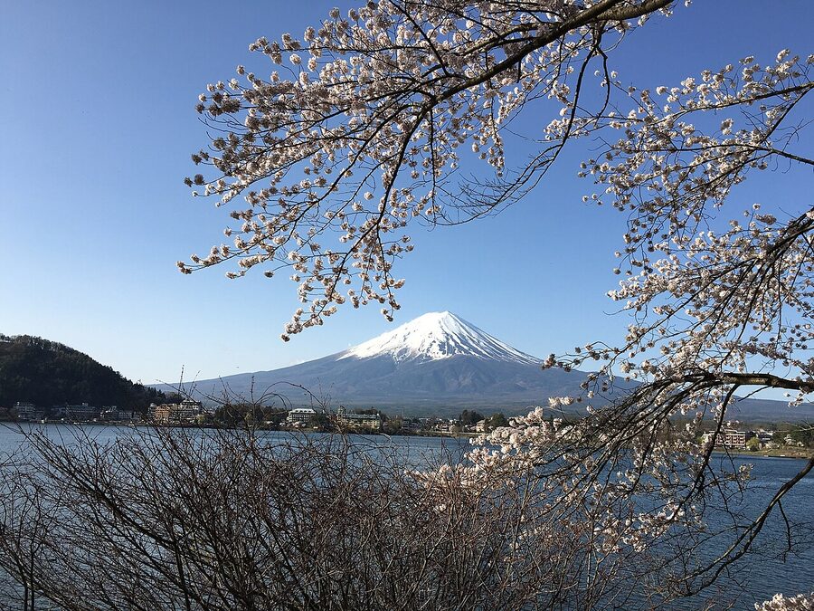
Cherry blossom around the lakes peaks one to two weeks later than central Tokyo, usually 10–20 April. Chureito Pagoda is the famous frame; Lake Kawaguchi’s Ubuyagasaki and Nagasaki Park are the lakeside frames. If you’re in Tokyo for sakura week and Mt. Fuji is on your list, it’s a one-day trip that’s worth the effort, but go on a weekday and start before sunrise to avoid the crowds.
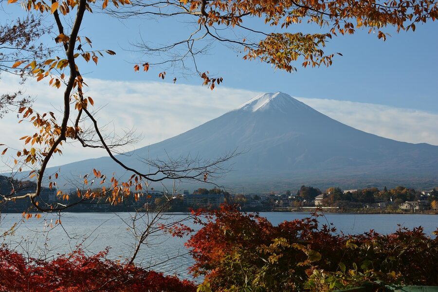
Autumn foliage is the better-kept secret. The Maples Corridor at Lake Kawaguchi peaks the first or second week of November. The Lake Yamanaka shoreline runs ten days later. The colour is just as dense as Kyoto, the photographs are arguably better with a snow-capped Fuji backdrop, and the crowds are a tenth of cherry blossom levels. The Fujikawaguchiko Maple Festival (about 1–15 November depending on the year) lights the corridor at night, which I prefer to the daytime crowds.
Late April brings the Fuji Shibazakura Festival on the southwest corner of Lake Motosu, where pink moss phlox carpets the slope below a still-snow-capped mountain. April 15 to May 24 in 2026, ¥1,200 entry. The festival site is reached by a shuttle bus from Kawaguchiko Station that adds about 50 minutes each way. I think it’s overhyped: the colour is impressive but the visitor density is brutal, but it’s a defensible item on a five-day Yamanashi itinerary.
The winter case
If you’re new to Japan and only thinking sakura, hear me out: come in late January or early February. Visibility is at its best of the year, the snow cap is the deepest, the lakes are sometimes frozen at the edges, and the crowds at every viewpoint are 10 to 20 percent of spring volumes. Daytime temperatures around the lakes hover at 5 to 9 °C, dropping below freezing at night. Most ryokan run their outdoor onsen pools right through winter, and the contrast of soaking in a 41 °C bath while watching snow fall on the cone is the postcard most travellers don’t know to ask for.
The catch: Mt. Fuji itself is closed to climbing November to June. If your trip’s premise is the climb, winter is wrong. If it’s the view, winter is right.
The Hokusai problem
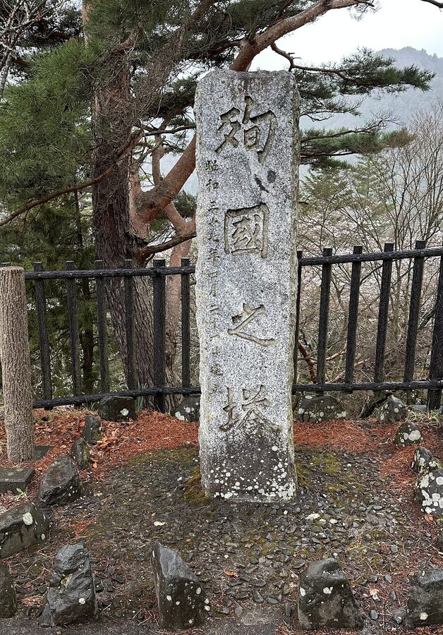
You will see this mountain in a thousand reproductions before you see the real thing. The Katsushika Hokusai woodblock prints (the “Thirty-six Views of Mount Fuji,” which include the famous Great Wave and Red Fuji) are the visual shorthand for Japan in much of the world. They were published 1830–1833. Almost two centuries on, the same compositions still describe the angles you can stand in today. Red Fuji’s exact viewpoint is the Yamanashi-side ridgeline near Misaka Pass, around dawn in late summer. The Tomonoura wave-and-mountain composition that became the Great Wave is loose with geography, but Mt. Fuji from the Tokaido-corridor coast remains the same scene Hiroshige painted.
Knowing that doesn’t make the live mountain less impressive. It makes it more, in the same way that finally seeing the Eiffel Tower in person doesn’t deflate the postcard. But it changes what you’re looking for. You’re not discovering the mountain. You’re recognising it.
Some honest blockers and downsides
For balance: the Mt. Fuji area is one of the more touristed parts of Japan, and it shows.
- Day-trip bus volumes are heavy on weekends. Saturday and Sunday at Chureito Pagoda or Oishi Park in cherry blossom season is shoulder-to-shoulder with tour groups. Weekday or weekday, basically.
- The cloud miss-rate is real. I’ve already said this. Don’t book your only Japan trip around a single Mt. Fuji photo and expect it to work.
- English signage is patchy off the main bus routes. The Fujikyu Railway and the headline viewpoints are well signed; the smaller lake bus loops are less so. Have Google Translate (camera mode) and an offline map.
- Restaurants close early. Most non-hotel restaurants around the lakes shut by 20:00, some by 19:00. Plan dinner accordingly, or eat at your ryokan.
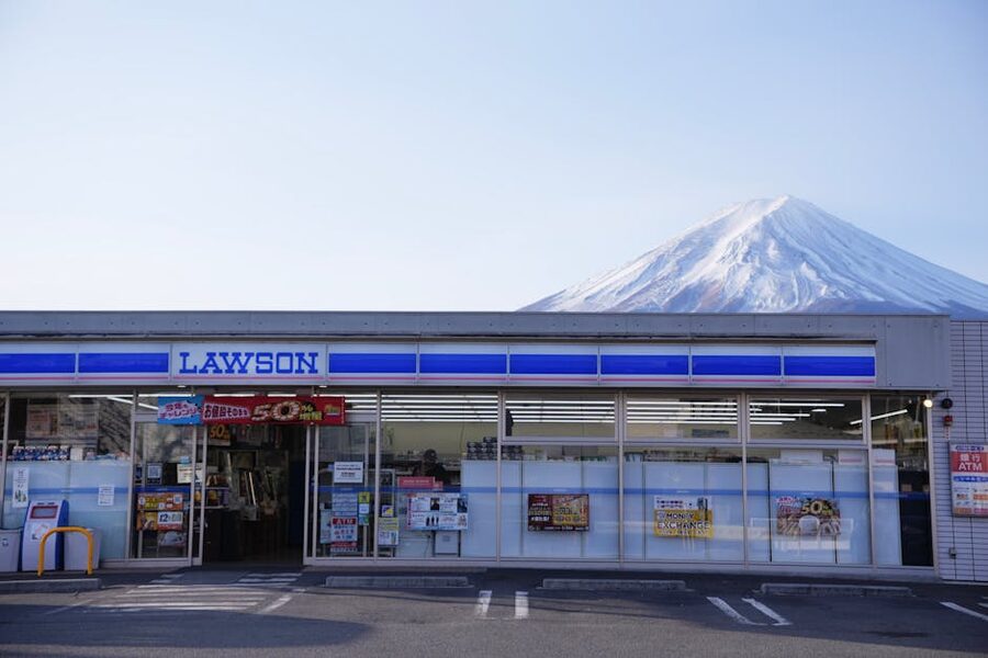
- The Fuji-Q convenience-store photo trend has had local consequences. The Lawson on Route 137 with Mt. Fuji behind it became so heavily photographed that the local government installed and then removed a huge black screen to deter photographers. The location is fine to photograph, just be respectful of traffic and the actual customers using the store.
How to put a trip together
If the mountain is the main event of your Japan trip, give it three nights and two full days. That gets you two dawn windows (the only time you can rely on visibility in summer) and one full day for either the Shizuoka side or the climbing trail. If it’s a side trip from a Tokyo-Kyoto itinerary, two nights at Kawaguchiko or one night at Hakone is enough.
A working three-night Yamanashi itinerary that I’ve used several times:
- Day 1: Mid-morning Fujikyu Highway Bus Shinjuku to Kawaguchiko (depart 09:00, arrive 10:45). Drop bags at your accommodation. Lake Kawaguchi north shore by bike, lunch at Hoto Fudo, afternoon at Oshino Hakkai. Sunset at Lake Yamanaka via the Fujikko-go bus.
- Day 2: Sunrise at Chureito Pagoda (5th-floor steps from 05:30). Late breakfast in Shimoyoshida. Late morning at Kachi Kachi Yama Ropeway. Lunch lakeside. Afternoon at the Saiko Iyashi-no-Sato Nenba thatched-cottage village. Evening onsen at your ryokan.
- Day 3: Drive or bus to Lake Motosu for the ¥1,000-note view. Continue to the Fuji Shibazakura Festival (April–May only) or the Aokigahara wind/ice caves. Late afternoon return to Kawaguchiko.
- Day 4 morning: Bus or Fuji Excursion train back to Tokyo.
If you only have one day from Tokyo, the calculus is sharper: skip Yamanaka and Motosu, anchor on Chureito + Lake Kawaguchi + Oshino Hakkai, and accept that you’re racing the cloud line. The full breakdown is in the Mt. Fuji from Tokyo guide.
And on a clear morning
Back at Lake Kawaguchi, three years after the 04:36 cormorant trip, I’m sitting on a stone bench at Ubuyagasaki at 06:50 in mid-November. The water is so still it’s reflecting individual maple leaves. A heron walks the shore. There’s no one else here. The mountain has been visible for forty straight minutes. By the time I leave for breakfast it’ll have started its slow disappearance under the day’s cloud, but for now there it is, exactly the size and shape Hokusai painted, exactly the symmetry that put it on the ¥1,000 note, and the only thing I can think is: of course this got worshipped. Of course the country built shrines facing it. Of course they put it on the money.
Go in winter if you can.
.jpg)
.jpg)
.jpg)